geo.wikisort.org - Mountains
Marsh Butte is a 4,721-foot-elevation (1,439 meter) summit located in the Grand Canyon, in Coconino County in the northern part of the U.S. state of Arizona.[2] It is situated eight miles northwest of Grand Canyon Village, immediately east-northeast of Diana Temple, and Tower of Ra stands directly opposite across Granite Gorge. Topographic relief is significant, as Marsh Butte rises over 2,300 feet (700 meters) above the Colorado River in half a mile (1 km).
| Marsh Butte | |
|---|---|
 East aspect, from Tonto Trail | |
| Highest point | |
| Elevation | 4,721 ft (1,439 m)[1] |
| Prominence | 301 ft (92 m)[1] |
| Parent peak | Diana Temple (6,683 ft)[1] |
| Isolation | 1.51 mi (2.43 km)[1] |
| Coordinates | 36°07′15″N 112°14′43″W[2] |
| Naming | |
| Etymology | Othniel Charles Marsh |
| Geography | |
 Marsh Butte Location in Arizona  Marsh Butte Marsh Butte (the United States) | |
| Location | Grand Canyon National Park Coconino County, Arizona, US |
| Parent range | Coconino Plateau Colorado Plateau |
| Topo map | USGS Grand Canyon |
| Geology | |
| Type of rock | limestone, shale, sandstone |
| Climbing | |
| First ascent | 1977 |
| Easiest route | class 4 climbing[1] |
Marsh Butte is composed of Mississippian Redwall Limestone, overlaying the Cambrian Tonto Group, and finally granite of the Paleoproterozoic Vishnu Basement Rocks at river level in Granite Gorge.[3][4] According to the Köppen climate classification system, Marsh Butte is located in a cold semi-arid climate zone.[5]
History

In March 1906, this butte was officially named "Endymion Dome", for Endymion of Greek mythology, in keeping with Clarence Dutton's practice of naming geographical features in the Grand Canyon after mythological deities.[2][6] However, George Wharton James suggested it should be named after preeminent paleontologist Othniel Charles Marsh (1831–1899), and two months later it was officially renamed in May 1906 by the U.S. Board on Geographic Names.[2] George Wharton James described it in his 1910 book "The Grand Canyon of Arizona How to See It" as "a butte of singularly beautiful structure."[7]
The first ascent of the summit was made October 29, 1977, by Pete Baertlein and Mitch McCombs via the class 4 east ridge.[8]
See also
- Geology of the Grand Canyon area
Gallery
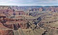 Marsh Butte (centered in bullseye), from Pima Point
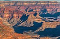 Marsh Butte centered in bullseye, Geikie Peak behind it
 Aerial view with Marsh Butte lower left, Diana Temple upper left, Geikie Peak centered at bullseye.
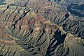 Aerial view of Diana Temple (upper left) and Marsh Butte (lower right)
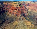 Diana Temple centered at top and Marsh Butte centered at bottom.
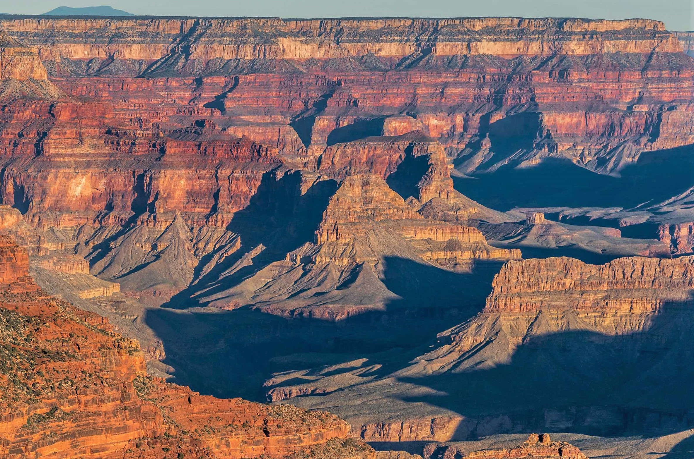
Aerial view from ENE.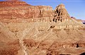 Marsh Butte (end of ridge) formed in Redwall Limestone. Tapeats Sandstone (brown cliff at bottom of photograph), Manakacha Formation (red cliff at top of photograph).


References
- "Marsh Butte – 4,721' AZ". Lists of John. Retrieved 2021-01-14.
- "Marsh Butte". Geographic Names Information System. United States Geological Survey. Retrieved 2021-01-14.
- N.H. Darton, Story of the Grand Canyon of Arizona, 1917, page 39.
- William Kenneth Hamblin, Anatomy of the Grand Canyon: Panoramas of the Canyon's Geology, 2008, Grand Canyon Association Publisher, ISBN 9781934656013.
- Peel, M. C.; Finlayson, B. L.; McMahon, T. A. (2007). "Updated world map of the Köppen−Geiger climate classification". Hydrol. Earth Syst. Sci. 11. ISSN 1027-5606.
- Randy Moore and Kara Felicia Witt, The Grand Canyon: An Encyclopedia of Geography, History, and Culture, 2018, ABC-CLIO Publisher, page 151.
- George Wharton James, The Grand Canyon of Arizona How to See It, 1910, Little Brown and Company, page 40.
- Aaron Tomasi, Pernell Tomasi, Grand Canyon Summits Select An Obscure Compilation of Sixty-nine Remote Ascent Routes in the Grand Canyon National Park Backcountry, 2001, ISBN 9780971088009, page 54.
External links
| Wikimedia Commons has media related to Marsh Butte. |
- Weather forecast: National Weather Service
- Climbing Marsh Butte: Themtsarecalling.com
Другой контент может иметь иную лицензию. Перед использованием материалов сайта WikiSort.org внимательно изучите правила лицензирования конкретных элементов наполнения сайта.
WikiSort.org - проект по пересортировке и дополнению контента Википедии