geo.wikisort.org - Mountains
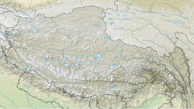
Lajo Dada (also known as Langu Himal) is a mountain peak in Dhaulagiri Zone, Gandaki Province of western-central Nepal.[1]
| Lajo Dada | |
|---|---|
 Lajo Dada, Nepal. Image taken by NASA's Skylab on December 9, 1973 | |
| Highest point | |
| Elevation | 6,426 m |
| Coordinates | 28°32′45.33″N 85°3′12.18″E |
| Geography | |
| Country | Nepal |
| Parent range | Himalayas |
| Climbing | |
| First ascent | October 17, 2017; by three-member Japanese team |
Location
It is located at 6,426 m (21,083 ft) above sea level in the west of the Tsum Valley and south of the Tabsar at 6,065 m (19,898 ft).[2] This peak was not accessible to the public until 2014, when it was opened for climbing by the Nepalese government.
Climbing history
On October 17, 2017, a three-member Japanese team made the first ascent of Lajo Dada. All three were members of Tomon Alpine Club and graduates of Waseda University — Norifumi Fukuda, Kojuro Hagihara, and Yudai Suzuki.[2][3]
References
- "Mount Lajo Dada, Location in Narchyang, Province No. 4, Nepal - Aloeus". www.aloeus.com. Retrieved 2022-09-03.
- "AAC Publications - Lajo Dada (a.k.a. Langu Himal), Northern Glacier and West-Northwest Ridge". publications.americanalpineclub.org. American Alpine Club. Retrieved 2022-09-03.
- "Waseda Alpine Club conquers unclimbed 6,426m Himalayan peak". Waseda University. Retrieved 2022-09-03.
Текст в блоке "Читать" взят с сайта "Википедия" и доступен по лицензии Creative Commons Attribution-ShareAlike; в отдельных случаях могут действовать дополнительные условия.
Другой контент может иметь иную лицензию. Перед использованием материалов сайта WikiSort.org внимательно изучите правила лицензирования конкретных элементов наполнения сайта.
Другой контент может иметь иную лицензию. Перед использованием материалов сайта WikiSort.org внимательно изучите правила лицензирования конкретных элементов наполнения сайта.
2019-2025
WikiSort.org - проект по пересортировке и дополнению контента Википедии
WikiSort.org - проект по пересортировке и дополнению контента Википедии


