geo.wikisort.org - Mountains
Kum (pronounced [ˈkuːm]; German: Kumberg[2]) is the highest peak in the Slovenian Sava Hills. Its summit is at 1,220 meters (4,000 ft) above sea level. The mountain is also called the "Sava Triglav" (Slovene: Zasavski Triglav) because it is the highest peak in the region. There are a number of structures at the summit, notably a church dedicated to Saint Agnes from the 17th century and a transmitter. It belongs to the settlement of Ključevica.
This article may be expanded with text translated from the corresponding article in Slovenian. (December 2011) Click [show] for important translation instructions.
|
| Kum | |
|---|---|
 The church and transmitter at the top of Kum | |
| Highest point | |
| Elevation | 1,220 m (4,000 ft)[1] |
| Coordinates | 46°5′16.28″N 15°4′22.72″E[1] |
| Geography | |
 Kum Slovenia | |
| Parent range | Sava Hills |
See also
- Mountains of Slovenia
References
- Kum at hribi.net
- Leksikon občin kraljestev in dežel zastopanih v državnem zboru, vol. 6: Kranjsko. 1906. Vienna: C. Kr. Dvorna in Državna Tiskarna, p. 89. Archived 2013-06-05 at the Wayback Machine (in Slovene)
External links
 Media related to Kum at Wikimedia Commons
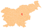
Municipality of Trbovlje | ||||||
|---|---|---|---|---|---|---|
| Settlements | Administrative seat: Trbovlje
|  | ||||
| Landmarks |
| |||||
| Notable people |
| |||||
| Authority control |
|
|---|
This Slovenian geography article is a stub. You can help Wikipedia by expanding it. |
На других языках
- [en] Kum (mountain)
[it] Kum (monte)
Il Kum (1.220 m s.l.m.) è il monte più alto delle Prealpi Slovene orientali nelle Prealpi Slovene. Si trova nella Zasavska (Slovenia).Текст в блоке "Читать" взят с сайта "Википедия" и доступен по лицензии Creative Commons Attribution-ShareAlike; в отдельных случаях могут действовать дополнительные условия.
Другой контент может иметь иную лицензию. Перед использованием материалов сайта WikiSort.org внимательно изучите правила лицензирования конкретных элементов наполнения сайта.
Другой контент может иметь иную лицензию. Перед использованием материалов сайта WikiSort.org внимательно изучите правила лицензирования конкретных элементов наполнения сайта.
2019-2026
WikiSort.org - проект по пересортировке и дополнению контента Википедии
WikiSort.org - проект по пересортировке и дополнению контента Википедии