geo.wikisort.org - Mountains
Kropotkin Range (Russian: Хребет Кропоткина) is a mountain range in Okinsky District, Buryatia, Russian Federation.[2][3]
| Kropotkin Range Хребет Кропоткина | |
|---|---|
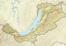 Location in Buryatia | |
| Highest point | |
| Peak | Khoyto-Ula |
| Elevation | 3,149 m (10,331 ft) |
| Coordinates | 52°51′N 99°42′E[1] |
| Dimensions | |
| Length | 120 km (75 mi) SW / NE |
| Width | 40 km (25 mi) |
| Geography | |
| Country | Russia |
| Federal subject | Buryatia |
| Range coordinates | 52°55′N 99°45′E |
| Parent range | Eastern Sayan South Siberian System |
| Geology | |
| Orogeny | Alpine orogeny |
Geography
The Kropotkin Range is part of the Eastern Sayan mountains. It rises at the western end of Buryatia, to the northwest of the Oka river, stretching roughly for about 120 kilometres (75 mi) in a SW to NE direction. The Khoyto-Oka tributary of the Oka separates this range from the Oka Range (Окинский хребет) to the west and north. To the eastern side of the river rise the Belskye Goltsy (Бельские Гольцы). The confluence of the Khoyto-Oka and the Oka marks the northeastern limit of the range.[4][5]
The mountains display an Alpine relief. The highest summit is 3,149 metres (10,331 ft) high Khoyto-Ula.[6][1][4][7]
See also
References
- Khrebet Kropotkina HP - Peakbagger
- Google Earth
- Khrebet Kropotkina - Google Maps
- "N-47 Chart (in Russian)". Retrieved 7 December 2021.
- Water of Russia - Ока
- пик Хойто-Ула - Nature Baikal
- Eastern Sayan / Great Russian Encyclopedia; in 35 vol.] / Ch. ed. Yu.S. Osipov . - M .: Great Russian Encyclopedia, 2004—2017.
External links
- хребет Кропоткина - Nature Baikal (Pictures)
- The Devonian magmatism in the Kropotkin Ridge (East Sayan) and sources of basites: geological, geochemical, and Sr-Nd isotope data
This Buryatia location article is a stub. You can help Wikipedia by expanding it. |
Другой контент может иметь иную лицензию. Перед использованием материалов сайта WikiSort.org внимательно изучите правила лицензирования конкретных элементов наполнения сайта.
WikiSort.org - проект по пересортировке и дополнению контента Википедии