geo.wikisort.org - Mountains
Kontalaksky Golets (Russian: Конталакский Голец) is a peak in the Yablonoi Mountains. Administratively it is part of the Transbaikal Krai, Russian Federation.
| Kontalaksky Golets | |
|---|---|
| Конталакский Голец | |
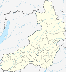
 Yablonoi Mountains, Tungokochensky District map section showing location of Kontalaksky Golets | |
| Highest point | |
| Elevation | 1,706 m (5,597 ft)[1] |
| Coordinates | 53°54′47″N 115°41′35″E |
| Geography | |
 Kontalaksky Golets Transbaikal Krai, Russian Far East | |
| Parent range | Yablonoi Mountains, South Siberian System |
| Climbing | |
| Easiest route | from Tungokochen, Tungokochensky District |
Geography
This 1,706 m (5,597 ft) high mountain is the highest point of the Yablonoi Range, a long mountain chain of moderate elevations which is part of the South Siberian System of ranges. It is located in the far northeastern section of the range, just a little north of Tungokochen.[2][3]
The Kontalaksky Golets is a ‘’golets’’-type of mountain with a bald peak. It rises to the west of the valley of the Karenga in a largely remote and uninhabited part of Transbaikalia.[2] There are pillar-like rock formations in this mountain similar to the kigilyakhs of Yakutia.[4]
See also
- List of mountains in Russia
- List of rock formations§Russia
References
- "Zabaykalsky Krai Mountains - PeakVisor". PeakVisor.
- Google Earth
- Яблоновый хребет, Small Encyclopedia of Transbaikalia
- W. Dybowski. "Die Gasteropoden-Fauna des Baikal-Sees : anatomisch und systematisch". Volumes 22-28 of Mémoires de l'Académie Impériale des Sciences de St. Pétersbourg. Académie Impériale des sciences. 1875.
External links
- природа — LiveJournal (Picture of rock formations)
This Zabaykalsky Krai location article is a stub. You can help Wikipedia by expanding it. |
Другой контент может иметь иную лицензию. Перед использованием материалов сайта WikiSort.org внимательно изучите правила лицензирования конкретных элементов наполнения сайта.
WikiSort.org - проект по пересортировке и дополнению контента Википедии