geo.wikisort.org - Mountains
Ichocollo[2][3] or Ichucollo[4] (possibly from Aymara jichu ichhu (Peruvian feather grass), qullu mountain) [5] is a mountain in the Apolobamba mountain range at the border of Bolivia and Peru, about 5,423 metres (17,792 ft) high. According to the Bolivian IGM (Instituto Geográfico Militar) map and a map edited by the Peruvian Ministry of Education it is located in the La Paz Department, Franz Tamayo Province, Pelechuco Municipality, near 14°41′57″S 69°14′55″W.[2][3][6] According to reports of mountaineers, however, its position is more to the west on the Peruvian border[4] of the Puno Region, Putina Province, Ananea District, near 14°41′30″S 69°15′30″W. This information is based on a DAV (Deutscher Alpenverein) map of 1957.
| Ichocollo | |
|---|---|
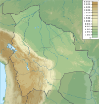  Ichocollo Location in Bolivia | |
| Highest point | |
| Elevation | 5,423[1] m (17,792 ft) |
| Coordinates | 14°41′01″S 69°15′32″W |
| Geography | |
| Location | Bolivia – Peru border |
| Parent range | Andes, Apolobamba |
Statements about the height of Ichocollo also vary considerably.
References
- Ade Miller, Southampton University Mountaineering Club, Bolivian Expedition
- BIGM map 1:100,000 3041 Pelechuco
- escale.minedu.gob.pe - UGEL map of the Putina Province (Puno Region)
- "Bolivian Mountain Guide". Eduardo Mamani Quispe. Retrieved December 16, 2014. Sketch map of the northern Apolobamba range
- Radio San Gabriel, "Instituto Radiofonico de Promoción Aymara" (IRPA) 1993, Republicado por Instituto de las Lenguas y Literaturas Andinas-Amazónicas (ILLLA-A) 2011, Transcripción del Vocabulario de la Lengua Aymara, P. Ludovico Bertonio 1612 (Spanish-Aymara-Aymara-Spanish dictionary)
- "Pelechuco". ine.gob.bo. Archived from the original on December 7, 2014. Retrieved December 12, 2014.

 La Paz Department  | ||
|---|---|---|
Capital: La Paz | ||
| Provinces |
|  |
| Municipalities (and seats) |
| |
| Mountains |
| |
| Protected areas |
| |
 | This La Paz Department geography article is a stub. You can help Wikipedia by expanding it. |
Другой контент может иметь иную лицензию. Перед использованием материалов сайта WikiSort.org внимательно изучите правила лицензирования конкретных элементов наполнения сайта.
WikiSort.org - проект по пересортировке и дополнению контента Википедии