geo.wikisort.org - Mountains
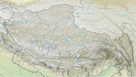
Hungchi (also known as Chakhung) is a mountain peak in the Himalayas on the border of Nepal and the Tibet Autonomous Region of People's Republic of China.[1]
| Hungchi | |
|---|---|
 Panoramic view of Ngozumpa glacier and encircling mountains. Hungchi is the second mountain from the left. | |
| Highest point | |
| Elevation | 7,036 m (23,084 ft) |
| Prominence | 876 m (2,874 ft) |
| Coordinates | 28°02′06″N 86°45′32″E |
| Geography | |
| Country | Nepal |
| Parent range | Himalayas |
Location
Hungchi is located at 7,036 m (23,084 ft), at the head of Gyoko valley[2] and south of high mountain pass Nup La. To the east, the ridge continues over to the Chumbu and Pumori.[1]
Climbing history
Hungchi was first climbed on April 19, 2003, by a Japanese expedition.[3]
References
- "Hungchi". PeakVisor. Retrieved 2022-04-22.
- Yates, Simon (2012-03-19). The Wild Within. Vertebrate Publishing. ISBN 978-1-906148-43-0.
- "AAC Publications - Asia, Nepal, Mahalangur Himal (Khumbu), Hungchi, First Ascent". publications.americanalpineclub.org. Retrieved 2022-04-22.
На других языках
[de] Hungchi
Der Hungchi (auch Chakhung) ist ein 7036 m (nach anderen Quellen 7029 m) hoher Berg im Himalaya an der Grenze zwischen der Volksrepublik China und Nepal – 17,19 km westnordwestlich des Mount Everest.- [en] Hungchi
Текст в блоке "Читать" взят с сайта "Википедия" и доступен по лицензии Creative Commons Attribution-ShareAlike; в отдельных случаях могут действовать дополнительные условия.
Другой контент может иметь иную лицензию. Перед использованием материалов сайта WikiSort.org внимательно изучите правила лицензирования конкретных элементов наполнения сайта.
Другой контент может иметь иную лицензию. Перед использованием материалов сайта WikiSort.org внимательно изучите правила лицензирования конкретных элементов наполнения сайта.
2019-2025
WikiSort.org - проект по пересортировке и дополнению контента Википедии
WikiSort.org - проект по пересортировке и дополнению контента Википедии


