geo.wikisort.org - Mountains
The Hozameen Range (spelled Hozomeen Range in the United States[2]) is a mountain range in southwestern British Columbia and northern Washington, straddling the division between the Coast and Interior regions of that province. It is a subrange of the North Cascades and is neighboured on the east by the Okanagan Range and on the northwest by the unofficially-named Coquihalla Range, which lies between that river and the Fraser. In the northwest part of the range is the one named subrange, the Bedded Range.
| Hozameen Range | |
|---|---|
| Hozomeen Range | |
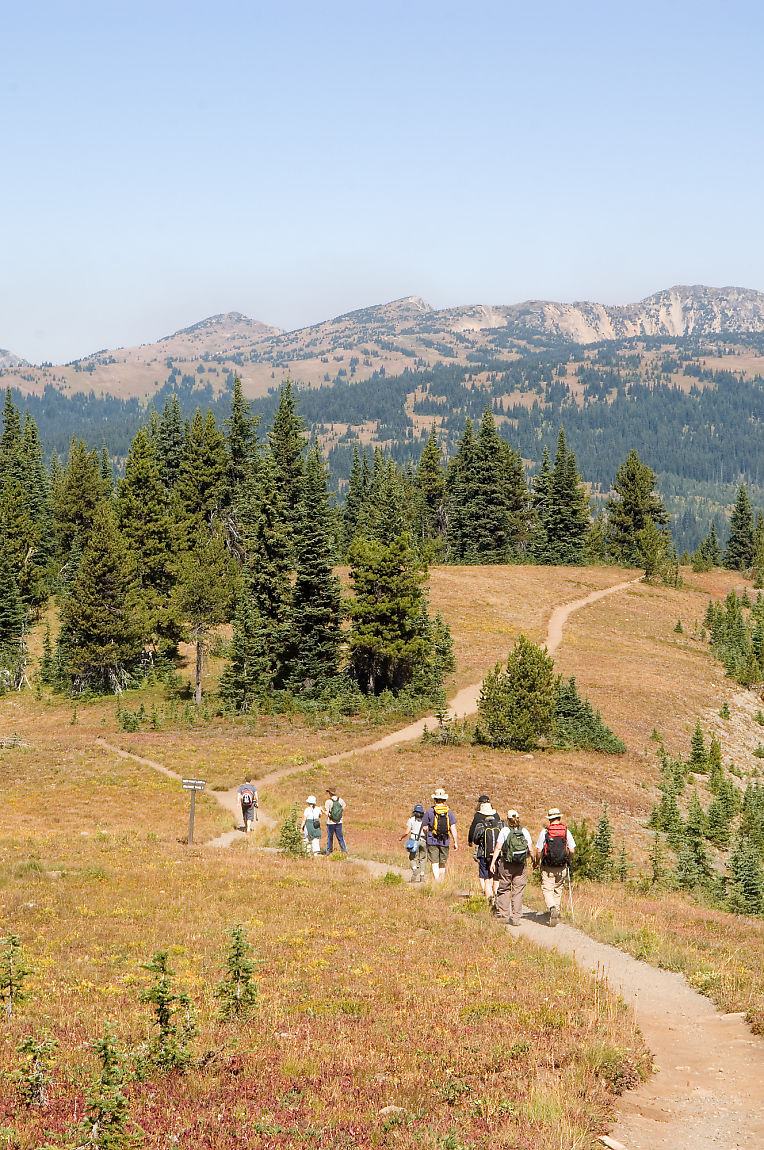
 Hozameen Range from Snow Camp Mountain in E.C. Manning Provincial Park | |
| Highest point | |
| Peak | Jack Mountain |
| Elevation | 2,763 m (9,065 ft)[1] |
| Coordinates | 48°46′22″N 120°57′23″W[1] |
| Geography | |
  | |
| Countries | Canada and United States |
| States/Provinces | British Columbia and Washington |
| Range coordinates | 49°15′N 121°00′W |
| Parent range | North Cascades |
There are differences of opinion about the location and boundaries of the subranges of the northern Cascades, although early geologists and topographers had a fundamental agreement on the topic. The Hozomeen Range was seen as bounded by the Skagit River on the west and extending east to the Pasayten River (east of the Sumallo River) and Coquihalla River. The core of the Hozomeen Range under this definition marks the divide between streams in British Columbia that flow west to the Fraser River and those that flow via longer routes via the Nicola River, Thompson River, and Similkameen River tributaries into the Fraser or Okanagan River. This early nomenclature defined the Hozomeen Range as extending south of the US border and including the peaks of the Hozomeen Mountain area.[2]
BCGNIS defines the range as extending south from the Coquihalla River and west of the Tulameen River and Pasayten River, and bounded to the west by the Skagit Range.[3]
Peakbagger.com defines the Hozameen Range as bounded on the west by the Skagit River, the Coquihalla River to the northwest, the Tulameen River to the northeast, and the Similkameen River to the east.[4]
Parks
- E.C. Manning Provincial Park is wholly within the boundaries of the Hozameen Range.
References
- "Jack Mountain, Washington". Peakbagger.com. Retrieved 2021-05-15.
- Beckey, Fred (2009). Cascade Alpine Guide: Climbing and High Routes: Rainy Pass to Fraser River (3rd ed.). The Mountaineers. pp. 185–186, 261. ISBN 978-0-89886-423-6.
- "Hozameen Range". BC Geographical Names. Retrieved 2021-05-15.
- "Hozameen Range". Peakbagger.com. Retrieved 10 August 2009.
Authority control | |
|---|---|
| General |
|
| National libraries | |
This article about a location in the Interior of British Columbia, Canada is a stub. You can help Wikipedia by expanding it. |
This article about a location in the state of Washington is a stub. You can help Wikipedia by expanding it. |
This article related to a mountain, mountain range, or peak in the United States is a stub. You can help Wikipedia by expanding it. |
This article related to a mountain, mountain range, or peak in Canada is a stub. You can help Wikipedia by expanding it. |
На других языках
[de] Hozameen Range
Die Hozameen Range (in den Vereinigten Staaten Hozomeen Range geschrieben[1]) ist ein Gebirgszug im südwestlichen British Columbia (Kanada) und im nördlichen Teil des US-Bundesstaates Washington, welche die geographische Grenze zwischen der Küsten- und der Inlandsregion von British Columbia darstellt. Sie ist eine Teilkette der Nördlichen Kaskadenkette und liegt in Nachbarschaft zur Okanagan Range im Osten und zur (inoffiziell so genannten) Coquihalla Range im Nordwesten, welche zwischen dem gleichnamigen Fluss und dem Fraser River liegt. Im nordwestlichen Teil der Hozameen Range befindet sich ihre einzige benannte Teilkette, die Bedded Range.- [en] Hozameen Range
[fr] Chaînon Hozameen
Le chaînon Hozameen[1] (en anglais : Hozameen Range au Canada ou Hozomeen Range aux États-Unis) est une subdivision des North Cascades, la partie septentrionale de la chaîne des Cascades.Другой контент может иметь иную лицензию. Перед использованием материалов сайта WikiSort.org внимательно изучите правила лицензирования конкретных элементов наполнения сайта.
WikiSort.org - проект по пересортировке и дополнению контента Википедии