geo.wikisort.org - Mountains
The Hohgant is a mountain of the Emmental Alps, located south of the Emmental in the canton of Berne. The main summit has an elevation of 2,197 metres above sea level and is distinguished by the name Furggengütsch.
| Hohgant | |
|---|---|
| Furggengütsch | |
 The north side of the Hohgant | |
| Highest point | |
| Elevation | 2,197 m (7,208 ft) |
| Prominence | 638 m (2,093 ft)[1] |
| Parent peak | Brienzer Rothorn |
| Coordinates | 46°47′17.4″N 7°54′06.6″E |
| Geography | |
 Hohgant Location in Switzerland | |
| Location | Berne, Switzerland |
| Parent range | Emmental Alps |
Several caves (F1 and K2 networks) developing in the Urgonian limestone formation (Aptian) have their entrances on the Hohgant mountain. The F1 cave is connected to the Siebenhengste cave network.
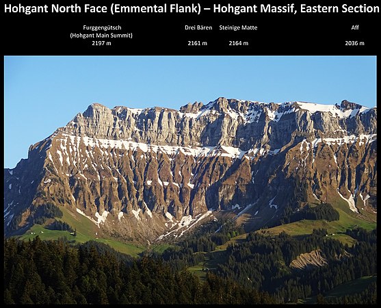 Hohgant Massif – Eastern section with main summit Furggengütsch (to the left)
 Hohgant Massif – Eastern end with main summit Furggengütsch (left of centre) & "Drei Bären / The Three Bears" (to the right)


See also
- Siebenhengste-Hohgant-Höhle
References
- Retrieved from the Swisstopo topographic maps. The key col is the Feldmoos (1,559 m).
External links
| Authority control |
|
|---|
This article about a mountain, mountain range, or peak located in the canton of Bern is a stub. You can help Wikipedia by expanding it. |
На других языках
[de] Hohgant
Der Hohgant (.mw-parser-output .IPA a{text-decoration:none}[ˌhoːˈɡant]) ist ein Gebirgsstock der Emmentaler Alpen im Schweizer Kanton Bern.- [en] Hohgant
Текст в блоке "Читать" взят с сайта "Википедия" и доступен по лицензии Creative Commons Attribution-ShareAlike; в отдельных случаях могут действовать дополнительные условия.
Другой контент может иметь иную лицензию. Перед использованием материалов сайта WikiSort.org внимательно изучите правила лицензирования конкретных элементов наполнения сайта.
Другой контент может иметь иную лицензию. Перед использованием материалов сайта WikiSort.org внимательно изучите правила лицензирования конкретных элементов наполнения сайта.
2019-2026
WikiSort.org - проект по пересортировке и дополнению контента Википедии
WikiSort.org - проект по пересортировке и дополнению контента Википедии