geo.wikisort.org - Mountains
Herðubreið (Icelandic pronunciation: [ˈhɛrðʏˌpreiːθ], broad-shouldered) is a tuya in northern part of Vatnajökull National Park, Iceland. It is situated in the Highlands of Iceland at the east side of the Ódáðahraun [ˈouːˌtauːðaˌr̥œiːn] desert and close to Askja volcano. The desert is a large lava field originating from eruptions of Trölladyngja and other shield volcanoes in the area. Herðubreið was formed beneath the icesheet that covered Iceland during the last glacial period.[1]
This article needs additional citations for verification. (March 2011) |
| Herðubreið | |
|---|---|
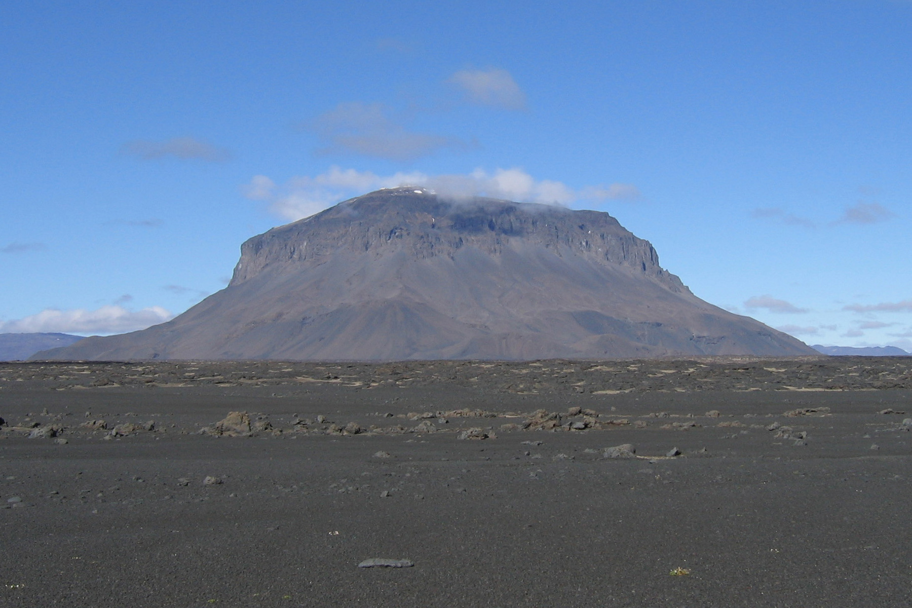 Herðubreið, viewed from the southeast | |
| Highest point | |
| Elevation | 1,682 m (5,518 ft) |
| Listing | List of volcanoes in Iceland |
| Coordinates | 65°10′44.06″N 16°20′50.36″W |
| Geography | |
 Herðubreið Iceland | |
| Location | Eastern Iceland |
| Geology | |
| Age of rock | Pleistocene |
| Mountain type | Tuya |
| Last eruption | Pleistocene |
Overview
Due to the mountain's steep and unstable sides, the first ascent was in 1908 despite centuries of knowledge of its existence.[citation needed]
The Mountain is often referred to as "The Queen of Icelandic Mountains" by Icelanders due to its beautiful shape.[2]
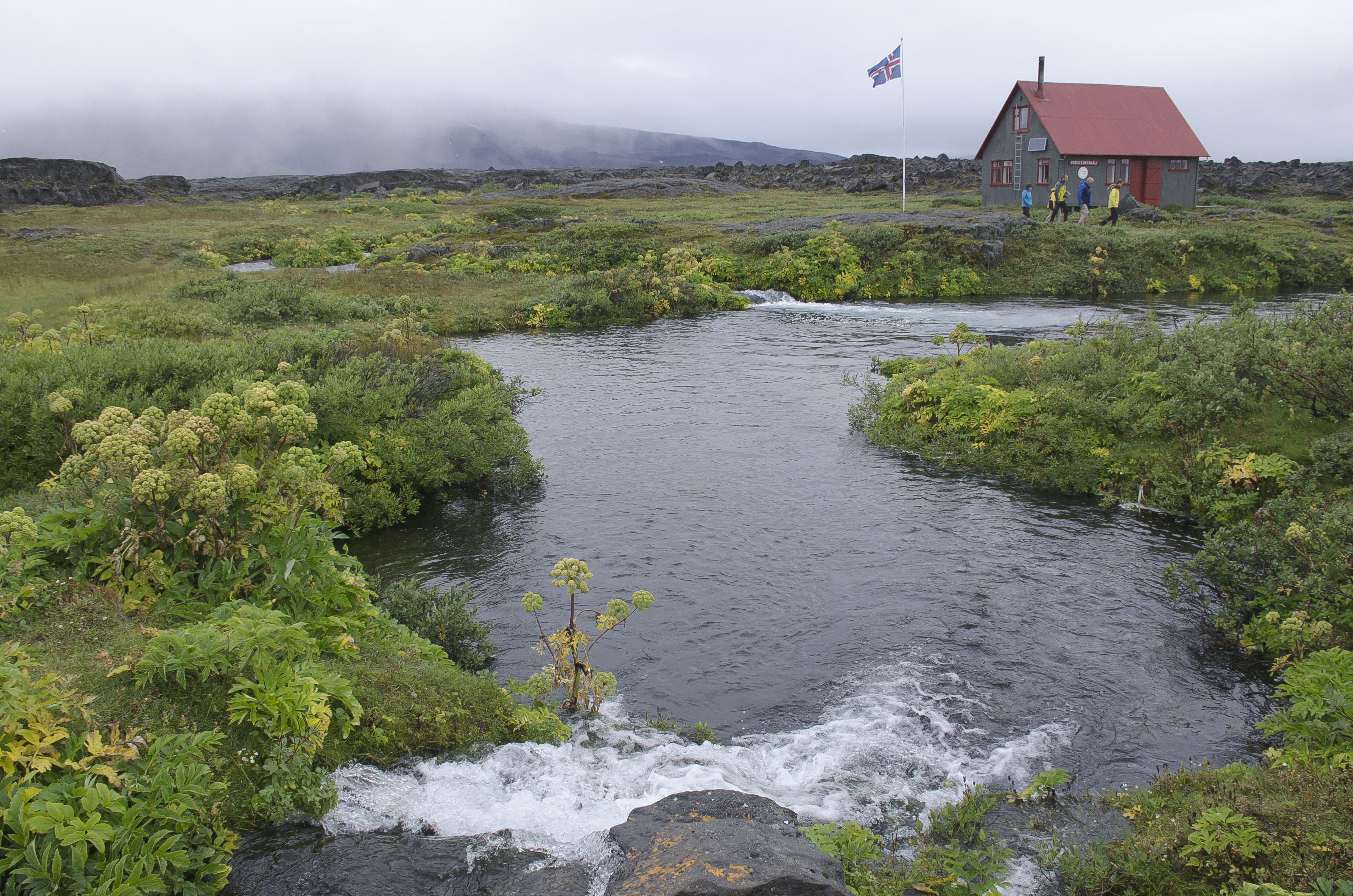
Near the mountain lies an oasis called Herðubreiðarlindir [ˈhɛrðʏˌpreiːðarˌlɪntɪr̥] with a campground and hiking trails. In former times, outcasts who had been excluded from Icelandic society because of crimes they had committed lived at the oasis.[citation needed] One such outlaw was Fjalla-Eyvindur, who lived there during the winter of 1774–1775.[3]
In 2019 Herðubreið became a part of Vatnajökull National Park.[4]
See also
- Geography of Iceland
- Volcanism of Iceland
References
- Teitsson, Ingvar. "Herðubreið - Drottning íslenskra fjalla". International year of mountains 2002. Icelandic Environment Association. Archived from the original on 2005-02-21. Retrieved 2011-10-19.
{{cite web}}: CS1 maint: bot: original URL status unknown (link) Archive.org - "Var Herðubreið eldfjall og gæti hún gosið?".
- Askja and Kverkfjoll: Exploring the Area, Frommer's Iceland, 1st Edition.
- "Vatnajökulsþjóðgarður stækkaður: Herðubreið og Herðubreiðarlindir hluti af þjóðgarðinum".
External links
| Wikimedia Commons has media related to Herðubreið. |
- Official Website of Vatnajökull National Park
- "Herdubreid". Global Volcanism Program. Smithsonian Institution. Retrieved 2021-06-25.
- Images
- Herðubreiðarlindir – picture gallery from islandsmyndir.is
- http://isafold.de/panorama/panoram.htm (via "Askja")
Authority control | |
|---|---|
| General |
|
| National libraries | |
На других языках
[de] Herðubreið
Herðubreið [.mw-parser-output .IPA a{text-decoration:none}'hεrðʏ̩prεiˑð] (deutsch: die Breitschultrige) gilt mit ihrer auffälligen Form eines Tafelvulkans als die "Königin der Berge Islands". Der Berg ist 1682 Meter hoch und liegt im isländischen Hochland in der Wüste Ódáðahraun, nicht weit entfernt vom Vulkan Askja.- [en] Herðubreið
[es] Herðubreið
El Herðubreið es un tuya situado en la región de Norðurland Eystra, el noreste de las Tierras Altas de Islandia y en el desierto del campo de lava de Ódáðahraun, a lo largo de la Öskjuleið y en las cercanías del Askja. Tiene una altura de 1.682 msnm.[fr] Herðubreið
Le Herðubreið est un volcan d'Islande de type tuya, situé dans le centre-est du pays, dans la région des Hautes Terres.[it] Herðubreið
Herðubreið è un tuya situato nel nord-est degli Altopiani d'Islanda nel deserto del campo di lava di Ódáðahraun, lungo la Öskjuleið e non molto lontano dall'Askja.[ru] Хердюбрейд
Хердюбрейд (исл. Herðubreið) — вулкан на северо-востоке Исландии. Расположен на Исландском плато в середине пустынной местности Оудаудахрейн неподалеку от вулкана Аскья. Оудаудахрейн представляет собой лавовое поле, возникшее вследствие извержений вулкана Трёдладингья. Хердюбрейд сформировался под ледником, покрывавшим Исландию в последний ледниковый период. Состоит из андезита.Другой контент может иметь иную лицензию. Перед использованием материалов сайта WikiSort.org внимательно изучите правила лицензирования конкретных элементов наполнения сайта.
WikiSort.org - проект по пересортировке и дополнению контента Википедии