geo.wikisort.org - MountainsHawk's Tor is a hill and tor on Bodmin Moor in Cornwall, England, UK. Its summit is 307 metres (1,007 ft) above sea level.[2]
Hill and tor on Bodmin Moor, Cornwall, England
| Hawk's Tor |
|---|
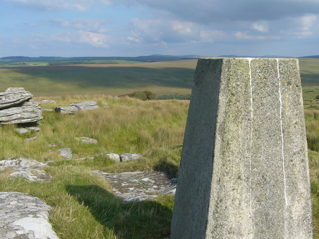
 View from the trig point on Hawk's Tor. |
|
| Elevation | 307 m (1,007 ft)[1] |
|---|
| Prominence | 61 m (200 ft)[1] |
|---|
| Listing | Tump |
|---|
|
| Location | West Bodmin Moor, Cornwall |
|---|
| OS grid | SX141755 |
|---|
| Topo map | OS Landranger 200, Explorer 109 |
|---|
|
| Mountain type | granite tor |
|---|
The tor, which is in the civil parish of Blisland, is located 7 miles (11 km) north east of the town of Bodmin.[2] The slopes of the tor contain Hawkstor Downs, the Stripple stones, a stone circle and Hawkstor Pit, which is a Site of Special Scientific Interest noted for its biological interest.[3]
There is another Hawk's Tor (329 m) on Bodmin Moor, further east, near the village of North Hill.[2]
References
 Cornwall portal
- Hawk's Tor at www.hill-bagging.co.uk. Retrieved 29 Dec 2016.
- Ordnance Survey: Landranger map sheet 200 Newquay & Bodmin ISBN 978-0-319-22938-5
- "Hawkstor Pit" (PDF). Natural England. 1993. Retrieved 1 November 2011.
Geological Sites of Special Scientific Interest in Cornwall and the Isles of Scilly |
|---|
| Summary |
- Summarised data for all sites (biological and geological)
|
|---|
| Cornwall |
- Aire Point to Carrick Du
- Baulk Head to Mullion
- Bedruthan Steps and Park Head
- Belowda Beacon
- Boscastle to Widemouth
- Boscawen
- Bude Coast
- Caerthillian to Kennack
- Cameron Quarry
- Carn Grey Rock and Quarry
- Clicker Tor Quarry
- Cligga Head
- Coverack Cove and Dolor Point
- Coverack to Porthoustock
- Crocadon Quarry
- Crow's Nest
- Cuckoo Rock to Turbot Point
- Cudden Point to Prussia Cove
- De Lank Quarries
- Duckpool to Furzey Cove
- East Lizard Heathlands
- Folly Rocks
- Gerrans Bay to Camels Cove
- Godrevy Head to St Agnes
- Great Wheal Fortune
- Greystone Quarry
- Gwithian to Mexico Towans
- Harbour Cove
- Hawkstor Pit
- Hingston Down Quarry & Consols
- Kennack to Coverack
- Kingsand to Sandway Point
- Lidcott Mine
- Loe Pool
- Lower Fal & Helford Intertidal
- Luxulyan Quarry
- Meneage Coastal Section
- Mulberry Downs Quarry
- Mullion Cliff to Predannack Cliff
- Penberthy Croft Mine
- Penlee Point
- Penlee Quarry
- Pentire Peninsula
- Polyne Quarry
- Polyphant
- Porthcew
- Porthleven Cliffs
- Porthleven Cliffs East
- Rame Head & Whitsand Bay
- Roche Rock
- Rock Dunes
- Rosemullion
- Rosenun Lane
- South Terras Mine
- St Agnes Beacon Pits
- St Erth Sand Pits
- St Mewan Beacon
- St Michael's Mount
- Stepper Point
- Stourscombe Quarry
- Swanpool
- Tater-du
- Tintagel Cliffs
- Trebetherick Point
- Tregargus Quarries
- Trelavour Downs
- Tremearne Par
- Trevaunance Cove
- Trevone Bay
- Trevose Head and Constantine Bay
- Viverdon Quarry
- West Lizard
- Wheal Alfred
- Wheal Gorland
- Wheal Martyn
- Wheal Penrose
- Yeolmbridge Quarry
|
|---|
| Isles of Scilly |
- Castle Down (Tresco)
- Chapel Down (St. Martin's)
- Peninnis Head (St. Mary's)
- Porth Seal (St. Martin's)
- Porthloo
- Shipman Head & Shipman Down (Bryher)
- St Martin's Sedimentary Shore
- Teän
- Watermill Cove
- White Island
|
|---|
- Neighbouring areas: Sites of Special Scientific Interest in Devon
- Sites of Special Scientific Interest in Somerset
|
Текст в блоке "Читать" взят с сайта "Википедия" и доступен по лицензии Creative Commons Attribution-ShareAlike; в отдельных случаях могут действовать дополнительные условия.
Другой контент может иметь иную лицензию. Перед использованием материалов сайта WikiSort.org внимательно изучите правила лицензирования конкретных элементов наполнения сайта.
2019-2026
WikiSort.org - проект по пересортировке и дополнению контента Википедии