geo.wikisort.org - Mountains
Gutsal Ridge (Bulgarian: Гуцалски хребет, ‘Gutsalski Hrebet’ \'gu-tsal-ski 'hre-bet\) is the ice-covered ridge extending 10.4 km in northwest-southeast direction and rising to 1574 m (Trambesh Peak)[1] on the southeast side of Stribog Mountains on Brabant Island in the Palmer Archipelago, Antarctica. The southeast half of the ridge has steep and partly ice-free southwest slopes. It surmounts Hippocrates Glacier to the southwest and Balanstra Glacier to the northeast.
The ridge is named after the settlement of Gutsal in Western Bulgaria.
Location
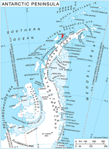
Gutsal Ridge is centred at 64°20′25″S 62°20′40″W. British mapping in 1980 and 2008.
Maps
- Antarctic Digital Database (ADD). Scale 1:250000 topographic map of Antarctica. Scientific Committee on Antarctic Research (SCAR). Since 1993, regularly upgraded and updated.
- British Antarctic Territory. Scale 1:200000 topographic map. DOS 610 Series, Sheet W 64 62. Directorate of Overseas Surveys, Tolworth, UK, 1980.
- Brabant Island to Argentine Islands. Scale 1:250000 topographic map. British Antarctic Survey, 2008.
Notes
- Reference Elevation Model of Antarctica. Polar Geospatial Center. University of Minnesota, 2019
References
- Bulgarian Antarctic Gazetteer. Antarctic Place-names Commission. (details in Bulgarian, basic data in English)
- Gutsal Ridge. SCAR Composite Antarctic Gazetteer.
External links
- Gutsal Ridge. Copernix satellite image

This article includes information from the Antarctic Place-names Commission of Bulgaria which is used with permission.
This Brabant Island location article is a stub. You can help Wikipedia by expanding it. |
На других языках
[de] Gutsal Ridge
Gutsal Ridge (englisch; bulgarisch Гуцалски рид .mw-parser-output .Latn{font-family:"Akzidenz Grotesk","Arial","Avant Garde Gothic","Calibri","Futura","Geneva","Gill Sans","Helvetica","Lucida Grande","Lucida Sans Unicode","Lucida Grande","Stone Sans","Tahoma","Trebuchet","Univers","Verdana"}Guzalski rid) ist ein vereister, in nordwest-südöstlicher Ausrichtung 10,4 km langer und bis zu 1600 m hoher Gebirgskamm auf der Brabant-Insel im Palmer-Archipel westlich der Antarktischen Halbinsel. Er ragt auf der südöstlichen Seite der Stribog Mountains auf. Seine südöstliche Hälfte ist gekennzeichnet durch steile und teilweise unvereiste Südwesthänge. Der Hippokrates-Gletscher liegt südwestlich, der Balanstra-Gletscher nordöstlich von ihm.- [en] Gutsal Ridge
Другой контент может иметь иную лицензию. Перед использованием материалов сайта WikiSort.org внимательно изучите правила лицензирования конкретных элементов наполнения сайта.
WikiSort.org - проект по пересортировке и дополнению контента Википедии