geo.wikisort.org - Mountains
Gurla Mandhata, also Naimona'nyi or Nemo Nani (Chinese: 納木那尼峰), is the highest peak of the Nalakankar Himal, a small subrange of the Himalaya. It is named after king Mandhata of suryavansha of Ikshvaku dynasty. It lies in Burang County of the Ngari Prefecture in the Tibet Autonomous Region of China, near the northwest corner of Nepal. It is the 34th-highest peak in the world (using a 500-metre prominence cutoff). It is also notable for being well within the interior of the Tibetan Plateau (most peaks of similar height – except notably Shishapangma, the world's 14th-highest peak – lie nearer to or outside the edge of the Plateau) and relatively far away from other peaks with heights greater than 7,500 metres. It sits roughly across Lake Manasarovar from the sacred peak of Mount Kailash. The Tibetan name, Naimona'nyi, is said to come from naimo = "herbal medicine", na = "black", nyi = "heaped-up slabs", giving "the mountain of heaped-up slabs of black herbal medicine."[3]
| Gurla Mandhata | |
|---|---|
 Gurla Mandhata | |
| Highest point | |
| Elevation | 7,728 m (25,354 ft)[1] Ranked 34th |
| Prominence | 2,788 m (9,147 ft)[1] |
| Listing | Ultra |
| Coordinates | 30°26′09″N 81°17′45″E[1] |
| Geography | |
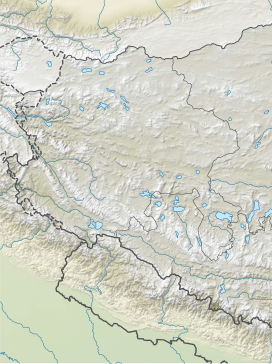 Gurla Mandhata Location in southwestern Tibet Autonomous Region | |
| Location | Tibet Autonomous Region, China |
| Parent range | Nalakankar Himal, Himalaya |
| Climbing | |
| First ascent | 1985 by Cirenuoji, Jiabu, Jin Junxi, K. Matsubayashi, Song Zhiyu, K. Suita, Y. Suita, T. Wada[2] |
| Easiest route | West flank: snow/ice climb |
Climbing history
In 1905, T. G. Longstaff, accompanied by two alpine guides and six porters, made an attempt on Gurla Mandhata. They turned back at around 7,000 m (23,000 ft) after being caught in an avalanche and encountering other difficulties.[2] This was a strong achievement for the time, especially for such a small group; at that time no summit of over 7,000 m had yet been climbed and Longstaff's height represented a world altitude record.
In 1935, a Viennese student, Herbert Tichy, disguised as an Indian pilgrim, made a trip to the holy mountain Kailash. On the way, he attempted Gurla Mandhata with one of his porters, Kitar. They reached a height of 23,400 ft. where they were turned back by fresh snow and bad weather.[4]
In 1955 the mountain was the intended destination of the inaugural Welsh Himalayan Expedition, led by Sydney Wignall.[5] The expedition, sponsored by the Liverpool Daily Post, intended to summit Gurla Mandata and plant three flags: the Welsh Dragon, the flag of the recently-overthrown Chinese Republic and the Jolly Roger.[5] Before the climb could begin, the group was captured by the Chinese military who imprisoned and tortured the climbers for two months under the belief they were CIA spies (Wignall had in fact offered to spy for India).[5]
The first ascent of the peak was by a joint Japanese/Chinese team led by Katsutoshi Hirabayashi, via the north side of the peak, in May 1985.[3] Since that time, there have been six additional successful ascents and two failed attempts on the peak.[6]
In 1997, an attempt was made to ascend the peak via the then-unclimbed North Face route by Quinn Simons, Soren Peters, and their guide, Charlie Fowler. The team made a valiant effort, climbing high on the mountain, but after severe storms and other difficulties had to retreat. Their descent ended in a fall of some 450 m (1,500 ft) down the North Face of the peak. Fowler was slightly injured, while Simons and Peters both suffered extreme frostbite on their extremities.[7]

The standard ascent route climbs the western flanks of the mountain ascending the Chaglung'mlungha Glacier to the summit plateau. Most teams choose to approach the mountain overland by jeep from either Lhasa, Tibet, or Kathmandu, Nepal. However, an alternate approach begins in the mountain hamlet of Simikot, Nepal, in the remote Humla district of west Nepal and follows the Karnali River northward, crossing into Tibet (China) in the village of Sher. Jeeps then take climbers north through Taklakot (Burang) to basecamp on the mountain.
References
- "China I: Tibet - Xizang". Peaklist.org. Retrieved 2014-05-29.
- Jill Neate, High Asia, The Mountaineers, 1989.
- American Alpine Journal 1986, p. 302.
- American Alpine Journal (2019). "Peaks in Asia". American Alpine Journal.
{{cite web}}: CS1 maint: url-status (link) - "Obituaries: Sydney Wignall". The Daily Telegraph. London: Telegraph Media Group. 25 April 2012. Retrieved 28 December 2017.
- The Alpine Club's Himalayan Index (accessed 2007-07-21) lists five ascents and two failed attempts through 2001. The American Alpine Journal records no ascents or attempts from 2002 through 2005. The Expedition blog of the First American ascent of Gurla Mandhata records the only other ascent, in 2006. (There is some possibility of unrecorded ascents or attempts, so these numbers may be slight underestimates.)
- American Alpine Journal 1999, pp. 211-213.
External links
- A list of prominent Asian peaks
- Digital Elevation Data (Go to n30e081)
- Historical photo of Gurla Mandhata with Mount Kailas taken from Lipu Pass, on a NASA-related site
- Virtual Aerial Video of Gurla Mandhata
Authority control | |
|---|---|
| General |
|
| National libraries | |
На других языках
[de] Gurla Mandhata
Der Naimona’nyi (auch: Gurla Mandhata) liegt im Nordosten des Sitzes der Kreisregierung von Burang im Regierungsbezirk Ngari, im Südwesten des Autonomen Gebiets Tibet der Volksrepublik China.[1] Er ist der höchste Gipfel des Nalakankar Himal, eines kleinen, westlich gelegenen Teilbereichs des Himalaya.- [en] Gurla Mandhata
[es] Gurla Mandhata
El Gurla Mandhata, también conocido como Naimona'nyi o Memo Nani (en chino, 納木那尼峰) es el pico más alto de la Nalakankar Himal, una subcordillera del Himalaya. Se encuentra en el Condado de Burang, en la prefectura de Ngari, en la Región Autónoma del Tíbet, en China, cerca del extremo noroccidental de Nepal. Se trata del 34.º pico más alto del mundo, teniendo en cuenta un corte prominente de unos 500 metros. Se encuentra dentro de la meseta tibetana -cuando la mayor parte de los picos con una altura similar, excepto el Shisha Pangma, el 14.º pico más alto del mundo, se encuentran cerca o fuera de los márgenes de la meseta- y relativamente alejado de otros picos de más de 7.500 msnm. Está situado aproximadamente al otro lado del lago Manasarovar desde el monte sagrado del Kailāsh. Se dice que su nombre tibetano, Naimona'nyi, proviene de naimo = hierba medicinal, na = negro y nyi = losas apiladas, resultando, "la montaña de losas apiladas de hierbas medicinales negras".[2][fr] Gurla Mandhata
Le Gurla Mandhata, ou Naimona'nyi ou Nani (en chinois : 納木那尼峰) est le point culminant du Nalakankar Himal, une chaîne de l'Himalaya. Il est situé dans le xian de Burang de la préfecture de Ngari dans la région autonome du Tibet, à proximité du Nord-Ouest du Népal. Il est le 34e plus haut sommet dans le monde. Il a la particularité d'être très à l'intérieur du plateau Tibétain (la plupart des sommets d'altitude similaire sont à la marge du plateau). Il est situé à proximité du lac Manasarovar et du mont Kailash. Le nom tibétain, Naimona'nyi, est censé provenir de naimo = « phytothérapie », na = « noir », nyi = « dalles entassées », donnant « la montagne aux dalles entassées de la phytothérapie noire ».[it] Gurla Mandhata
Il Gurla Mandhata (7.694 m s.l.m., detto anche Naimona'nyi o Memo Nani, in cinese 納木那尼峰), è la montagna più alta della catena montuosa del Nalakankar Himal, nell'Himalaya.[ru] Гурла-Мандхата
Гурла́-Мандха́та[2] (непальск. गुरला मान्धाता; тиб. ཎིམོནའི྇ཉ།, Наймона-Нии; кит. 納木那尼峰, Намунани) — самый высокий пик хребта Налаканкар Химал, в центральной части Гималаев. Расположена в провинции Нгари Тибетского автономного района близ северо-западной границы Непала. 34 по высоте вершина в мире. Гурла-Мандхата также является высочайшей вершиной на плато Тибет (ближайшая высокая вершина Шишабангма, 14 по высоте пик мира, находится за пределами плато) и расположена в отдалении от других высоких вершин (свыше 7500 м). Находится на противоположном от священной горы Кайлас берегу озера Мапам-Юмцо. Тибетское название — Наймона-Нии, переводится — Наймо — «травяной настой», на — «чёрный», Нии — «взгромождённые скалы», приблизительно как «Гора чёрного настоя»[3]Другой контент может иметь иную лицензию. Перед использованием материалов сайта WikiSort.org внимательно изучите правила лицензирования конкретных элементов наполнения сайта.
WikiSort.org - проект по пересортировке и дополнению контента Википедии