geo.wikisort.org - Mountains
Gaydari Peak (Bulgarian: връх Гайдари, romanized: vrah Gaydari, IPA: [ˈvrɤɣ ɡɐjˈdari]) is the ice-covered peak rising to 852 m[1] on the coast of Darbel Bay on Loubet Coast in Graham Land, Antarctica. It surmounts Darbel Bay to the west and its part Tlachene Cove to the south, and Hopkins Glacier to the southeast.
The peak is named after the settlement of Gaydari in the Northern Bulgaria.
Location
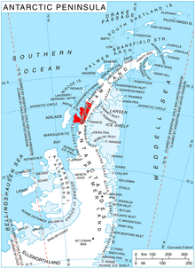
Gaydari Peak is located at 66°33′58″S 65°41′25″W, which is 16.3 km southwest of Roygos Ridge, 10.48 km west of Mount Bain and 12.5 km northwest of Voit Peak. British mapping in 1976.
Maps
- Antarctic Digital Database (ADD). Scale 1:250000 topographic map of Antarctica. Scientific Committee on Antarctic Research (SCAR). Since 1993, regularly upgraded and updated.
- British Antarctic Territory. Scale 1:200000 topographic map. DOS 610 Series, Sheet W 66 64. Directorate of Overseas Surveys, Tolworth, UK, 1976.
Notes
- Reference Elevation Model of Antarctica. Polar Geospatial Center. University of Minnesota, 2019
References
- Bulgarian Antarctic Gazetteer. Antarctic Place-names Commission. (details in Bulgarian, basic data in English)
- Gaydari Peak. SCAR Composite Antarctic Gazetteer.
External links
- Gaydari Peak. Copernix satellite image
This article includes information from the Antarctic Place-names Commission of Bulgaria which is used with permission.
This Loubet Coast location article is a stub. You can help Wikipedia by expanding it. |
На других языках
[de] Gaydari Peak
Der Gaydari Peak (englisch; bulgarisch връх Гайдари .mw-parser-output .Latn{font-family:"Akzidenz Grotesk","Arial","Avant Garde Gothic","Calibri","Futura","Geneva","Gill Sans","Helvetica","Lucida Grande","Lucida Sans Unicode","Lucida Grande","Stone Sans","Tahoma","Trebuchet","Univers","Verdana"}wrach Gajdari) ist ein 800 m hoher und vereister Berg an der Loubet-Küste des Grahamlands im Norden der Antarktischen Halbinsel. Er ragt 16,3 km südwestlich des Roygos Ridge, 10,48 km westlich des Mount Bain und 12,5 km nordwestlich des Voit Peak auf. Die Darbel Bay liegt westlich, die Tlachene Cove südlich und der Hopkins-Gletscher südöstlich von ihm.- [en] Gaydari Peak
Другой контент может иметь иную лицензию. Перед использованием материалов сайта WikiSort.org внимательно изучите правила лицензирования конкретных элементов наполнения сайта.
WikiSort.org - проект по пересортировке и дополнению контента Википедии