geo.wikisort.org - Mountains
Garrow Tor is a bare, tor-crowned hill, 330 metres (1,080 ft) high, located on Garrow Downs in the northwest of Bodmin Moor in the county of Cornwall, England, UK.[2]
| Garrow Tor | |
|---|---|
 On Garrow Tor | |
| Highest point | |
| Elevation | 330 m (1,080 ft)[1] |
| Prominence | 57 m (187 ft)[1] |
| Listing | TuMP |
| Coordinates | 50°34′34.03″N 4°37′12.81″W |
| Geography | |
| Location | Bodmin Moor, England |
| OS grid | SX145780 |
| Topo map | OS Landranger 200, Explorer 109 |
| Geology | |
| Mountain type | granite tor |
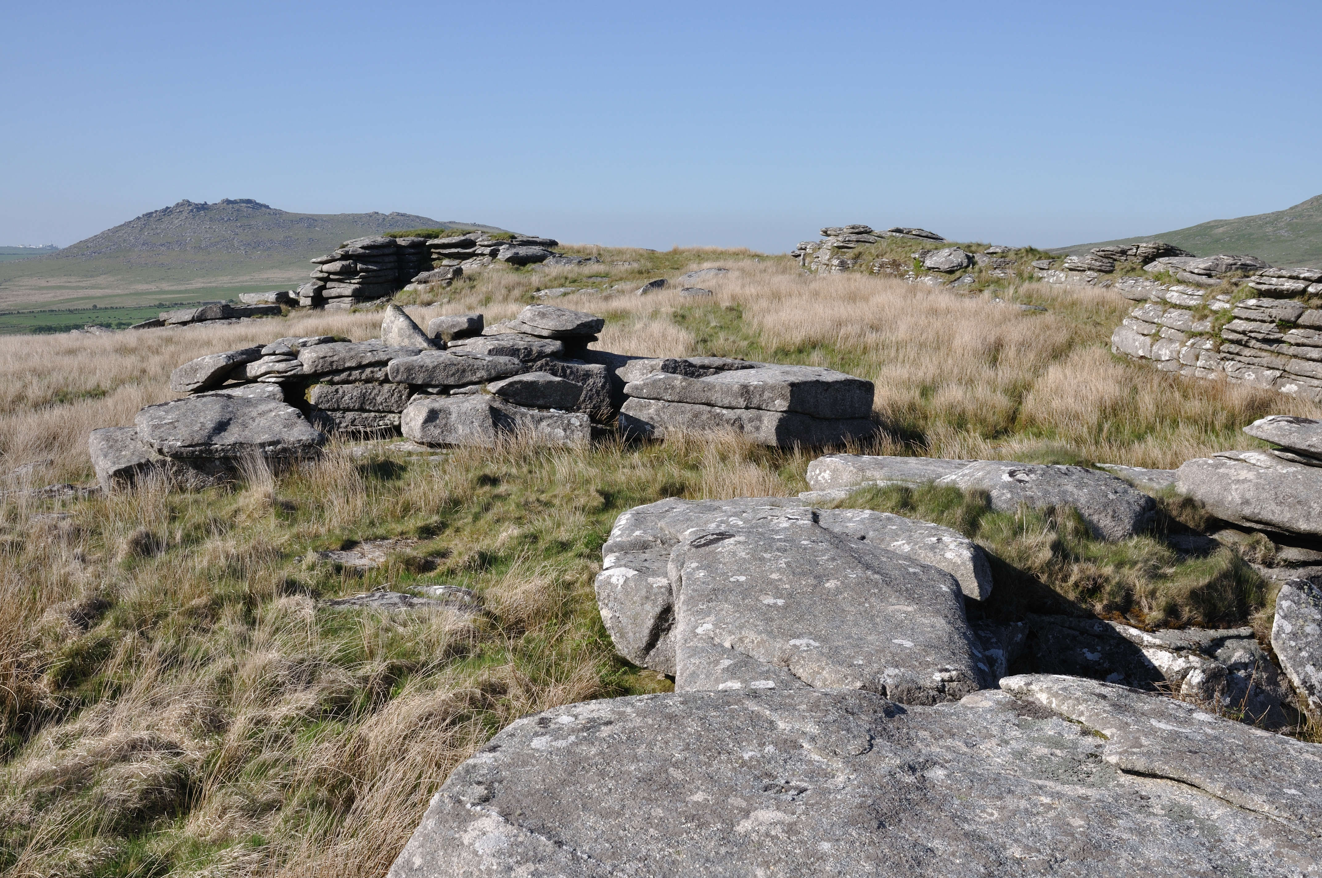
At the summit of Garrow Tor are granite rock outcrops and the hill also bears extensive evidence of early settlement, including a massive stone hedge, Bronze Age settlements and hut circles and Medieval settlements. Panoramic views from the summit include Caradon Hill to the south, Rough Tor and Brown Willy to the north, Butter's Tor to the east, clay country to the west and the Atlantic Ocean to the northwest. .[3][2]
The De Lank River runs past the eastern flank of the tor from north to south, before swinging southwest around the southern foot of the hill. King Arthur's Hall lies a kilometre to the southwest.[2]
When visiting the hill, a useful place to park is by the waterworks to the southwest.[3]
References
- Garrow Tor at www.hill-bagging.co.uk. Accessed on 5 Sep 2013
- Ordnance Survey 1:25,000 Explorer map series, No. 109
- Garrow Tor at www.oliverscornwall.co.uk. Accessed on 5 Sep 2013
Другой контент может иметь иную лицензию. Перед использованием материалов сайта WikiSort.org внимательно изучите правила лицензирования конкретных элементов наполнения сайта.
WikiSort.org - проект по пересортировке и дополнению контента Википедии