geo.wikisort.org - Mountains
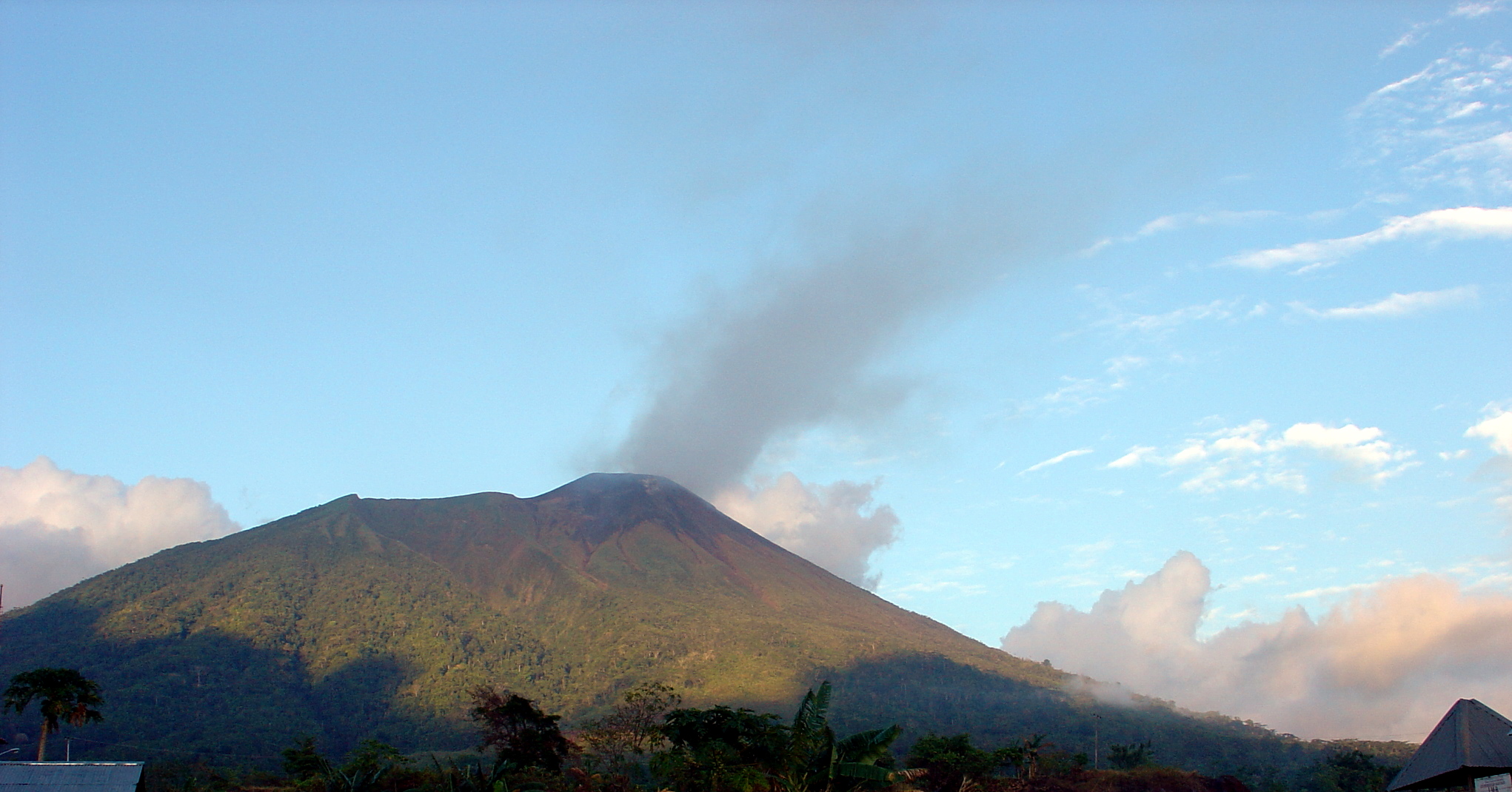
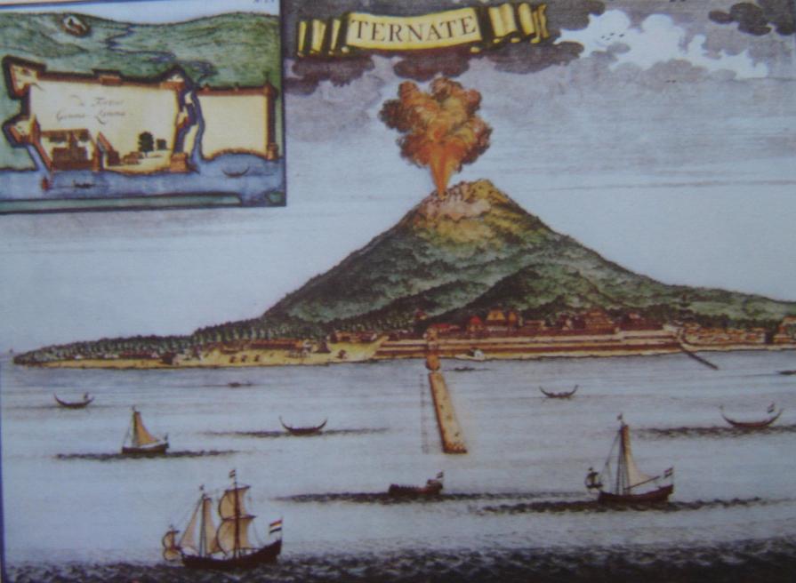
Gamalama is a near-conical stratovolcano that comprises the entire Ternate island in Indonesia. The island lies off the western shore of Halmahera island in the north of the Maluku Islands. For centuries, Ternate was a center of Portuguese and Dutch forts for spice trade, which have accounted for thorough reports of Gamalama's volcanic activities.
| Gamalama | |
|---|---|
| Pulau Ternate | |
 | |
| Highest point | |
| Elevation | 1,715 m (5,627 ft)[1] |
| Prominence | 1,715 m (5,627 ft)[2] |
| Listing | Ultra Ribu |
| Coordinates | 00°48′33″N 127°20′00″E[2] |
| Geography | |
 Gamalama Location in Indonesia of the island | |
| Location | Ternate, Maluku Islands, Indonesia |
| Geology | |
| Mountain type | Stratovolcano |
| Last eruption | October 2018 (ongoing) |
An eruption in 1775 caused the deaths of approximately 1300 people.[3]
On December 4, 2011 Mount Gamalama erupted, ejecting material up to 2,000 meters into the air. Thousands of residents in nearby Ternate City fled due to ash and dust particles raining down on the town.[4] Finally on December 27 some 4 people died and dozens injured from debris falls (lahar) after a month of activity.[5]
More eruptions occurred in September 2012.[6]
An eruption on December 18, 2014, deposited five centimeters of ash on the runway of Babullah Airport in Ternate, closing the airport.[7]
See also
- List of volcanoes in Indonesia
- List of Ultras of Malay Archipelago
References
- "Gamalama". Global Volcanism Program. Smithsonian Institution. Retrieved 2006-12-13.
- "Mountains of the Indonesian Archipelago" Listed as Pulau Ternate. Peaklist.org. Retrieved 2012-01-22.
- "Eruption of the Gamalama volcano". earthquake-report.com. December 7, 2011. Archived from the original on 2012-02-12.
- "Thousands flee as Indonesian volcano erupts". December 5, 2011.
- "Most Popular E-mail Newsletter". USA Today. 2011-12-28.
- "Indonesia's Mount Gamalama erupts spewing ash and lava". BBC News. 2012-09-17.
- "Babullah Airport Shut as Mount Gamalama Erupts". 2014-12-19.
External links
This article about a location in Maluku Province is a stub. You can help Wikipedia by expanding it. |
На других языках
[de] Gamalama
Der Vulkan Gamalama auf der Vulkaninsel Ternate gehört zu den aktivsten Vulkanen in Indonesien. Er liegt in der Provinz Maluku Utara in den Molukken im Osten Indonesiens. Der Gamalama ist Teil einer Vulkankette, die sich westlich der Insel Halmahera gebildet hat, darunter der Gamkonora auf der Insel Tidore, der Hiri oder der Makian.- [en] Gamalama
[fr] Gamalama
Le Gamalama, aussi appelé Arfat, Arufat ou encore pic de Ternate[1], est un stratovolcan d'Indonésie qui constitue le point culminant de l'île de Ternate[2]. De forme conique, il occupe la totalité de l'île de Ternate située à une dizaine de kilomètres du rivage occidental de l'île de Halmahera, la plus grande de la province des Moluques du Nord[2].[ru] Гамалама
Гамалама (индон. Gunung Gamalama) — вулкан, расположен на острове Тернате, входящий в провинцию Северное Малуку, Индонезия. Другие названия вулкана: Арфат, Афурат, Тернате. Находится к западу от острова Хальмахера.Другой контент может иметь иную лицензию. Перед использованием материалов сайта WikiSort.org внимательно изучите правила лицензирования конкретных элементов наполнения сайта.
WikiSort.org - проект по пересортировке и дополнению контента Википедии