geo.wikisort.org - Mountains
Forollhogna (or Forolhogna) is a mountain located on the border between three municipalities in Norway: Midtre Gauldal and Holtålen (in Trøndelag county) and Os (in Innlandet county). The 1,332-metre (4,370 ft) tall mountain Forollhogna is the highest mountain inside Forollhogna National Park.[3]
| Forollhogna | |
|---|---|
| Forolhogna | |
 Forollhogna (image center) as seen from Ilfjellet (west) | |
| Highest point | |
| Elevation | 1,332 m (4,370 ft) |
| Prominence | 700 m (2,300 ft)[1] |
| Isolation | 35.8 to 36 km (22.2 to 22.4 mi) |
| Coordinates | 62.6789°N 10.7924°E[2] |
| Geography | |
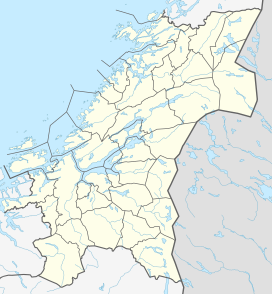 Forollhogna Location of the mountain  Forollhogna Forollhogna (Innlandet)  Forollhogna Forollhogna (Norway) | |
| Location | Trøndelag and Innlandet, Norway |
| Topo map | 1620 II Dalsbygda |
The mountain is about 27 kilometres (17 mi) southeast of the village of Enodden in Midtre Gauldal and about 30 kilometres (19 mi) northwest of town of Røros.
References
- "Forolhogna 1332 moh - fakta" (in Norwegian). Toppomania. Archived from the original on 2011-07-22. Retrieved 2011-02-13.
- "Forollhogna, Midtre Gauldal (Trøndelag)" (in Norwegian). yr.no. Retrieved 2018-01-18.
- Mæhlum, Lars, ed. (2017-10-27). "Forollhogna". Store norske leksikon (in Norwegian). Kunnskapsforlaget. Retrieved 2018-01-18.
This article about a mountain, mountain range, or peak in Trøndelag is a stub. You can help Wikipedia by expanding it. |
This article about a mountain, mountain range, or peak in Innlandet is a stub. You can help Wikipedia by expanding it. |
На других языках
[de] Forollhogna
Der Forollhogna (auch Forolhogna) ist ein 1332 moh.[1] hoher Berg in Norwegen. Er ist der höchste Berg im Forollhogna-Nationalpark[2] und gehört zu den Gemeinden Os, Midtre Gauldal und Holtålen in den Provinzen Innlandet und Trøndelag.- [en] Forollhogna
Текст в блоке "Читать" взят с сайта "Википедия" и доступен по лицензии Creative Commons Attribution-ShareAlike; в отдельных случаях могут действовать дополнительные условия.
Другой контент может иметь иную лицензию. Перед использованием материалов сайта WikiSort.org внимательно изучите правила лицензирования конкретных элементов наполнения сайта.
Другой контент может иметь иную лицензию. Перед использованием материалов сайта WikiSort.org внимательно изучите правила лицензирования конкретных элементов наполнения сайта.
2019-2026
WikiSort.org - проект по пересортировке и дополнению контента Википедии
WikiSort.org - проект по пересортировке и дополнению контента Википедии