geo.wikisort.org - Mountains
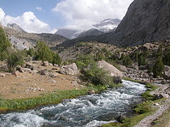
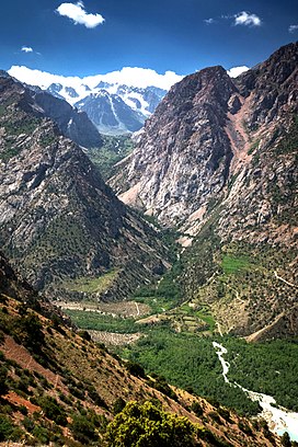
The Fann Mountains (Tajik: Кӯҳҳои Фон) are part of the western Pamir-Alay mountain system in Tajikistan's Sughd Province, between the Zarafshan Range to the north and the Gissar Range to the south.[1] In an east-west direction, they extend from the Fan Darya to the Archimaydan River.
| Fann Mountains | |
|---|---|
 | |
| Highest point | |
| Elevation | 5,489 m (18,009 ft) |
| Parent peak | Chimtarga Peak |
| Coordinates | 39°10′00.0″N 68°15′00.0″E |
| Naming | |
| Native name | |
| Geography | |
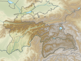 Location in Western Tajikistan | |
| Location | Tajikistan and Uzbekistan |
| Parent range | Pamir-Alay |
Peaks, lakes and access
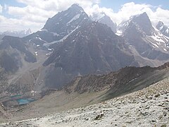
The Fanns boast about a hundred peaks, with several rising to altitudes of more than 5,000 meters and relative elevations of up to 1,500 meters.[2] The highest point in Fann Mountains is Chimtarga peak (5,489 m). Other 5,000-meter peaks are Bodkhona (5,138 m), Chapdara (5,050 m), Big Hansa, Little Hansa (5,031 m), Zamok ('5,070 m), Mirali (5,132 m), and Energia (5,120 m).
There are many lakes in the Fanns.The best known are Alaudin lakes in the Chapdara River valley, Kulikalon Lakes on the northern slope of Chimtarga peak, Big Allo Lake and Iskanderkul Lake.
There is a stunning mountain range in Western Tajikistan, near the city of Punjikent, which surprises tourists with its vivid, ever-changing colours. This are known as the Seven Lakes, Haftkul, or even Marguzor Lakes. In Tadjiki it means seven lakes (named after the largest lake in the group).[3]
The best time for visiting is late June–mid-September for trekking and July–August for mountaineering, when the weather is usually at its best. Access is generally from Panjakent, which can be reached either from Dushanbe or Samarkand.[4]
|
See also
- Alay Mountains
- Pamir Mountains
References
- Latombe, Jean-Claude. "Zigzagging in the Fann Mountains". Stanford University.
- "Fann mountains". TravelTajikistan.net. Retrieved 15 September 2015.
- "Seven Lake". Retrieved March 31, 2021.
{{cite web}}: CS1 maint: url-status (link) - "Fann mountains trekking: a guide". Caravanistan. Retrieved 2020-02-26.
External links
На других языках
[de] Fan-Gebirge
Das Fan-Gebirge (tadschikisch Кӯҳҳои Фон) ist ein Hochgebirge in Zentralasien. Der Gebirgszug gehört zum westlichen Pamir-Gebirge und befindet sich zum größten Teil in der tadschikischen Provinz Sughd.- [en] Fann Mountains
[es] Montes Fann
Las montañas o montes Fann, también conocidas simplemente como Lo[a]s Fanns (en tayiko, қаторкӯҳи Фан, katorkuhi Fan; en ruso, Фанские горы, Fanskije gory) es una cadena montañosa perteneciente a la sección occidental de la cordillera de Pamir, localizada entre las cordilleras Zeravshan, al norte, y Gissar, al sur. Administrativamente, es parte de la provincia de Sughd de Tayikistán.[it] Monti Fan
I monti Fan (in tagico Фон, Fon; in uzbeco Fon togʻlari; in russo Фанские горы, Fanskie gory) sono la parte più elevata dei monti Zeravshan, nell'Asia centrale. Si trovano nell'angolo nord-ovest del Tagikistan, nella provincia di Suƣd (distretti di Panjakent e di Ayni), estendendosi fino al confine con l'Uzbekistan. Sono posti tra la catena montuosa dei Zeravshan, a nord, e i monti Hisor a sud[1].[ru] Фанские горы
Фанские горы (в просторечии Фаны, тадж. Кӯҳҳои Фон) расположены на юго-западе Памиро-Алая в районе Гиссарского и Зеравшанского хребтов, что переводится соответственно как «Крепость» и «Дающий золото» — этот район до сих пор хранит золотоносные рудники. Преимущественно расположены на территории Таджикистана.Другой контент может иметь иную лицензию. Перед использованием материалов сайта WikiSort.org внимательно изучите правила лицензирования конкретных элементов наполнения сайта.
WikiSort.org - проект по пересортировке и дополнению контента Википедии
