geo.wikisort.org - Mountains
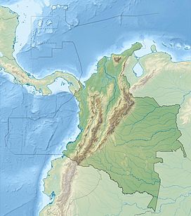
The Metropolitan Regional Natural Park Cerro El Volador is the largest natural park located within the metropolitan area of Medellín, Colombia. The park comprises 106 hectares and also is one of the seven so-called "guardian hills" in the city. The park was recently renovated in 2014.
| El Volador | |
|---|---|
 Ecoparque Cerro El Volador. | |
| Highest point | |
| Elevation | 82 m (269 ft)above mean city level |
| Coordinates | 6°16′N 75°35′W |
| Geography | |
Many of the first settlements in the Aburrá Valley were established on the hill in the center-western zone that is today known as the Robledo. This hill is surrounded by the La Iguaná ravine to the south, and by the streams Mononga and La Malpaso to the north. To the east, it is cut off by the 65th street.
The campus of the National University of Colombia and the University of Antioquia are near the hill too; as well, in some paths have been archaeological finds dating from the early centuries of the Christian era, as well as funerary complex from the 14th to 16th centuries caused by the Aburrá people.[1] For these reasons the hill was included as a natural colombian heritage site in 1992, and in 1998 due to the environmental and archaeological wealth it possesses, the hill was named of interest to the nation, by the Culture Ministry.
See also
- Nutibara Hill
- National Monuments of Colombia
References
- "El Volador". Cerros tutelares (in Spanish). Archived from the original on 2011-07-07. Retrieved 2009-01-28.
На других языках
- [en] El Volador hill
[es] Cerro El Volador
El Parque Natural Regional Metropolitano Cerro El Volador, es el parque natural más grande dentro del área urbana de la ciudad de Medellín, Colombia. Cuenta con un área de 107,13 hectáreas y 82 metros de altura sobre el nivel de la ciudad, y es uno de los llamados cerros tutelares de dicha localidad; Junto el Cerro Pan de Azúcar, Cerro El Salvador, Cerro El Picacho, Cerro La Asomadera, Cerro Las Tres Cruces, Cerro Nutibara y el Cerro Santo Domingo, una red de accidentes geográficos a lo largo del Valle del Aburrá que posee un importante valor histórico, arqueológico, ecológico y turístico. [1]Muchas de las primeras colonias de Medellín se establecieron en el cerro El Volador. Está ubicado en la zona centroccidente de la ciudad, en donde hoy se asienta la Comuna 7 de la localidad. Este cerro está rodeado por unas vecinas históricas, la quebrada La Iguaná, al sur. Al norte, por las quebradas Moñonga y La Malpaso. Al oriente se encuentra aislado por una vía urbana, la carrera 65.Другой контент может иметь иную лицензию. Перед использованием материалов сайта WikiSort.org внимательно изучите правила лицензирования конкретных элементов наполнения сайта.
WikiSort.org - проект по пересортировке и дополнению контента Википедии

