geo.wikisort.org - Mountains
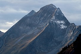
The Dent de Brenleire (French pronunciation: [dɑ̃ d(ə) bʁɑ̃lɛːʁ]; lit. 'Tooth of Branleire') is a mountain of the Fribourg Alps, located south of Charmey in the Swiss canton of Fribourg. It has an elevation of 2,353 metres above sea level and is amongst the highest summits in the canton of Fribourg, after the Vanil Noir, the Vanil de l'Ecri and the Pointe de Paray. It is also the highest mountain entirely within the canton.
| Dent de Brenleire | |
|---|---|
 Dent de Brenleire and Dent de Folliéran behind | |
| Highest point | |
| Elevation | 2,353 m (7,720 ft) |
| Prominence | 274 m (899 ft)[1] |
| Parent peak | Vanil Noir |
| Isolation | 3.1 km (1.9 mi) |
| Coordinates | 46°33′3″N 7°10′29.2″E |
| Geography | |
| Location | Fribourg, Switzerland |
| Parent range | Fribourg Alps |
The summit of the Dent de Brenleire is accessible by a trail running on the east side of the mountain, from the Gros Mont.
References
- Retrieved from the Swisstopo topographic maps. The key col is located west of Dent de Folliéran at 2,079 m.
External links
На других языках
[de] Dent de Brenleire
Die Dent de Brenleire ist ein 2353,2 m hoher Berg in den Freiburger Voralpen auf Gemeindeboden von Val-de-Charmey im Kanton Freiburg in der Schweiz.- [en] Dent de Brenleire
[fr] Dent de Brenleire
La dent de Brenleire est un sommet des Préalpes fribourgeoises situé dans le canton de Fribourg, en Suisse.[it] Dent de Brenleire
La Dent de Brenleire (2.353 m s.l.m.) è una montagna delle Prealpi di Vaud e Friburgo nelle Prealpi Svizzere.Текст в блоке "Читать" взят с сайта "Википедия" и доступен по лицензии Creative Commons Attribution-ShareAlike; в отдельных случаях могут действовать дополнительные условия.
Другой контент может иметь иную лицензию. Перед использованием материалов сайта WikiSort.org внимательно изучите правила лицензирования конкретных элементов наполнения сайта.
Другой контент может иметь иную лицензию. Перед использованием материалов сайта WikiSort.org внимательно изучите правила лицензирования конкретных элементов наполнения сайта.
2019-2025
WikiSort.org - проект по пересортировке и дополнению контента Википедии
WikiSort.org - проект по пересортировке и дополнению контента Википедии
