geo.wikisort.org - Mountains
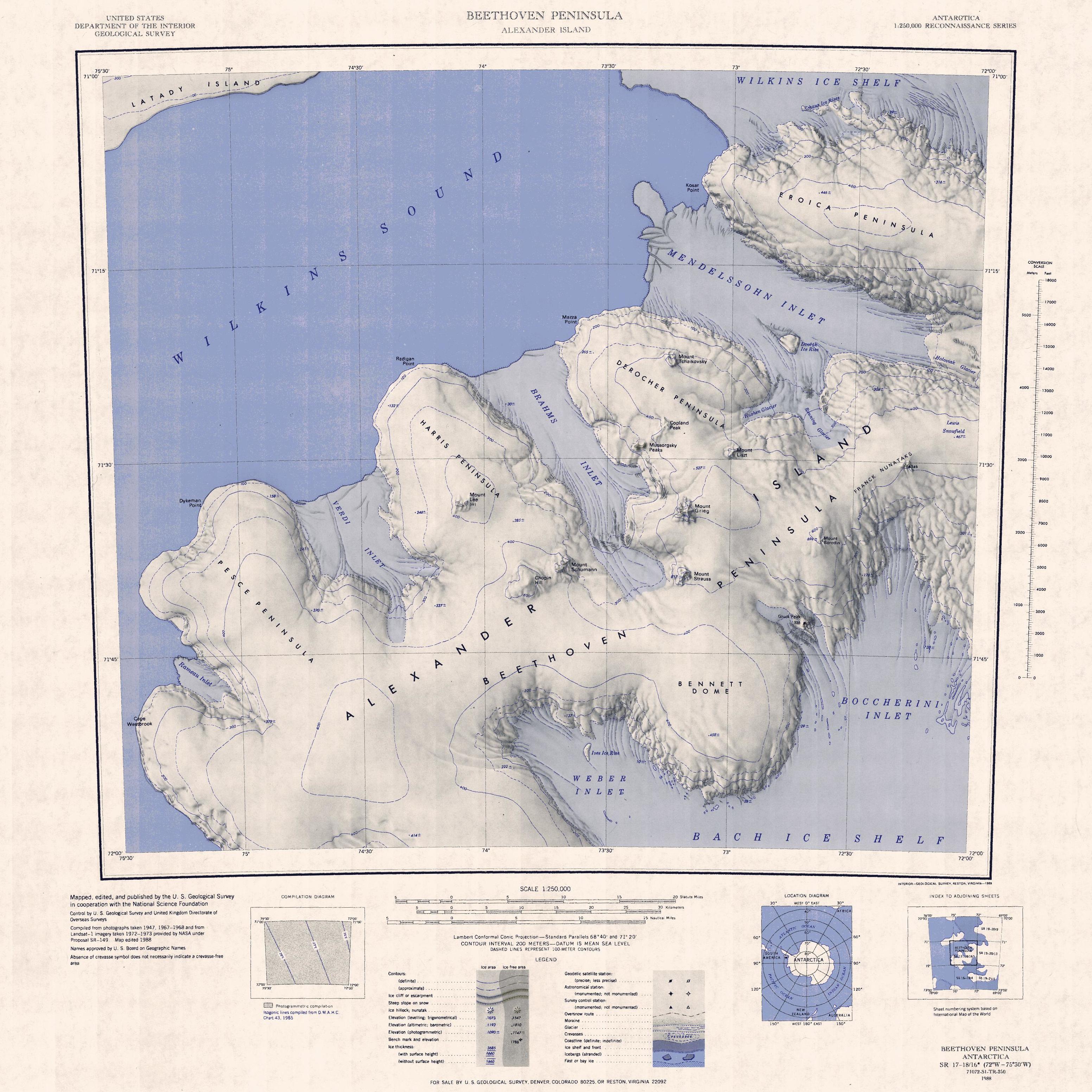
Chopin Hill (71°40′S 73°49′W) is a low, snow-covered hill, about 600 metres (2,000 ft) high, lying 2 nautical miles (4 km) southwest of Mount Schumann lying on the base of Harris Peninsula, Beethoven Peninsula, southwest Alexander Island, Antarctica. It was first mapped, from air photos taken by the Ronne Antarctic Research Expedition, 1947–48, by D. Searle of the Falkland Islands Dependencies Survey in 1960, and named by the UK Antarctic Place-Names Committee after Frédéric Chopin, the Polish composer.[1]
References
- "Chopin Hill". Geographic Names Information System. United States Geological Survey, United States Department of the Interior. Retrieved 10 November 2011.
![]() This article incorporates public domain material from the United States Geological Survey document: "Chopin Hill". (content from the Geographic Names Information System)
This article incorporates public domain material from the United States Geological Survey document: "Chopin Hill". (content from the Geographic Names Information System)
This Alexander Island location article is a stub. You can help Wikipedia by expanding it. |
На других языках
[de] Chopin Hill
Der Chopin Hill ist ein 600 m hoher und schneebedeckter Hügel auf der westantarktischen Alexander-I.-Insel. Er ragt 3 km südwestlich des Mount Schumann auf der Beethoven-Halbinsel auf.- [en] Chopin Hill
Другой контент может иметь иную лицензию. Перед использованием материалов сайта WikiSort.org внимательно изучите правила лицензирования конкретных элементов наполнения сайта.
WikiSort.org - проект по пересортировке и дополнению контента Википедии