geo.wikisort.org - Mountains
Chopicalqui[1][2] or Chopicallqui[3] (possibly from Huaylas Quechua Chawpi "center" kallki "ravine")[4] is a mountain in the Cordillera Blanca area in the Andes of Peru.[1] With a summit elevation of 6,354 metres (20,846 ft) above sea level[1] it is one of the highest peaks of the Cordillera Blanca. It lies in Yungay Province, Ancash, between the mountains Huascarán and Contrahierbas.[1][3]
| Chopicalqui | |
|---|---|
 | |
| Highest point | |
| Elevation | 6,354 m (20,846 ft) |
| Coordinates | 9°05′12″S 77°34′26″W |
| Naming | |
| Language of name | Quechua |
| Geography | |
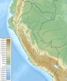 Chopicalqui Peru | |
| Location | Yungay Province, Peru |
| Parent range | Cordillera Blanca (Andes) |
| Climbing | |
| First ascent | August 3, 1932 by H. Hoerlin, E. Schneider, P. Borchers, E. Hein |
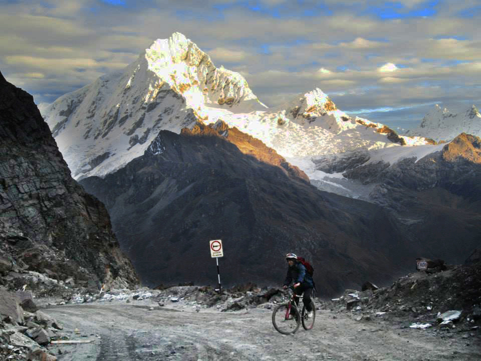
Climbing
The standard climbing route is the Southwest Ridge, a moderate snow climb that is popular with climbers and can be crowded at times. It possesses a difficulty rating of PD+/AD- on the French System for grading alpine routes but deep snow on the summit slopes causes most failures for parties attempting the ridge.[5]
Other established climbing routes include the following:
References
- Alpenvereinskarte 0/3a. Cordillera Blanca Nord (Peru). 1:100 000. Oesterreichischer Alpenverein. 2005. ISBN 3-928777-57-2.
- Biggar, John (2020). The Andes: A Guide for Climbers and Skiers. Andes. p. 90. ISBN 9780953608768.
- Peru 1:100 000, Carhuás (19-h). IGN (Instituto Geográfico Nacional - Perú).
- Leonel Alexander Menacho López, Yachakuqkunapa Shimi Qullqa, Anqash Qhichwa Shimichaw (Ministerio de Educación), Wordbook Ancash Quechua-Spanish: Kallki. - Encañada.
- B. Johnson, Classic Climbs of the Cordillera Blanca Peru, 2009
This Ancash Region geography article is a stub. You can help Wikipedia by expanding it. |
На других языках
[de] Chopicalqui
Der Chopicalqui, ein Name der sich aus den Quechuaworten Chawpi für „Mitte“ und kallki für „Tobel, Schlucht“ ableitet, liegt in der Cordillera Blanca in den Anden in der Provinz Yungay und ist mit einer Höhe von 6354 m der sechst höchste Berg Perus.[1] Der Chopicalqui liegt im Nationalpark Huascarán. Der Huascarán ist im Osten mit dem Chopicalqui (6354 m) topographisch verbunden.- [en] Chopicalqui
[es] Chopicalqui
El Chopicalqui (en quechua ancashino: Chawpikallki) es el tercer pico del macizo nevado del Huascarán, ubicado en la Cordillera Blanca, entre los dos picos del Huascarán y Contrahierbas, en la provincia de Yungay, Perú. Con una altitud de 6.355 msnm es la quinta montaña más alta del departamento y la cuarta de la Cordillera Blanca.[3][fr] Chopicalqui
Le Chopicalqui est un sommet andin d'une altitude de 6 354 m, situé dans la cordillère Blanche, dans la province de Yungay au Pérou.[it] Chopicalqui
Il Chopicalqui è una montagna della Cordillera Blanca (Ande). È situata in Perù, nella provincia di Yungay, regione di Ancash, e fa parte del massiccio montuoso chiamato Macizo de Huascarán.Другой контент может иметь иную лицензию. Перед использованием материалов сайта WikiSort.org внимательно изучите правила лицензирования конкретных элементов наполнения сайта.
WikiSort.org - проект по пересортировке и дополнению контента Википедии