geo.wikisort.org - Mountains
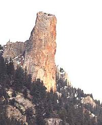
Chimney Rock (K'lpalekw in Secwepemctsin, meaning "Coyote's Penis") is a limestone formation in Marble Canyon, midway between the towns of Lillooet and Cache Creek in British Columbia, Canada. It is located within Marble Canyon Provincial Park.

| Chimney Rock | |
|---|---|
 Chimney Rock from the northwest | |
| Highest point | |
| Elevation | 1,725 m (5,659 ft) [1] |
| Prominence | 45 m (148 ft) [1] |
| Listing | Mountains of British Columbia |
| Coordinates | 50°52′42″N 121°43′14″W [1] |
| Geography | |
| Location | British Columbia, Canada |
| Parent range | Marble Range |
| Topo map | NTS 92I13 Pavilion[1] |
| Climbing | |
| First ascent | 1957 Hank Mather; Elfida Pigou[1] |
References
- "Chimney Rock". Bivouac.com. Retrieved 2021-05-27.
External links
- "Chimney Rock". Bivouac.com.
Текст в блоке "Читать" взят с сайта "Википедия" и доступен по лицензии Creative Commons Attribution-ShareAlike; в отдельных случаях могут действовать дополнительные условия.
Другой контент может иметь иную лицензию. Перед использованием материалов сайта WikiSort.org внимательно изучите правила лицензирования конкретных элементов наполнения сайта.
Другой контент может иметь иную лицензию. Перед использованием материалов сайта WikiSort.org внимательно изучите правила лицензирования конкретных элементов наполнения сайта.
2019-2025
WikiSort.org - проект по пересортировке и дополнению контента Википедии
WikiSort.org - проект по пересортировке и дополнению контента Википедии