geo.wikisort.org - Mountains
The Marble Range is a small mountain range adjoining the Fraser River on the southwestern edge of the Interior Plateau of British Columbia. It has an area of 1,250 square kilometres and about 65 km NNW to SSE and about 20 km wide. Its southern flank is the north wall of Marble Canyon and the valley occupied by the ranching and First Nations community of Pavilion.
| Marble Range | |
|---|---|
 | |
| Dimensions | |
| Area | 1,727 km2 (667 sq mi) |
| Geography | |
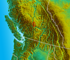 Location map of the Marble Range
| |
| Country | Canada |
| Province | British Columbia |
| Parent range | Fraser Plateau |
See also
References
- "Marble Range". BC Geographical Names.
- Marble Range in the Canadian Mountain Encyclopedia
| Interior Plateau | |
|---|---|
| Stikine Plateau |
|
| Yukon Plateau |
|
| Vancouver Island |
|
This article about a location in the Cariboo Regional District, Canada is a stub. You can help Wikipedia by expanding it. |
Текст в блоке "Читать" взят с сайта "Википедия" и доступен по лицензии Creative Commons Attribution-ShareAlike; в отдельных случаях могут действовать дополнительные условия.
Другой контент может иметь иную лицензию. Перед использованием материалов сайта WikiSort.org внимательно изучите правила лицензирования конкретных элементов наполнения сайта.
Другой контент может иметь иную лицензию. Перед использованием материалов сайта WikiSort.org внимательно изучите правила лицензирования конкретных элементов наполнения сайта.
2019-2026
WikiSort.org - проект по пересортировке и дополнению контента Википедии
WikiSort.org - проект по пересортировке и дополнению контента Википедии