geo.wikisort.org - Mountains
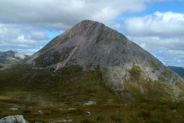
Binnein Beag is a Scottish mountain situated at the eastern end of the Mamores range seven kilometres north north-east of Kinlochleven. It is a relatively small, conical peak which is connected to its larger neighbour, Binnein Mòr, by a bealach at 750m. Despite being overshadowed by Binnein Mòr, it is listed as a Munro with a height of 943 m (3094 ft). It is commonly climbed from Kinlochleven in combination with Binnein Mòr. Its summit gives good views of Ben Alder to the east, the Grey Corries to the north, and the vast bulk of Binnein Mòr to the south-west.
| Binnein Beag | |
|---|---|
 Binnein Beag | |
| Highest point | |
| Elevation | 943 m (3,094 ft)[1] |
| Prominence | 197 m (646 ft) |
| Parent peak | Binnein Mòr |
| Listing | Munro, Marilyn |
| Naming | |
| English translation | small peak |
| Language of name | Gaelic |
| Pronunciation | Scottish Gaelic: [ˈpiɲɛɲ ˈpek] English approximation: BIN-yen-BEK |
| Geography | |
| Location | Highland, Scotland |
| Parent range | Mamores |
| OS grid | NN221677 |
| Topo map | OS Landranger 41, OS Explorer 392 |
References
- The Munros (SMC Guide), Donald Bennett et al., ISBN 0-907521-13-4
- "walkhighlands Binnein Beag". walkhighlands.co.uk. 2013. Retrieved 22 November 2013.
Munros of Scotland: Fort William to Loch Ericht | |||
|---|---|---|---|
 | Nevis range | 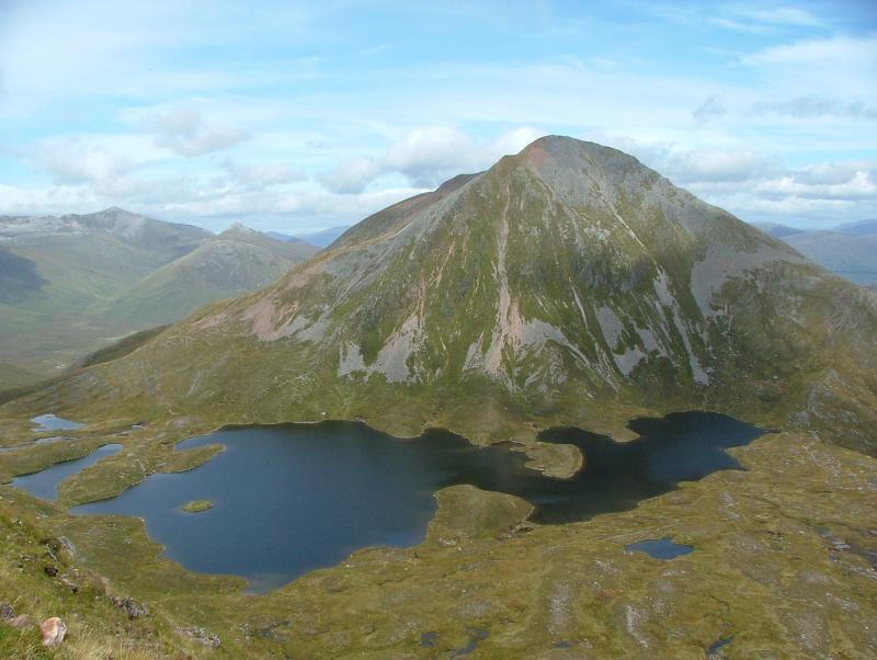 | |
| Mamores | |||
| Grey Corries |
| ||
| Alder/Ardverikie |
| ||
| Ossian/Treig |
| ||
List of Munros and Munro Tops in Scotland | |||
This Highland location article is a stub. You can help Wikipedia by expanding it. |
На других языках
[de] Binnein Beag
Der Binnein Beag ist ein als Munro und Marilyn eingestufter, 943 Meter hoher Berg in Schottland. Sein gälischer Name kann in etwa mit Kleine Spitze übersetzt werden.[1]- [en] Binnein Beag
Текст в блоке "Читать" взят с сайта "Википедия" и доступен по лицензии Creative Commons Attribution-ShareAlike; в отдельных случаях могут действовать дополнительные условия.
Другой контент может иметь иную лицензию. Перед использованием материалов сайта WikiSort.org внимательно изучите правила лицензирования конкретных элементов наполнения сайта.
Другой контент может иметь иную лицензию. Перед использованием материалов сайта WikiSort.org внимательно изучите правила лицензирования конкретных элементов наполнения сайта.
2019-2026
WikiSort.org - проект по пересортировке и дополнению контента Википедии
WikiSort.org - проект по пересортировке и дополнению контента Википедии