geo.wikisort.org - Mountains
Bidein a' Choire Sheasgaich (Scottish Gaelic: Bidean Coire an t-Seasgaich)[7] is a remote mountain in the Northwest Highlands of Scotland. It is a Munro with a height of 945 metres (3,100 ft) and is at the western end of an east–west ridge comprising a Munro Top Meall Mor (974 metres), and the Munro Lurg Mhòr (986 metres).[8]
| Bidein a' Choire Sheasgaich | |
|---|---|
| Bidean Coire an t-Seasgaich | |
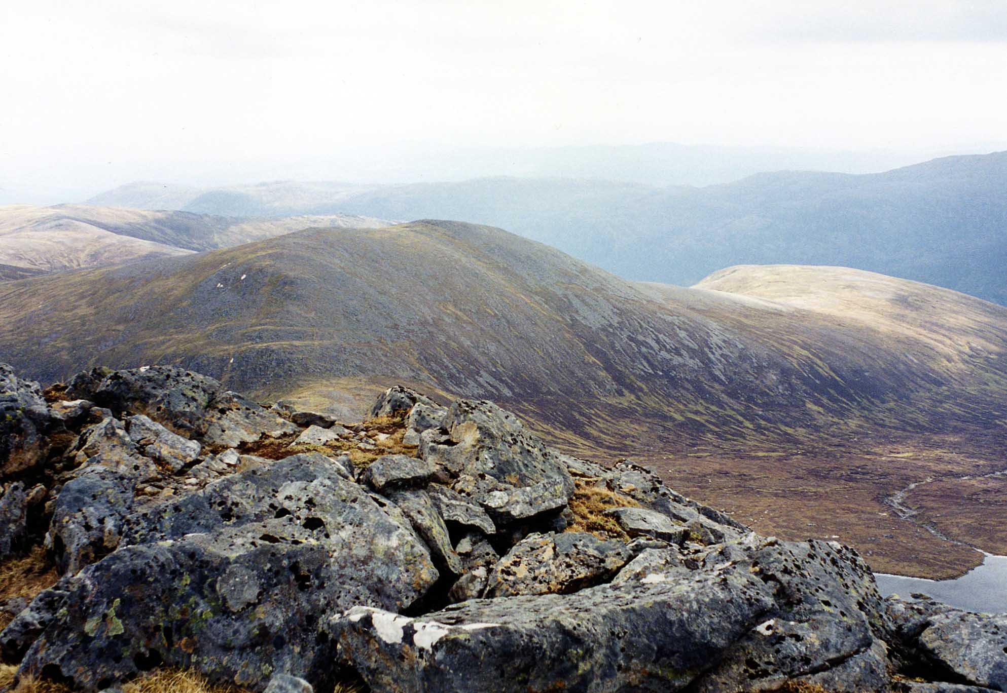
 Bidein a' Choire Sheasgaich, north face, from Bearnais bothy | |
| Highest point | |
| Elevation | 945 m (3,100 ft)[1] |
| Prominence | 209 m (686 ft)[2] |
| Parent peak | Lurg Mhòr |
| Listing | Munro, Marilyn |
| Coordinates | 57°25′11″N 05°15′2″W |
| Naming | |
| English translation | peak of the barren corrie/reedy corrie/corrie of barren cattle[note 1] |
| Language of name | Gaelic |
| Geography | |
 Bidein a' Choire Sheasgaich Attadale Estate, Scotland | |
| Parent range | Northwest Highlands |
| OS grid | NH049413 |
| Topo map | OS Landranger 25 Explorer 429[6] |
Geographical situation and topography

![North face of the mountain with lochan at head of Coire Seasgach[note 2]](http://upload.wikimedia.org/wikipedia/commons/3/3f/Lochan%2C_by_Bidein_a_Choire_Sheasgaich_%28geograph_4057632%29.jpg)
Bidein a' Choire Sheasgaich, is situated west of Loch Monar[note 3] and east of the strath of Bearneas and the Attadale Forest, and is at the apex of a horseshoe of Munros around the loch.[10][8] Glen Carron lies to the north and Glen Shiel to the south.[8]
The mountain, also known by the nickname "Cheese Grater", is located on the Attadale Estate.[11][12] The bedrock is of the Glenfinnan Group of the Moine Supergroup – highly metamorphosed sedimentary sandstone.[13]
The summit it guarded by crags to the north and east but there is a straightforward approach via Sail Riabach a kilometre or so to the southwest. The ridge between Bidein and Lurg Mhor and the path from the south have no technical difficulties.[14]
Approaches to the mountain
Bidein a' Choire Sheasgaich and Lurg Mhòr are, according to Cameron McNeish, "two of the lonliest Munros in the land"[15] An approach can be made from the north, the east or the west. All the approach routes are long and arduous but, if a two-day expedition is planned, three open bothies are available as an alternative to wild camping.
The route from the east is along, and possibly around, Loch Monar which is reached through Glen Strathfarrar. From Struy a private road goes along the glen to the foot of the loch at Monar Lodge. Cycling is allowed and a very limited number of vehicles are also permitted access.[note 4][17][18] Even if using a mountain bike the expedition is, according to Dan Bailey "a single epic trip, which can be undertaken either as an appealingly brutal one-day assault or a slower overnighter". The route round the loch traversing these Munros and the three immediately north of the loch is 43 km (27 mi) plus 52 km (32 mi) cycling – 18 hours.[19]
The shortest route to the mountain from a public road is from Achnashellach (Lair) in Glen Carron to the north on the A890 but to start off it is necessary to wade across the River Carron or use the two-wire bridge – cycling is not an option. Otherwise, from Craig nearby there is a somewhat longer route which may be cycled for the first 5.5 km (3.4 mi) – this way the total distance to Bidean is 12.5 km (7.8 mi) – 5 hours on foot.[20][21]
Bearnais bothy is a Mountain Bothies Association bothy not far off these routes and for a stop-over it is conveniently located. However, a less hilly route to get there directly is from Achintee (Strathcarron station) from where it may be reached by a stalkers' path of 9.7 km (6 mi).[22]
From the west at Attadale there is an 13 km (8 mi) track along which a mountain bike may be ridden, with difficulty, to the open bothy at Ben Dronaig Lodge which is maintained by the Attadale Estate to a very high standard.[23][24][25] From bothy to Bidein is another 7.2 km (4.5 mi) on a stalkers' path.[26] A shorter 9.7 km (6 mi) stalkers' path leads to this bothy from Achintee (Strathcarron station).[23][27]
Maol Bhuidhe bothy is an MBA bothy which can be reached from Atterdale or Killian (Camus-luinie carpark) on mountain bike by tracks at least 16 km (10 mi) long.[28][24]
Notes
- Bennet suggests "peak of the corrie of the barren cattle" or "milkless cattle",[3] Butterfield: "little peak of the reedy corrie",[4] Bailey: "pinnacle of corrie of farrow cattle".[5]
- The OS spell the mountain "Bidein a' Choire Sheasgaich" and the corrie "Coire Seasgach"[9]
- Loch Monar is not to be confused with Loch Morar, another remote west coast loch.
- Mountaineering Scotland publish the Strathfarrar access agreement.[16]
References
Citations
- Bennet (1990), p. 162.
- "Bidein a'Choire Sheasgaich, United Kingdom". www.peakbagger.com. Archived from the original on 2 August 2017.
- Bennet (1991), p. 186.
- Butterfield (1986), p. 318.
- Bailey, Dan (31 January 2014). Great Mountain Days in Scotland: 50 classic hillwalking challenges. Cicerone Press. p. 92. ISBN 978-1-84965-500-2.
- "Find paper maps by location, NH049413". Ordnance Survey. Archived from the original on 10 August 2017.
- "Bidean a' Choire Sheasgaich". Ainmean-Àite na h-Alba: Gaelic Place-Names of Scotland.
- Bennet (1990), pp. 162–164.
- "204950_841350". Streetmap OS maps.
- Townsend, Chris (30 March 2011). Scotland. Cicerone Press Limited. pp. 379–380. ISBN 978-1-84965-353-4.
- Allan (2017), p. 84.
- Howie, Robin (30 July 2008). "Robin Howie - On the track from Attadale". www.scotsman.com. Archived from the original on 10 August 2017.
- "Geology of Britain viewer". mapapps.bgs.ac.uk. British Geological Survey. Archived from the original on 2 December 2016. Retrieved 11 May 2017. and "BGS Lexicon of Named Rock Units - Result Details". www.bgs.ac.uk. British Geological Survey. Retrieved 11 May 2017.
- Butterfield (1986), p. 208.
- McNeish, Cameron (14 June 2012). Wilderness World of Cameron McNeish: Essays From Beyond The Black Stump. Neil Wilson Publishing. pp. 184–186. ISBN 978-1-906000-12-7.
- "Strathfarrar access". www.mountaineering.scot. Mountaineering Scotland. Archived from the original on 11 May 2017.
- Bennet (1991), p. 185.
- "Loch Monar Wilderness – Meall Mor". The Adventures of a Mountain Coward. 25 August 2014. Archived from the original on 16 October 2014. Retrieved 10 May 2017.
- Bailey, Dan (31 January 2014). Great Mountain Days in Scotland: 50 classic hillwalking challenges. Cicerone Press. pp. 91–95. ISBN 978-1-84965-500-2.
- Bennet (1991), p. 187.
- "Munro Central : Bidein a' Choire Sheasgaich and Lurg Mhor from Glen Carron". www.munrocentral.co.uk. Archived from the original on 18 December 2010. Retrieved 15 May 2017.
- Allan (2017), p. 85.
- Allan (2017), p. 87.
- Allan, Geoff. "Maol Bhuidhe". Bothies on a bike.
- "Putting the PUSH into Pushbiking to Bendronaig Bothy (Sheasgaich & Lurg Mhor)". The Adventures of a Mountain Coward. 22 April 2011. Archived from the original on 11 May 2017.
- "The walk: Lurg Mhor and Bidein a'Choire Sheasgaich". www.scotsman.com. 16 October 2015. Archived from the original on 10 August 2017.
- "Bidein a'Choire Sheasgaich & Lurg Mhor". Walkhighlands. Archived from the original on 10 August 2017. Retrieved 10 May 2017.
- Allan (2017), pp. 97–99.
Works cited
- Allan, Geoff (1 February 2017). The Scottish Bothy Bible. Wild Things Publishing. ISBN 978-1910636107.
- Bennet, Donald (1990). "Chapter 10: Glen Carron, Killilan and West Monar". In Bennet, Donald; Strang, Tom (eds.). The Northwest Highlands. Scottish Mountaineering Trust. pp. 158–169. ISBN 0-907521-28-2.
- Bennet, Donald (1991). "Section 12: Glen Cannich to Glen Carron". In Bennet, Donald (ed.). The Munros (2nd ed.). Scottish Mountaineering Trust. pp. 180–191. ISBN 0-907521-31-2.
- Butterfield, Irvine (1986). "Chapter 22: Strathcarron and Achnasheen". The High Mountains of Britain and Ireland (Book Club Associates ed.). Diadem Books. pp. 205–213.
Munros of Scotland: Kyle of Lochalsh to Inverness | |||
|---|---|---|---|
 |  | ||
List of Munros | |||
На других языках
[de] Bidein a’ Choire Sheasgaich
Der Bidein a’ Choire Sheasgaich ist ein als Munro und Marilyn eingestufter, 945 m (3.100 ft) hoher Berg in den schottischen Highlands. Sein gälischer Name kann in etwa mit Spitze des Kars der unfruchtbaren Rinder übersetzt werden.[1] Er liegt in einer weitgehend unbesiedelten Berglandschaft der Northwest Highlands zwischen Loch Carron und Loch Monar, gut 60 Kilometer westlich von Inverness.- [en] Bidein a' Choire Sheasgaich
Другой контент может иметь иную лицензию. Перед использованием материалов сайта WikiSort.org внимательно изучите правила лицензирования конкретных элементов наполнения сайта.
WikiSort.org - проект по пересортировке и дополнению контента Википедии