geo.wikisort.org - Mountains
Beinn a' Choin (769 m) is a mountain in the Grampian Mountains of Scotland. It lies on the border of the Stirling region and Argyll at the northern end of Loch Lomond.
| Beinn a' Choin | |
|---|---|
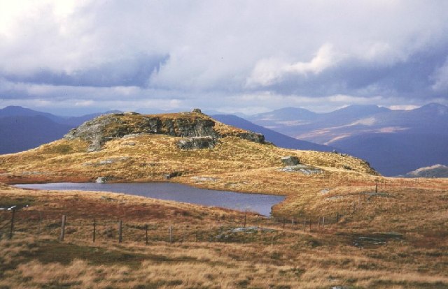 Beinn a' Choin summit | |
| Highest point | |
| Elevation | 769 m (2,523 ft)[1] |
| Prominence | 345 m (1,132 ft) |
| Listing | Corbett, Marilyn |
| Coordinates | 56°16′52″N 4°39′36″W |
| Geography | |
| Location | Stirling / Argyll and Bute, Scotland |
| Parent range | Grampian Mountains |
| OS grid | NN354130 |
| Topo map | OS Landranger 50, 56 |
A rugged and wild mountain of rocks and moorland lying north of Ben Lomond, it usually climbed from the small settlement of Inversnaid.[2]
References
- "Beinn a' Choin". hill-bagging.co.uk. Retrieved 19 June 2019.
- "walkhighlands Beinn a' Choin". walkhighlands.co.uk. Retrieved 19 June 2019.
This Stirling location article is a stub. You can help Wikipedia by expanding it. |
This Argyll and Bute location article is a stub. You can help Wikipedia by expanding it. |
Текст в блоке "Читать" взят с сайта "Википедия" и доступен по лицензии Creative Commons Attribution-ShareAlike; в отдельных случаях могут действовать дополнительные условия.
Другой контент может иметь иную лицензию. Перед использованием материалов сайта WikiSort.org внимательно изучите правила лицензирования конкретных элементов наполнения сайта.
Другой контент может иметь иную лицензию. Перед использованием материалов сайта WikiSort.org внимательно изучите правила лицензирования конкретных элементов наполнения сайта.
2019-2026
WikiSort.org - проект по пересортировке и дополнению контента Википедии
WikiSort.org - проект по пересортировке и дополнению контента Википедии