geo.wikisort.org - Mountains
The Batura Muztagh (Urdu: بتورا موز تاغ) mountains are a sub-range of the Karakoram mountain range. They are located in between central hunza and upper hunza(Gojal valley) in the Hunza district of the Gilgit-Baltistan province in northern Pakistan.[1]
| Batura Muztagh بتورا موز تاغ | |
|---|---|
| Chinese: 巴托拉慕士塔格山 | |
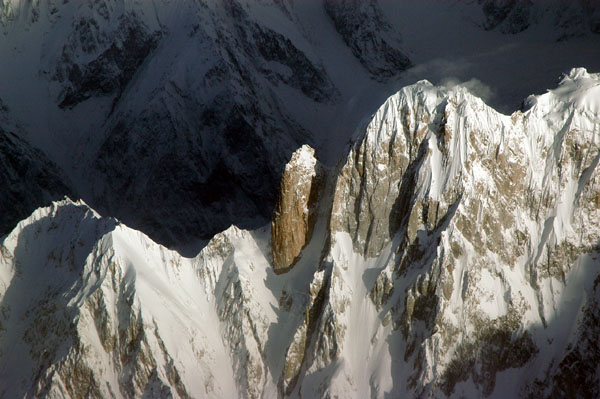
 Aerial view of part of the Batura Muztagh from the southeast | |
| Highest point | |
| Peak | Batura Sar |
| Elevation | 7,795 m (25,574 ft) |
| Coordinates | 36°30′36″N 74°31′37″E |
| Geography | |
 Batura Muztagh Location of the Batura Muztagh within the greater Karakoram region  Batura Muztagh Batura Muztagh (Gilgit Baltistan)  Batura Muztagh Batura Muztagh (Pakistan) | |
| Country | Pakistan |
| Region | Gilgit District |
| Parent range | Karakoram |
 | |
They are the westernmost sub-range of the Karakoram, running from Chalt village in Bar Valley in the east to Kampir Dior in the Kurumbar Valley in the west, and they separate the Hindu Raj range from the Karakoram range. The Muchu Chhish peak located in this sub-range remains the second highest unclimbed peak in the world.[2]
Selected peaks in the Batura Muztagh
| Mountain | Height (m) | Height (ft) | Coordinates | Prominence (m) | Parent mountain | First ascent | Ascents (attempts) |
|---|---|---|---|---|---|---|---|
| Batura Sar | 7,795 | 25,574 | 36°30′36″N 74°31′27″E | 3,118 | Distaghil Sar | 1976 | 4 (6) |
| Shispare | 7,611 | 24,970 | 36°26′26″N 74°40′51″E | 1,240 | Batura Sar | 1974 | 3 (1) |
| Pasu Sar | 7,476 | 24,528 | 36°29′16″N 74°35′16″E | 645 | Batura Sar | 1994 | 1 (0) |
| Ultar Sar | 7,388 | 24,239 | 36°23′54″N 74°42′32″E | 700 | Shispare | 1996 | 2 (5) |
| Sangemarmar Sar | 7,000 | 22,966 | 36°25′31″N 74°33′38″E | 1,100 | Pasu Sar | 1984 | 1 (3) |
| Bublimotin (Ladyfinger Peak) | 6,000 | 19,685 | 36°22′12″N 74°39′00″E | <200 | Hunza Peak | 1982 | 2 (5) |
Books, pamphlets, and maps about Batura Muztagh
- High Asia: An Illustrated History of the 7000 Metre Peaks by Jill Neate, ISBN 0-89886-238-8
- Batura Mustagh (sketch map and pamphlet) by Jerzy Wala, 1988.
- Orographical Sketch Map of the Karakoram by Jerzy Wala, 1990. Published by the Swiss Foundation for Alpine Research.
See also
- List of Highest Mountains of the World
- List of mountains in Pakistan
Notes
- ^ This data is from the Himalayan Index and is not always correct. In particular it is not clear if Batura Sar has really had four ascents or only three.
- ^ Sometimes called Batura I.
- ^ Sometimes called Ultar II or Bojohagur Duanasir II.
- ^ Also known as Sang-e-Marmar (or Sangemarmar), and sometimes referred to by locals as Marble Peak.
- ^ The heights given for this peak vary between 6949m and 7050m.
- ^ This elevation is approximate.
References
- King, John; St. Vincent, David (1993). Pakistan: A Travel Survival Kit. Lonely Planet Publications. p. 376.
- "This place in Pakistan is one of the hardest places to reach on Earth". The Express Tribune. March 16, 2017.
External links
Wikimedia Commons has media related to Batura Muztagh.
- Himalayan Index
- A clickable map of the Batura Muztagh
- DEM files for the Himalaya (Corrected versions of SRTM data; look for the "Batura Sar" tile)
На других языках
[de] Batura Muztagh
Das Batura Muztagh ist der westlichste Gebirgszug des Karakorum-Gebirges.- [en] Batura Muztagh
[es] Batura Muztagh
Batura Muztagh es una subcordillera del Karakórum que se encuentra en Gilgit-Baltistán, Pakistán, al noroeste del Valle de Hunza. Es la subcordillera situada más al oeste del Karakórum. Se extiende del el poblado de Chalt, en el Valle de Bar, hacia el este, hasta Kampir Dior en el Valle de Kurumbar, al oeste, que separa la Cordillera del Pamir y el Hindu Kush del Karakórum.[fr] Batura Muztagh
Le Batura Muztagh (ou massif du Batura) est un massif montagneux du Karakoram. Il se situe dans la région autonome du Gilgit-Baltistan au Pakistan, à l'ouest de la vallée de la Hunza. C'est le massif le plus occidental du Karakoram. Son plus haut sommet est le Batura Sar (7 795 m).Текст в блоке "Читать" взят с сайта "Википедия" и доступен по лицензии Creative Commons Attribution-ShareAlike; в отдельных случаях могут действовать дополнительные условия.
Другой контент может иметь иную лицензию. Перед использованием материалов сайта WikiSort.org внимательно изучите правила лицензирования конкретных элементов наполнения сайта.
Другой контент может иметь иную лицензию. Перед использованием материалов сайта WikiSort.org внимательно изучите правила лицензирования конкретных элементов наполнения сайта.
2019-2026
WikiSort.org - проект по пересортировке и дополнению контента Википедии
WikiSort.org - проект по пересортировке и дополнению контента Википедии