geo.wikisort.org - Mountains
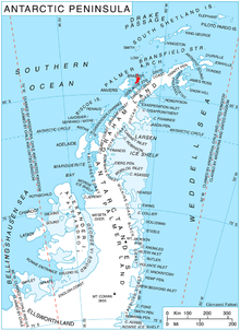
Avroleva Heights (Bulgarian: Възвишения Авролева, romanized: Vazvisheniya Avroleva) are the mostly ice-covered heights rising to 1137 m (Opizo Peak)[1] on the east coast of Brabant Island in the Palmer Archipelago, Antarctica. They extend 7.3 km in north-south direction from Hill Bay to Svetovrachene Glacier, and 7.3 km in east-west direction from Mitchell Point to Doriones Saddle, which saddle connects the heights to Taran Plateau in Stribog Mountains. The heights have steep and partly ice-free north and east slopes.
Avroleva is the medieval name of a mountain in Southeastern Bulgaria.
Location
Avroleva Heights are centred at 64°13′10″S 62°08′50″W. British mapping in 1980 and 2008.
Maps
- Antarctic Digital Database (ADD). Scale 1:250000 topographic map of Antarctica. Scientific Committee on Antarctic Research (SCAR). Since 1993, regularly upgraded and updated.
- British Antarctic Territory. Scale 1:200000 topographic map. DOS 610 Series, Sheet W 64 62. Directorate of Overseas Surveys, Tolworth, UK, 1980.
- Brabant Island to Argentine Islands. Scale 1:250000 topographic map. British Antarctic Survey, 2008.
Notes
- Reference Elevation Model of Antarctica. Polar Geospatial Center. University of Minnesota, 2019
References
- Bulgarian Antarctic Gazetteer. Antarctic Place-names Commission. (details in Bulgarian, basic data in English)
- Avroleva Heights. SCAR Composite Antarctic Gazetteer.
External links
- Avroleva Heights. Copernix satellite image

This article includes information from the Antarctic Place-names Commission of Bulgaria which is used with permission.
This Brabant Island location article is a stub. You can help Wikipedia by expanding it. |
На других языках
[de] Avroleva Heights
Die Avroleva Heights (englisch; bulgarisch възвишения Авролева .mw-parser-output .Latn{font-family:"Akzidenz Grotesk","Arial","Avant Garde Gothic","Calibri","Futura","Geneva","Gill Sans","Helvetica","Lucida Grande","Lucida Sans Unicode","Lucida Grande","Stone Sans","Tahoma","Trebuchet","Univers","Verdana"}waswischenija Awrolewa) sind ein größtenteils vereister und bis zu 1100 m hoher Höhenzug auf der Brabant-Insel im Palmer-Archipel westlich der Antarktischen Halbinsel. Er erstreckt sich in nord-südlicher Ausdehnung über eine Länge von 7,3 km von der Hill Bay bis zum Swetowratschene-Gletscher und in ost-westlicher Ausdehnung über ebenfalls 7,3 km vom Mitchell Point bis zum Doriones Saddle. Letzterer verbindet das Gebirge mit dem Taran-Plateau in den Stribog Mountains. Seine steilen Nord- und Osthänge sind teilweise eisfrei.- [en] Avroleva Heights
Другой контент может иметь иную лицензию. Перед использованием материалов сайта WikiSort.org внимательно изучите правила лицензирования конкретных элементов наполнения сайта.
WikiSort.org - проект по пересортировке и дополнению контента Википедии