geo.wikisort.org - Mountains
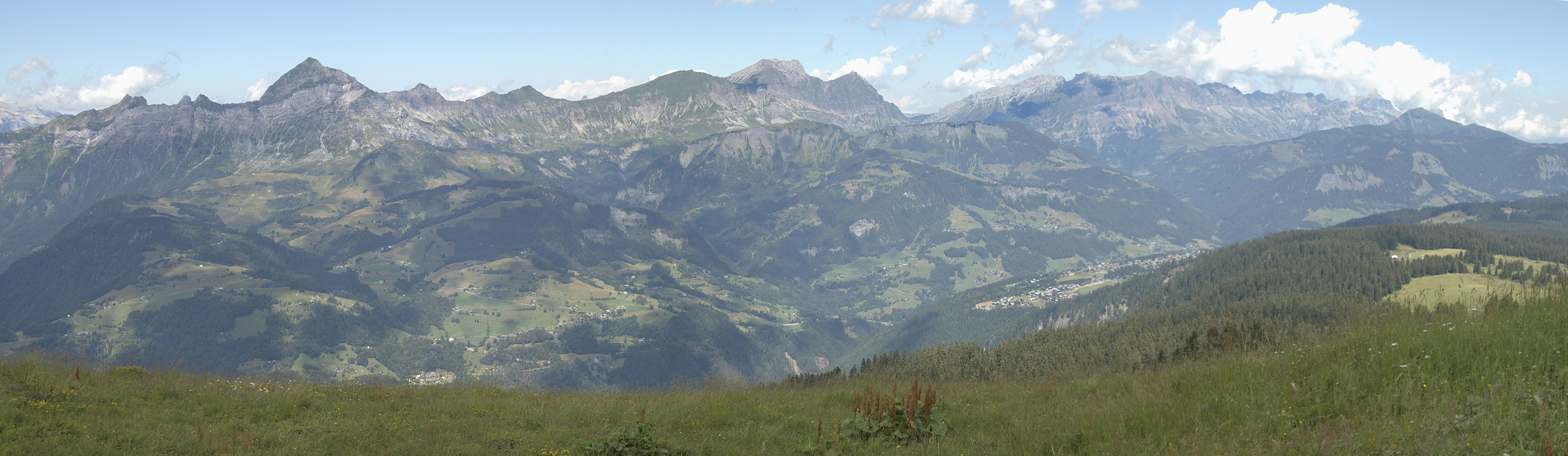
The Aravis (French: Chaîne des Aravis) is a mountain range in Savoie and Haute-Savoie, eastern France. It is part of the French Prealps, a lower chain of mountain ranges west of the main chain of the Alps. Its highest summit is the Pointe Percée, at 2753m. The orientation of the Aravis is north-south, and it stretches from Cluses in the north, to Ugine in the south. The Bornes massif, sometimes considered part of the Aravis, lies to its west. The Aravis is separated from the Chablais mountains in the north-east by the Arve river valley, and from the Graian Alps in the south-east by the Arly river valley.
| Aravis Range | |
|---|---|
 Pointe Percée | |
| Highest point | |
| Peak | Pointe Percée |
| Elevation | 2,753 m (9,032 ft) |
| Coordinates | 45°57′21″N 6°33′20″E |
| Naming | |
| Native name | Chaîne des Aravis (French) |
| Geography | |
| Country | France |
| Department | Savoie and Haute-Savoie |
| Parent range | French Prealps |
| Borders on | Chablais and Graian Alps |
| Geology | |
| Type of rock | Sedimentary |
Peaks
- Pointe Percée, 2,753 m (9,032 ft)
- Grande Balmaz, 2,616 m (8,583 ft)
- Roualle, 2,589 m (8,494 ft)
- Parrossaz, 2,556 m (8,386 ft)
- Mont Charvet, 2,538 m (8,327 ft)
- Roche Perfia, 2,499 m (8,199 ft)
- Aiguille de Borderan, 2,489 m (8,166 ft)
- Étale (mountain), 2,484 m (8,150 ft)
- Pointe d'Areu, 2,478 m (8,130 ft)
- Mont Charvin, 2,409 m (7,904 ft)
References
- Bouvier, L. (1866). La Chaine des Aravis: topographie botanique, histoire and statistique des vallées de La Clusaz, du Grand-Bornand, du Reposoir, et de Thônes (in French). Imprimerie de Louis Thesio. Retrieved 2022-07-10.
| Authority control |
|
|---|
This Savoie geographical article is a stub. You can help Wikipedia by expanding it. |
This Haute-Savoie geographical article is a stub. You can help Wikipedia by expanding it. |
На других языках
- [en] Aravis Range
[fr] Chaîne des Aravis
La chaîne des Aravis est une chaîne de montagnes située dans les Préalpes à cheval entre la Haute-Savoie (versant ouest) et la Savoie (versant est). Son plus haut sommet est la pointe Percée (2 750 m) que se partagent les communes du Grand-Bornand, de Sallanches et du Reposoir. L'extrémité septentrionale du massif est appelée chaîne du Reposoir[1],[2].[it] Catena des Aravis
La Catena des Aravis è un massiccio montuoso delle Prealpi di Savoia. Si trova in Francia ed interessa il dipartimento dell'Alta Savoia e della Savoia.Другой контент может иметь иную лицензию. Перед использованием материалов сайта WikiSort.org внимательно изучите правила лицензирования конкретных элементов наполнения сайта.
WikiSort.org - проект по пересортировке и дополнению контента Википедии