geo.wikisort.org - Mountains
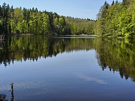
The Altdorf Forest (German: Altdorfer Wald) is a forested, low mountain ridge between Aulendorf and Vogt in the county of Ravensburg in the German state of Baden-Württemberg. It is up to 776.6 m above sea level (NHN)[1] high.
| Altdorf Forest | |
|---|---|
 | |
| Highest point | |
| Peak | Galgenberg |
| Elevation | 776.6 m above NHN |
| Geography | |

| |
| Location | between Aulendorf and Vogt; county of Ravensburg, Baden-Württemberg (Germany) |
| Range coordinates | 47°46′28″N 9°43′33″E |
The forest has an area of about 82 km²[2] and is thus the largest contiguous forest in Upper Swabia. It is divided into state, municipal and private forests, of which the aristocratic House of Waldburg-Wolfegg owns the largest area.
References
- Map services of the Federal Agency for Nature Conservation
- Landscape fact file by the BfN – Altdorfer Wald
Literature
- Anton Huber: Beiträge zur Geschichte des Altdorfer Waldes. Staatliches Forstamt, Ravensburg, 1998
- Jochen Jauch: Geschichte und Geschichten aus dem Altdorfer Wald. Von der Försterei Gambach zum Forstrevier Bergatreute. Eppe, Bergatreute, 2012, ISBN 978-3-89089-153-8
- Volker Kracht (ed.): Die Naturschutzgebiete im Regierungsbezirk Tübingen. 2nd edition. Thorbecke, Ostfildern, 2006, ISBN 978-3-7995-5175-5 (includes coverage of the few nature reserves in the Altdorf Forest)
- J. D. G. von Memminger: Der Altdorfer Wald, in: Beschreibung des Oberamts Ravensburg. Cotta, Stuttgart and Tübingen, 1836 (e-text and digital version at Wikisource)
- Der Altdorfer Wald, in: Allgemeine Forst und Jagdzeitung, 9th annual issue, 1840, pp. 424ff. (digitalised)
External links
Wikimedia Commons has media related to Altdorf Forest.
- 3202 Altdorfer Wald, landscape fact file by the BfN
На других языках
[de] Altdorfer Wald
Der Altdorfer Wald zwischen Aulendorf und Vogt im baden-württembergischen Landkreis Ravensburg ist ein bis 776,9 m ü. NHN[1] hoher, bewaldeter Höhenzug.- [en] Altdorf Forest
Текст в блоке "Читать" взят с сайта "Википедия" и доступен по лицензии Creative Commons Attribution-ShareAlike; в отдельных случаях могут действовать дополнительные условия.
Другой контент может иметь иную лицензию. Перед использованием материалов сайта WikiSort.org внимательно изучите правила лицензирования конкретных элементов наполнения сайта.
Другой контент может иметь иную лицензию. Перед использованием материалов сайта WikiSort.org внимательно изучите правила лицензирования конкретных элементов наполнения сайта.
2019-2025
WikiSort.org - проект по пересортировке и дополнению контента Википедии
WikiSort.org - проект по пересортировке и дополнению контента Википедии