geo.wikisort.org - Mountains
Akaroa is a small town on Banks Peninsula in the Canterbury Region of the South Island of New Zealand, situated within a harbour of the same name. The name Akaroa is Kāi Tahu Māori for "Long Harbour", which would be spelled Whangaroa in standard Māori. The area was also named Port Louis-Philippe by French settlers after the reigning French king Louis Philippe I.
Akaroa
Port Louis-Philippe | |
|---|---|
 Akaroa township and its Main Wharf | |
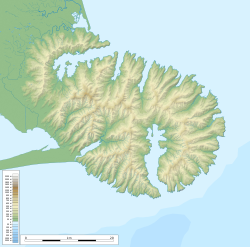 Akaroa Location of Akaroa in Banks Peninsula | |
| Coordinates: 43°48′15″S 172°58′00″E | |
| Country | New Zealand |
| Region | Canterbury Region |
| District | Christchurch City |
| Ward | Banks Peninsula |
| European settlement | 18 August 1840 |
| Founded by | Jean François Langlois |
| Area | |
| • Total | 2.03 km2 (0.78 sq mi) |
| Population (June 2022)[2] | |
| • Total | 780 |
| • Density | 380/km2 (1,000/sq mi) |
| Postcode | 7520 |
| Local iwi | Ngāi Tahu |


The town is 84 kilometres (52 mi) by road from Christchurch and is the terminus of State Highway 75. It is set on a sheltered harbour and is overlooked and surrounded by the remnants of a miocene volcano.[3] Akaroa is entirely dependent upon rainfall on the hills.[4]
Akaroa is a popular resort town. Many Hector's dolphins may be found within the harbour, and 'swim with the dolphins' boat tours are a major tourist attraction.[5][6]
Ōnuku marae, a marae (tribal meeting ground) of Ngāi Tahu and its Ōnuku Rūnanga branch, is located in Akaroa.[7] It includes the Karaweko wharenui (meeting house).[8]
History
![Saint Peter's Anglican Church (built c.1864), situated 10 Rue Balguerie in Akaroa[9]](http://upload.wikimedia.org/wikipedia/commons/c/cd/Church_Akaroa.JPG)
In 1830, the Māori settlement at Takapūneke, just east of the current town of Akaroa, became the scene of a notorious incident. The captain of the British brig Elizabeth, John Stewart, helped North Island Ngāti Toa chief, Te Rauparaha, to capture the local Kāi Tahu chief, Tama-i-hara-nui, his wife Te Whe and his young daughter, Roimata. The settlement of Takapūneke was sacked. Concern over the complicity of John Stewart, amongst other lawlessness among Europeans in New Zealand, led to the appointment of an official British Resident James Busby to New Zealand in 1832 – the first step in the British involvement that led to the Treaty of Waitangi.[10]
In early 1832, Te Rauparaha, fresh from his successful three-month siege of Kaiapoi Pā, took the pā on the Ōnawe Peninsula at the head of Akaroa Harbour. There were an estimated 400 Kāi Tahu in the pā and most were killed, with only the strongest taken as slaves.[11]
The earliest European settlers used Akaroa as a whaling base. Akaroa is now one of the few whaling bases in New Zealand that still exists as a town.[12]
French settlement


In 1838 Captain Jean François Langlois made a provisional purchase of land in "the greater Banks Peninsula" from 12 Kāi Tahu chiefs.[13] A deposit of commodities in the value of £6 was paid and a further £234 worth of commodities was to be paid at a later period.[14]
On his return to France, Langlois advertised for settlers to go to New Zealand, and ceded his interest in the land to the Nanto-Bordelaise Company, of which he became a part-owner. On 9 March 1840, 63 emigrants left from Rochefort. The settlers embarked for New Zealand on the Comte de Paris, an old man-of-war ship given to them by the French government. The Comte de Paris and its companion ship the Aube, captained by Commodore Charles-François Lavaud, arrived in the Bay of Islands in the North Island on 11 July 1840, where they discovered that during their voyage the British had claimed Banks Peninsula. The French arrived in Akaroa Harbour on 18 August and established a settlement centred on the present-day site of Akaroa. Bishop Pompallier established his first European station in Akaroa in 1840 as the French immigrants were all nominally Catholic. However, he closed the station in disgust, due to the religious apathy of the French immigrants.[15]
Given that the French colonists had set out for New Zealand on the assumption that they owned the land, the New Zealand authorities made a grant of 30,000 acres to the Nanto-Bordelaise Company, which ceded all rights to the peninsula for £4,500.[14]
Before 1840, the area of the current Akaroa town was also known as Wangaloa. The French at first called their settlement Port Louis-Philippe in honour of Louis Philippe I, who reigned as King of the French from 1830 to 1848.[16]
The area still shows a French influence, prominent in many local place names.[17] It is the oldest town in Canterbury and one of the most historic places in New Zealand.[12]
British settlement
After being informed of the French intention to colonise Akaroa and to further its use as a whaling port, the Lieutenant-Governor of New Zealand, Captain William Hobson, sent the ship HMS Britomart to proclaim sovereignty over the area for the British Crown. HMS Britomart arrived in Akaroa on 16 August 1840, although the captain's log shows the arrival date as 11 August. Captain Stanley raised the British flag, and held a court at each of the occupied settlements, to convince the French that the area was indeed under British control.[14] A monument at the eastern edge of the town commemorates the British arrival.
James Robinson Clough, also known as Jimmy Robinson, had arrived at Akaroa several years before. He acted as interpreter for Captain Owen Stanley at the flag-raising of 1840, and was the first European to travel up the Avon River in 1843. Clough's descendants are still prominent on the Peninsula today.
British immigrants settled in both Akaroa and German Bay (Takamatua), along with many German farmers, who set up dairy, sheep and cocksfoot (Dactylis glomerata) farms. The great majority of the artifacts currently held at Akaroa Museum are of the early farming community and their way of life at the time.
Demographics
Akaroa is defined by Statistics New Zealand as a rural settlement, and covers 2.03 km2 (0.78 sq mi).[1] It had an estimated population of 780 as of June 2022,[2] with a population density of 384 people per km2.
| Year | Pop. | ±% p.a. |
|---|---|---|
| 2006 | 591 | — |
| 2013 | 645 | +1.26% |
| 2018 | 756 | +3.23% |
| Source: [18] | ||
Akaroa had a population of 756 at the 2018 New Zealand census, an increase of 111 people (17.2%) since the 2013 census, and an increase of 165 people (27.9%) since the 2006 census. There were 288 households. There were 375 males and 378 females, giving a sex ratio of 0.99 males per female. The median age was 55.3 years (compared with 37.4 years nationally), with 63 people (8.3%) aged under 15 years, 108 (14.3%) aged 15 to 29, 339 (44.8%) aged 30 to 64, and 240 (31.7%) aged 65 or older.
Ethnicities were 82.5% European/Pākehā, 6.0% Māori, 0.8% Pacific peoples, 11.9% Asian, and 2.8% other ethnicities (totals add to more than 100% since people could identify with multiple ethnicities).
The proportion of people born overseas was 34.9%, compared with 27.1% nationally.
Although some people objected to giving their religion, 44.4% had no religion, 34.9% were Christian, 1.6% were Hindu, 4.8% were Muslim, 1.6% were Buddhist and 4.4% had other religions.
Of those at least 15 years old, 126 (18.2%) people had a bachelor or higher degree, and 87 (12.6%) people had no formal qualifications. The median income was $31,800, compared with $31,800 nationally. The employment status of those at least 15 was that 327 (47.2%) people were employed full-time, 111 (16.0%) were part-time, and 9 (1.3%) were unemployed.[18]
Education
Akaroa's first primary school opened in 1857, and the first high school followed in 1883. The high school was for boys only in the first year but became co-educational in the second year. However, in 1900 it closed due to a lack of paying students. The next year, it re-opened as a free District High School. It moved to the current site in 1935. In 2007, the primary school was merged with it to form Akaroa Area School.[19] This is now a co-educational composite school covering years 1 to 13,[20] with a roll of 128 as of July 2022.[21]
Notable residents
- Jessie Buckland (1878–1939), photographer[22]
- John Buckland (1844–1909), politician[23][24]
- Bob Parker (born 1953), former mayor of Banks Peninsula and former resident[25]
- William Penlington (1832–1899), sawmiller, builder and mayor of Akaroa[26]
- William Penlington (1890–1982), school principal and educationalist[27]
- Hugh Wilson (born 1945), botanist living at Hinewai Reserve over the hill from Akaroa[25]
- Frank Worsley (1872–1943), sailor and explorer who served on Ernest Shackleton's Imperial Trans-Antarctic Expedition of 1914–1916, as captain of the Endurance[28]
Notes
- "ArcGIS Web Application". statsnz.maps.arcgis.com. Retrieved 15 October 2021.
- "Population estimate tables - NZ.Stat". Statistics New Zealand. Retrieved 25 October 2022.
- Royal Society & February 1958, pp. 207ff.
- "Akaroa water supply". Christchurch City Council. Retrieved 11 July 2017.
- "Swimming with dolphins in Akaroa tops NZ must-dos". ODT. ODT. 28 February 2017. Retrieved 11 July 2017.
- Mitchell, Charlie (18 September 2016). "Ban on new dolphin tourism ventures in Akaroa Harbour". Stuff. Retrieved 11 July 2017.
- "Te Kāhui Māngai directory". tkm.govt.nz. Te Puni Kōkiri.
- "Māori Maps". maorimaps.com. Te Potiki National Trust.
- "Saint Peter's Anglican Church (1864) – Akaroa – New Zealand".
- "Captain Stewart and the Elizabeth". Ministry for Culture and Heritage. 20 December 2012. Retrieved 7 March 2020.
- Ogilvie 2010, p. 13.
- Ogilvie 2010, p. 20.
- "French colonists in Akaroa, South Island". New Zealand in History. Retrieved 23 May 2018.
- Andersen, Johannes C. "The Mission of the Britomart at Akaroa, in August, 1840" (PDF). The New Zealand Institute. Retrieved 23 May 2018.
- King, Michael (2003). The Penguin History of New Zealand. New Zealand: Penguin. pp. 170–1.
- Reed, A. W. (2010). Peter Dowling (ed.). Place Names of New Zealand. Rosedale, North Shore: Raupo. p. 19. ISBN 9780143204107.
- "SettlementatAkaroa".
- "Statistical area 1 dataset for 2018 Census". Statistics New Zealand. March 2020. Akaroa (333500). 2018 Census place summary: Akaroa
- "Brief School History". Akaroa Area School. Retrieved 25 August 2019.
- Education Counts: Akaroa Area School
- "New Zealand Schools Directory". New Zealand Ministry of Education. Retrieved 19 August 2022.
- Main, William. "Jessie Lillian Buckland". Dictionary of New Zealand Biography. Ministry for Culture and Heritage. Retrieved 23 April 2017.
- "Buckland, Jessie Lillian". teara.govt.nz. Retrieved 13 December 2021.
- "Buckland, Jessie Lillian, 1878-1939". National Library of New Zealand. 1 January 1878. Retrieved 13 December 2021.
- Easther, Elisabeth (31 January 2014). "Kia ora: Akaroa". The New Zealand Herald. Auckland. Retrieved 18 February 2014.
- Macdonald, George. "William Penlington". Macdonald Dictionary. Canterbury Museum. Retrieved 5 October 2022.
- Boyd, Mary. "William Arthur Greener Penlington". Dictionary of New Zealand Biography. Ministry for Culture and Heritage. Retrieved 10 December 2011.
- Dennerly, P. Y. "Worsley, Frank Arthur". Dictionary of New Zealand Biography. Ministry for Culture and Heritage. Retrieved 15 February 2014.
References
- Ogilvie, Gordon (2010). Banks Peninsula : Cradle of Canterbury (3rd ed.). Phillips & King Publishers. ISBN 978-0-9583315-7-9.
- The Royal Society of New Zealand (February 1958). New Zealand Journal of Geology and Geophysics. The Royal Society of New Zealand. p. 207.
External links
 Akaroa travel guide from Wikivoyage
 Media related to Akaroa at Wikimedia Commons
- Akaroa official website
- Akaroa Civic Trust
| Authority control |
|
|---|
На других языках
[de] Akaroa
Akaroa ist ein kleiner Ort auf der Banks Peninsula in der Region Canterbury auf der Südinsel von Neuseeland.- [en] Akaroa
[fr] Akaroa
Akaroa est un village situé dans la péninsule de Banks dans l'Île du Sud en Nouvelle-Zélande. Un bras de l'océan Pacifique, l'Akaroa Harbour (en) remonte jusqu'à Akaroa.[ru] Акароа
Акароа (маори Akaroa) — село на полуострове Банкс в регионе Кентербери на Южном острове Новой Зеландии, расположенное в одноимённой гавани[en]. На языке племени Каи Таху народа маори, Акароа означает «Длинная гавань»[2].Другой контент может иметь иную лицензию. Перед использованием материалов сайта WikiSort.org внимательно изучите правила лицензирования конкретных элементов наполнения сайта.
WikiSort.org - проект по пересортировке и дополнению контента Википедии