geo.wikisort.org - Mountains
Adi Kailash (Kumaoni: आदि कैलाश), also known as Shiva Kailash, Chota Kailash, Baba Kailash or Jonglingkong Peak, is a mountain located in the Himalayan mountain range in the Pithoragarh district of Uttarakhand, India.

| Adi Kailash | |
|---|---|
 Adi Kailash Location in India 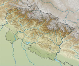 Adi Kailash Adi Kailash (Uttarakhand) | |
| Highest point | |
| Elevation | 5,945 m (19,505 ft)[1] |
| Coordinates | 30°19′09″N 80°37′57″E |
| Geography | |
| Location | Pithoragarh district, Uttarakhand, India |
| Parent range | Himalayas |
| Climbing | |
| First ascent | 8 October 2004[2][3] |
| Easiest route | Southwest ridge: glacier/snow/rock climb (PD+/AD-) |
Both Adi Kailash and Om Parvat are considered sacred by Hindus.[4]
About
The Adi Kailash and the Om Parvat are not one and the same.[5]
The Adi Kailash or Chota Kailash is located in a different direction, near Sin La pass and near Brahma Parvat, the base camp of Adi Kailash is 17 km from the Kutti village at sacred Jolingkong Lake with Lord Shiva temple.[5][6]
Om Parvat can be viewed in route to the Kailash Manasarovar Yatra from the last camp below Lipulekh Pass at Nabhidhang India-China border post protected by the Indo-Tibetan Border Police also has Public Works Department guest house on the Indian side.[7] Many trekkers to Adi Kailash often make a diversion to view Om Parvat. Om Parvat is located near Nabhi Dhang camp on Mount Kailash-Lake Manasarovar yatra route.[5]
First Ascent
From 19 Sept to 14 Oct 2002 the first attempt, which was abandoned 200 m (660 ft) short of the summit because of very loose snow and rock conditions, was made by an Indo-Aussie-British-Scottish team including Martin Moran, T. Rankin, M. Singh, S. Ward, A. Williams and R. Ausden. The climbers promised not to ascend the final 10 metres (30 ft) out of respect for the peak's holy status.[4][6][3]
On 8 October 2004, the first successful ascent of Adi Kailash was by the British-Scottish-American team composed of Tim Woodward, Jack Pearse, Andy Perkins (UK); Jason Hubert, Martin Welch, Diarmid Hearns, Amanda George (Scotland); and Paul Zuchowski (USA), who did not ascend the final few metres out of respect for the sacred nature of the summit.[2][3]
Adi Kailash Yatra Circuit
The Adi Kailash Yatra Circuit begins by going up the Darma Valley and then going to Kuthi Yankti Valley (India) via the Sin La pass to join the Mount Kailash-Lake Manasarovar Tibetan pilgrimage route down the Sharda River.[6] Motoroable Route to Adi Kailash is via Gunji. While approaching Gunji from Dharcula and the rest of India, the route along the western bank of Sharda River (also called Mahakali River) at Gunji forks into two separate motorable routes, one goes north to Kailash-Mansarovar and another to the west to Adi Kailash.[8] In July 2020, India also opened a newly constructed road in this area from Gunji to Limpiyadhura Pass (Lampiya Dhura Pass on India-China border) which has reduced the trek time to Adi Kailash to two hours.[8] Earlier in May 2020, India had inaugurated a new 80 km long road from Dharchula via Gunji to Lipulekh Pass on India-China border [under geostrategic India-China Border Roads project] to the Kailas-Manasarovar.[9]
See also
- Char Dham
- Hindu pilgrimage sites in India
- Kalapani territory
- Yatra
- Om Parvat
- Kinnaur Kailash
- Manimahesh Kailash
- Shrikhand Kailash
- Mount Kailash
References
- Moran, Martin (2015). "Cheepaydang, South Face and Southwest Ridge". American Alpine Journal. American Alpine Club.
- Moran, Martin (2005). "Adi (a.k.a. Chota or Little) Kailash (5,925m), First Ascent". American Alpine Journal. American Alpine Club. Archived from the original on 20 April 2019. Retrieved 20 April 2019.
- Moran, Martin (2007). "Three Weeks in Paradise: Exploring the Adi Kailash Range". Himalayan Journal. 63. Retrieved 20 April 2019.
- Moran, Martin (2003). "Asia, India, Kumaon, Adi Kailash Range, First Ascents and an Attempt on Adi Kailash". American Alpine Journal. American Alpine Club: 365–366. Archived from the original on 6 November 2016.
- "Om Parvat". Peakware.com. Archived from the original on 4 March 2016. Retrieved 20 April 2019.
- "Moran-Mountain.co.uk Little Kailash expedition 2012". Archived from the original on 4 February 2017. Retrieved 17 April 2016.
- "Borderline blues". AsiaNews. 28 October 2015. Archived from the original on 28 April 2016. Retrieved 17 April 2016.
- Kalyan Das and BD Kasniyal, Road to Limpiyadhura will reduce Adi Kailash trek to two hours, Hindustan Times, 17 July 2020.
- Suhasini Haidar, New road to Kailash Mansarovar runs into diplomatic trouble, The Hindu, 9 May 2020.
Hinduism | |
|---|---|
| |
|
На других языках
[de] Adi Kailash
Der Adi Kailash (auch Chotta Kailash, „Kleiner Kailash“) ist ein Berg im Kumaon-Himalaya im indischen Bundesstaat Uttarakhand.- [en] Adi Kailash
[ru] Ади-Кайлаш
Ади-Кайлаш (Кумаони: आदि कैलाश), также известная как Малый Кайлаш, пик Джонглингконг, Баба Кайлаш, Чхота Кайлаш, гора в Гималаях, расположена в округе Питхорагарх в штате Уттаракханд в Индии. Высота горы — 5945 метр[1].Другой контент может иметь иную лицензию. Перед использованием материалов сайта WikiSort.org внимательно изучите правила лицензирования конкретных элементов наполнения сайта.
WikiSort.org - проект по пересортировке и дополнению контента Википедии