geo.wikisort.org - Bergen
Das Patkai-Gebirge (auch Purvanchal-Gebirge genannt) ist ein Gebirgszug an der Grenze zwischen Indien und Myanmar (Birma) und bildet einen der südöstlichen Ausläufer des Himalaya.
| Patkai-Gebirge | ||
|---|---|---|
 Patkai-Gebirge vom Pangsau-Pass aus gesehen | ||
| Höchster Gipfel | Saramati (3826 m) | |
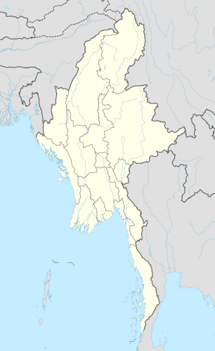
| Lage | Myanmar, Indien | |
| ||
| Koordinaten | 25° 30′ N, 94° 45′ O | |
Über den Kamm des Gebirges verläuft teilweise die Grenze zwischen Indien und Myanmar. Südlich des Patkai-Gebirges schließt sich das Arakan-Joma-Gebirge an.
Die Berge des Patkai erreichen teilweise Höhen über 3000 m. Zu den höchsten Gipfeln zählen Saramati (3826 m), Mol Len (3088 m) und Japvo (3014 m). Das Gebirge ist vorwiegend mit Kiefern und Teakholz bewaldet.
На других языках
- [de] Patkai
[en] Patkai
The Pat-kai (Pron:pʌtˌkaɪ) or Patkai Bum (Burmese: Kumon Taungdan)[2] are a series of mountains in the Indo-Myanmar border falling in the north-eastern Indian states of Arunachal Pradesh, Nagaland and Upper Burma region of Myanmar. They were created by the same tectonic processes that created the Himalayas in the Mesozoic.[citation needed] In Tai-Ahom language, Pat means to cut and Kai means chicken.[es] Patkai
Los montes Patkai o Purvachal son una cadena de montañas en la frontera este de la India con Birmania. Estas montañas fueron creadas por los mismos procesos tectónicos que formaron el Himalaya, aunque no son tan abruptas y sus picos son de mucho menor altura. La cadena incluye cumbres de tipo cónicas, pendientes pronunciadas y valles profundos.[fr] Patkai
Le Patkai est un massif de montagnes au sud-est de l'Himalaya faisant office de frontière naturelle entre le nord de la Birmanie et l'est de l'Inde. Ses plus hauts sommets se situent entre 3 000 et 4 000 mètres.[it] Patkai
I monti Patkai (chiamati anche monti Purvanchal) sono una catena montuosa al confine tra India e Birmania (Myanmar); costituiscono uno dei contrafforti sud-orientali dell'Himalaya.Текст в блоке "Читать" взят с сайта "Википедия" и доступен по лицензии Creative Commons Attribution-ShareAlike; в отдельных случаях могут действовать дополнительные условия.
Другой контент может иметь иную лицензию. Перед использованием материалов сайта WikiSort.org внимательно изучите правила лицензирования конкретных элементов наполнения сайта.
Другой контент может иметь иную лицензию. Перед использованием материалов сайта WikiSort.org внимательно изучите правила лицензирования конкретных элементов наполнения сайта.
2019-2026
WikiSort.org - проект по пересортировке и дополнению контента Википедии
WikiSort.org - проект по пересортировке и дополнению контента Википедии