geo.wikisort.org - Bergen
Mount Belecz ist ein 2120 m hoher Berg mit abgeflachtem Gipfel in der antarktischen Ross Dependency. Er ragt 10 km nordöstlich des Mount Ruth Gade in der Quarles Range auf.
| Mount Belecz | ||
|---|---|---|

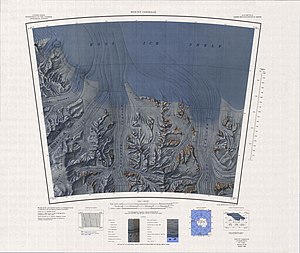
Topografische Karte mit Mount Belecz (links) | ||
| Höhe | 2120 m | |
| Lage | Ross Dependency, Antarktika | |
| Gebirge | Quarles Range, Königin-Maud-Gebirge, Transantarktisches Gebirge | |
| Koordinaten | 85° 34′ 0″ S, 163° 27′ 0″ W | |
|
| ||
| Normalweg | Hochtour (vergletschert) | |
Eine erste Kartierung erfolgte anhand von Vermessungen und Luftaufnahmen der US-amerikanischen Byrd Antarctic Expedition (1928–1930). Das Advisory Committee on Antarctic Names benannte ihn 1967 nach Dan Michael Belecz, Meteorologe auf der Amundsen-Scott-Südpolstation im antarktischen Winter 1962.
Weblinks
- Mount Belecz im Geographic Names Information System des United States Geological Survey (englisch)
- Mount Belecz auf geographic.org (englisch)
На других языках
- [de] Mount Belecz
[en] Mount Belecz
Mount Belecz is an ice-covered, flat-topped mountain, with a peak of 2,120 m, standing 6 nautical miles (11 km) northeast of Mount Ruth Gade in the Quarles Range. First mapped from ground surveys and air photos by the Byrd Antarctic Expedition, 1928–30. Named by Advisory Committee on Antarctic Names (US-ACAN) for Dan M. Belecz, meteorologist with the South Pole Station winter party in 1962.Текст в блоке "Читать" взят с сайта "Википедия" и доступен по лицензии Creative Commons Attribution-ShareAlike; в отдельных случаях могут действовать дополнительные условия.
Другой контент может иметь иную лицензию. Перед использованием материалов сайта WikiSort.org внимательно изучите правила лицензирования конкретных элементов наполнения сайта.
Другой контент может иметь иную лицензию. Перед использованием материалов сайта WikiSort.org внимательно изучите правила лицензирования конкретных элементов наполнения сайта.
2019-2025
WikiSort.org - проект по пересортировке и дополнению контента Википедии
WikiSort.org - проект по пересортировке и дополнению контента Википедии
