geo.wikisort.org - Bergen
Der Kubrat Knoll (bulgarisch Кубратова могила Kubratowa mogila) ist ein 140 m hoher und felsiger Hügel auf der Livingston-Insel im Archipel der Südlichen Shetlandinseln. Er ragt 0,64 km westsüdwestlich des Inott Point, 2 km östlich des Arbanassi-Nunatak und 1,8 km nördlich des Edinburgh Hill auf.
| Kubrat Knoll | ||
|---|---|---|
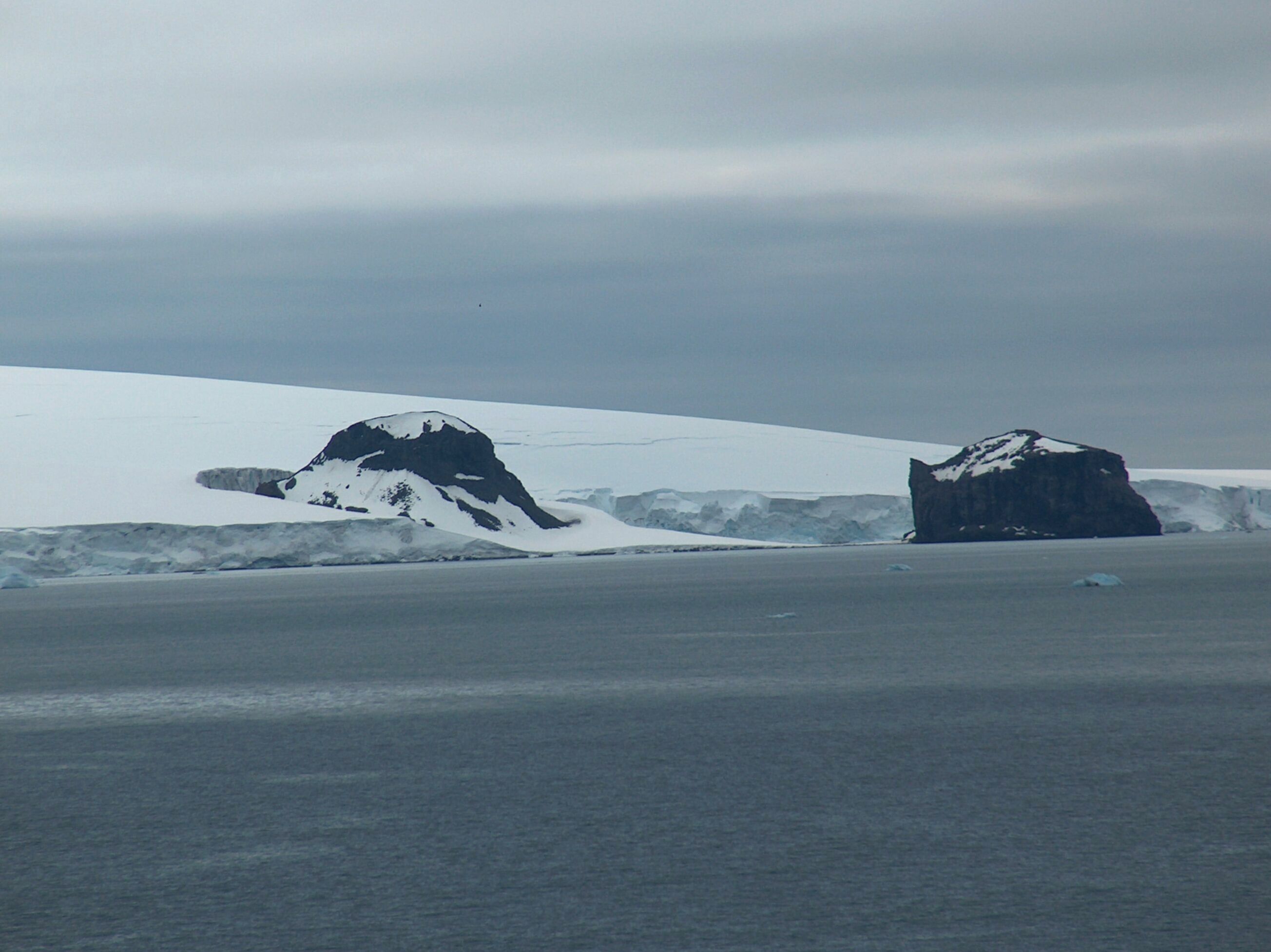
Blick von Half Moon Island auf den Kubrat Knoll (links) und den Inott Point (rechts) | ||
| Höhe | 140 m | |
| Lage | Livingston-Insel, Südliche Shetlandinseln | |
| Koordinaten | 62° 31′ 36″ S, 60° 1′ 4″ W | |
| ||

Bulgarische Wissenschaftler kartierten ihn bei Vermessungen der Tangra Mountains zwischen 2004 und 2005. Die bulgarische Kommission für Antarktische Geographische Namen benannte ihn 2005 nach Kubrat, einem protobulgarischen Herrscher des 7. Jahrhunderts.
Weblinks
- Kubrat Knoll im Composite Gazetteer of Antarctica (englisch)
На других языках
- [de] Kubrat Knoll
[en] Kubrat Knoll
Kubrat Knoll (Kubratova Mogila \ku-'bra-to-va mo-'gi-la\) is a rocky peak of elevation 140 m at the base of Inott Point, Varna Peninsula on eastern Livingston Island in the South Shetland Islands, Antarctica. It is named after Khan Kubrat, 632-668 AD, who founded the Kingdom of Great Bulgaria on the territory bounded by the Caucasus, Volga and the Carpathians in 632 AD.Текст в блоке "Читать" взят с сайта "Википедия" и доступен по лицензии Creative Commons Attribution-ShareAlike; в отдельных случаях могут действовать дополнительные условия.
Другой контент может иметь иную лицензию. Перед использованием материалов сайта WikiSort.org внимательно изучите правила лицензирования конкретных элементов наполнения сайта.
Другой контент может иметь иную лицензию. Перед использованием материалов сайта WikiSort.org внимательно изучите правила лицензирования конкретных элементов наполнения сайта.
2019-2026
WikiSort.org - проект по пересортировке и дополнению контента Википедии
WikiSort.org - проект по пересортировке и дополнению контента Википедии