geo.wikisort.org - Bergen
Der Cabeço Gordo, in freier Übersetzung aus dem Portugiesischen fetter Kopf, ist der höchste Berg der Insel Faial, Azoren. Er gehört zur Gemeinde Capelo.
| Cabeço Gordo | ||
|---|---|---|
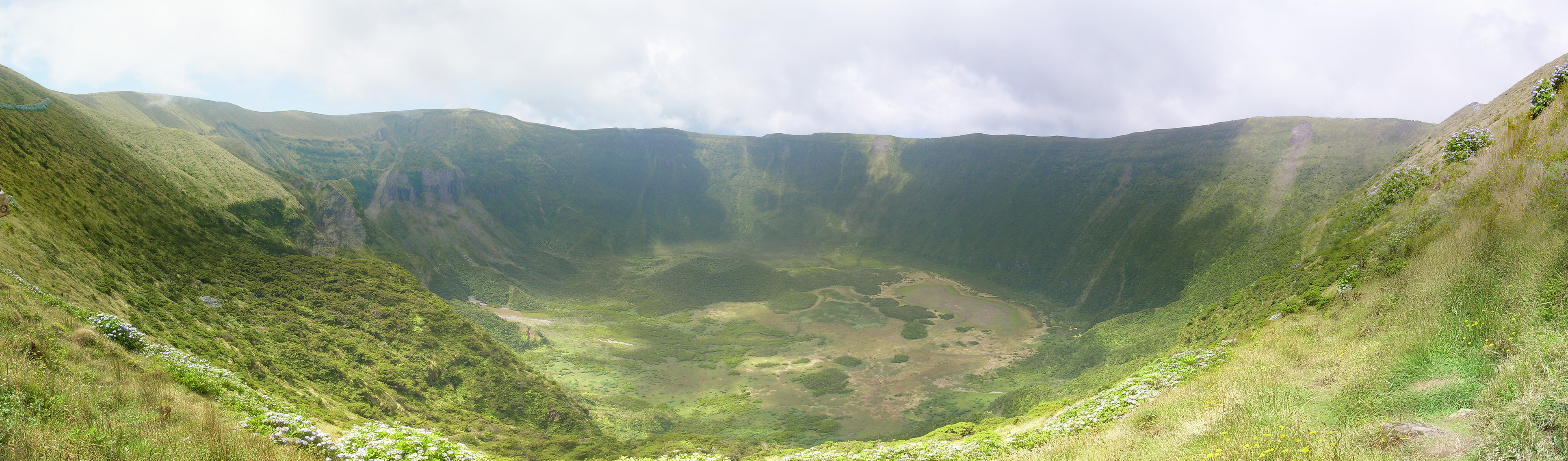
Blick von Süden in die Caldera | ||
| Höhe | 1043 m | |
| Lage | Azoreninsel Faial | |
| Koordinaten | 38° 34′ 37″ N, 28° 42′ 49″ W | |
| ||
| Typ | Schichtvulkan | |
| Letzte Eruption | 1957/58 | |

Der Kraterrand des Vulkans erhebt sich bis auf 1043 m Höhe, die Caldeira hat einen Durchmesser von 2 km und der Talkessel fällt steil 400 m ab. Dieser Hauptkrater prägt die Insel Faial, ist aber nur Teil eines in westliche Richtung wandernden Herdes. Der letzte Ausbruch ereignete sich 1957/58, wodurch der 2,4 km² große Capelinhos entstand.
Weblinks
Commons: Caldeira (Faial) – Sammlung von Bildern, Videos und Audiodateien
- Faial im Global Volcanism Program der Smithsonian Institution (englisch)
На других языках
- [de] Cabeço Gordo
[en] Cabeço Gordo
Cabeço Gordo (Portuguese for "fat mound") is the highest point in the island of Faial, measuring 1,043 metres (3,422 ft) above sea level.[1][2] Located on the southern rim of the Caldeira Volcano, on a clear day, most of the islands of the central group of the Azores are visible: Pico, São Jorge, and Graciosa, although normally the caldera may be covered in clouds and fog.[es] Cabeço Gordo
Cabeço Gordo o Pico Gordo es el lugar más alto de la Isla de Fayal, en el archipiélago de las Azores, Portugal.Текст в блоке "Читать" взят с сайта "Википедия" и доступен по лицензии Creative Commons Attribution-ShareAlike; в отдельных случаях могут действовать дополнительные условия.
Другой контент может иметь иную лицензию. Перед использованием материалов сайта WikiSort.org внимательно изучите правила лицензирования конкретных элементов наполнения сайта.
Другой контент может иметь иную лицензию. Перед использованием материалов сайта WikiSort.org внимательно изучите правила лицензирования конкретных элементов наполнения сайта.
2019-2026
WikiSort.org - проект по пересортировке и дополнению контента Википедии
WikiSort.org - проект по пересортировке и дополнению контента Википедии