geo.wikisort.org - Isola
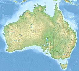
Thursday Island è un'isola dell'Australia. Fa parte del gruppo delle isole dello Stretto di Torres, amministrativamente facenti capo al Queensland, e si trova a circa 39 km a nord della penisola di Capo York[2] ed è il centro amministrativo e commerciale della regione di Torres Strait Island nonostante non faccia parte di quell'area del governo locale. La popolazione dell'isola, nel censimento del 2011, era di 2610 abitanti[1].
| Thursday Island | |
|---|---|
 | |
| Geografia fisica | |
| Localizzazione | Stretto di Torres |
| Coordinate | 10°34′44″S 142°13′12″E |
| Arcipelago | Isole dello Stretto di Torres |
| Superficie | 3,5 km² |
| Altitudine massima | 104 m s.l.m. |
| Geografia politica | |
| Stato | |
| Stato federato | |
| Local government area | Contea di Torres |
| Demografia | |
| Abitanti | 2610[1] (2011) |
| Cartografia | |
 | |
| voci di isole dell'Australia presenti su Wikipedia | |
La cittadina dell'isola è nota per essere la città più settentrionale dell'Australia. Il suo porto, Port Kennedy, fondato nel 1867, porta il nome di Edmund Kennedy[3], esploratore della penisola di Capo York.
Geografia
Thursday Island si trova a nord dell'isola Principe di Galles tra Hammond Island e Horn Island. Thursday ha una superficie di 3,5 km² e un'altezza massima di 104 m (Milman Hill).
Storia
Nel 1885 sull'isola fu fondata una lucrosa industria di perle e madreperla che attrasse lavoratori provenienti da tutta l'Asia, soprattutto dal Giappone[4][5] Le valve della locale Pinctada maxima erano usate principalmente per realizzare bottoni per camicie.
In seguito alla dichiarazione di guerra del Giappone nel 1941, la maggior parte della popolazione civile fu evacuata verso la terraferma. Tutti i residenti giapponesi di Thursday Island furono arrestati e internati nei campi del Nuovo Galles del Sud e di Victoria[4].
Note
- (EN) Australian Bureau of Statistics - 2011 Census - Thursday Island, su censusdata.abs.gov.au. URL consultato il 25 febbraio 2018.
- About the Shire, su torres.qld.gov.au. URL consultato il 22 febbraio 2018 (archiviato dall'url originale il 13 marzo 2018).
- Kennedy, Edmund Besley (1818–1848), su adb.anu.edu.au. URL consultato il 26 febbraio 2018.
- Thursday Island, su qld.gov.au. URL consultato il 26 febbraio 2018.
- (EN) Pearlers of North Australia: the romantic story of the diving fleets., su espace.library.uq.edu.au. URL consultato il 26 febbraio 2018.
Collegamenti esterni
- (EN) Thursday Island, su Enciclopedia Britannica, Encyclopædia Britannica, Inc.
| Controllo di autorità | VIAF (EN) 245833668 · NDL (EN, JA) 01007758 · WorldCat Identities (EN) viaf-245833668 |
|---|
На других языках
[de] Thursday Island
Thursday Island, von den einheimischen Torres-Strait-Insulanern traditionell Waiben genannt, ist das administrative und kommerzielle Zentrum der Inseln in der Torresstraße. Die Verwaltung des Torres Shire, der Shire Council, hat hier seinen Sitz. Die Stadt auf der Insel, Town of Thursday Island, ist Verwaltungssitz der nördlichsten Gemeinde (in Queensland Shire genannt) Australiens, Torres Shire[1].[en] Thursday Island
Thursday Island, colloquially known as TI, or in the Kawrareg dialect,[2] Waiben or Waibene,[3] is an island of the Torres Strait Islands, an archipelago of at least 274 small islands in the Torres Strait. TI is located approximately 39 kilometres (24 miles) north of Cape York Peninsula in Far North Queensland, Australia.[4] Thursday Island is also the name of the town in the south and west of the island and also the name of the locality which contains the island within the Shire of Torres.[5][6] The town of Rose Hill (known as Abednego until 7 September 1991) is located on the north-eastern tip of the island (10.5698°S 142.2250°E / -10.5698; 142.2250 (Rose Hill, Queensland)).[7][fr] Île Thursday
L'île Thursday (Thursday Island ou TI), connue aussi sous le nom de Waiden, est une des îles du détroit de Torrès, dans le détroit éponyme entre la péninsule du cap York dans l'extrême nord-est de l'Australie et la Nouvelle-Guinée. Située au centre du groupe des Inner Islands, les plus proches de la péninsule australienne, elle est entourée à proximité immédiate au sud-ouest par l'Île du Prince-de-Galles, au sud-est par l'île Horn (ou Ngurupai) et au nord-ouest par l'île Hummond. Thursday est à 39 km du continent australien. Son point le plus élevé est Milman Hill.- [it] Thursday Island
[ru] Терсди
Остров Те́рсди (англ. Thursday Island, TI; Waiben) — остров в Торресовом проливе, расположенный в 39 км к северу от полуострова Кейп-Йорк (Австралия). Остров имеет площадь около 3,5 км ². Высшая точка — Мильман-Хилл, 104 м над уровнем моря (во время Второй мировой войны — объект обороны). Расположен в 2182 км от Брисбена — столицы штата Квинсленд, 540 км от Порт-Морсби — столицы Папуа—Новой Гвинеи.Другой контент может иметь иную лицензию. Перед использованием материалов сайта WikiSort.org внимательно изучите правила лицензирования конкретных элементов наполнения сайта.
WikiSort.org - проект по пересортировке и дополнению контента Википедии
