geo.wikisort.org - Isola
Three Hummock Island è un'isola dell'Hunter Island Group nello stretto di Bass, in Tasmania (Australia). L'isola, che appartiene alla municipalità di Circular Head, prende il nome dalle sue tre prominenti colline (North, Middle e South Hummock).
| Three Hummock Island | |
|---|---|
 | |
| Geografia fisica | |
| Localizzazione | Stretto di Bass |
| Coordinate | 40°26′24″S 144°54′36″E |
| Arcipelago | Hunter Island Group |
| Superficie | 70[1] km² |
| Altitudine massima | 237 m s.l.m. |
| Geografia politica | |
| Stato | |
| Stato federato | |
| Local government area | Municipalità di Circular Head |
| Cartografia | |
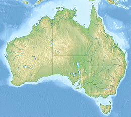 Three Hummock Island | |
| voci di isole dell'Australia presenti su Wikipedia | |
Geografia
Three Hummock è situata a nord-est di Hunter Island e a nord di Robbins Island. L'isola ha una superficie di 70 km² e un'altezza massima di 237 m. A nord-est dell'isola, a Cape Rochon, c'è un faro automatizzato[2].
Flora e fauna
Gran parte dell'isola è composta da una fitta macchia dominata da Leptospermum scoparium, Melaleuca ericifolia e Banksia marginata, mentre il 25% dell'area è ricoperta da boschi di Eucalyptus nitida.[3]
L'isola fa parte della Hunter Island Group Important Bird Area[4] (IBA). È presente su Three Hummock Island il pinguino minore blu, la berta codacorta (circa 2000 coppie), il prione fatato (circa 20 000 coppie), il gabbiano del Pacifico, la beccaccia di mare orientale, la beccaccia di mare fuligginosa e il corriere dal cappuccio. Tra i mammiferi alcune specie introdotte: il canguro grigio orientale, il gatto selvatico e il topo comune; e sono state registrate nel 1999 delle pecore selvatiche. È presente anche il serpente tigre.[3]
Curiosità
Giuseppe Garibaldi, in qualità di capitano della nave mercantile Carmen, ha visitato l'isola nel 1852[5] mentre era in esilio dall'Italia e ne fa menzione nella sua Autobiografia.[6][7]
|
«...we passed through Bass's Strait, between Australia and Van Diemen's Land. Touching at one of the Hunter Islands, to take in water, we found a small farm, lately deserted by an Englishman and his wife, on the death of his partner. This information we obtained from a board erected on the settler's grave, which set forth in brief the history of the little colony. "The husband and wife," said the inscription, "unable to bear the loneliness of the desert island, left it, and returned to Van Diemen.» |
| (Giuseppe Garibaldi, Autobiography) |
Note
- (EN) Bass Strait Island Nature Reserves, su parks.tas.gov.au, pp. 9-10. URL consultato il 27 gennaio 2018 (archiviato dall'url originale il 30 marzo 2011).
- (EN) Cape Rochon - An Island Light, su lighthouses.org.au. URL consultato il 27 gennaio 2018.
- Brothers, Nigel; Pemberton, David; Pryor, Helen; & Halley, Vanessa, Tasmania’s Offshore Islands: seabirds and other natural features., Hobart, Tasmanian Museum and Art Gallery, 2001, ISBN 0-7246-4816-X.
- (EN) Hunter Island Group, su datazone.birdlife.org. URL consultato il 26 gennaio 2018.
- (EN) Garibaldi in Tasmania, su thevelv.blogspot.it. URL consultato il 27 gennaio 2018.
- (EN) Giuseppe Garibaldi, Autobiography of Giuseppe Garibaldi, traduzione di A. Werner, vol. II, Londra, Walter Smith and Innes, 1889, pp. 65-66.
- La visita è riportata nel libro Island Affair di Eleanor Alliston
Collegamenti esterni
- Three Hummock’s Italian vibe (PDF), su elspethcallender.com. URL consultato il 27 gennaio 2018 (archiviato dall'url originale il 28 gennaio 2018).
На других языках
[de] Three Hummock Island
Three Hummock Island (deutsch „Drei-Hügel-Insel“) ist eine etwa 70 km² große Insel im südwestlichen Teil der Bass-Straße zwischen dem Festland von Australien und der Insel Tasmanien. Sie liegt nordöstlich von Hunter Island nahe der Nordwestküste von Tasmanien und ist am höchsten Punkt 237 m hoch.[en] Three Hummock Island
The Three Hummock Island, part of the Hunter Island Group, is a 70-square-kilometre (27 sq mi) granite island, located in the Bass Strait near King Island, lying off the north-west coast of Tasmania, Australia.[1]- [it] Three Hummock Island
[ru] Три-Хаммок
Три-Хаммок (англ. Three Hummock Island — «остров трёх холмов») — остров у западной части северного побережья острова Тасмания (Австралия), входит в состав штата Тасмания. Площадь острова 70 км²[1].Другой контент может иметь иную лицензию. Перед использованием материалов сайта WikiSort.org внимательно изучите правила лицензирования конкретных элементов наполнения сайта.
WikiSort.org - проект по пересортировке и дополнению контента Википедии