geo.wikisort.org - Isola
Hunter Island è l'isola principale del Hunter Island Group ed è situata vicino a Cape Grim, la punta nord-ovest della Tasmania (Australia), nello stretto di Bass. L'isola appartiene alla municipalità di Circular Head.
| Hunter Island | |
|---|---|
 | |
| Geografia fisica | |
| Localizzazione | Stretto di Bass |
| Coordinate | 40°30′S 144°47′E |
| Superficie | 73,3 km² |
| Dimensioni | 25 × 6,5 km |
| Altitudine massima | 90 m s.l.m. |
| Geografia politica | |
| Stato | |
| Stato federato | |
| Local government area | Municipalità di Circular Head |
| Cartografia | |
 Hunter Island | |
| voci di isole dell'Australia presenti su Wikipedia | |
Geografia

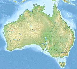
Hunter si trova nello stretto di Bass che divide l'isola di Tasmania dall'Australia e dista circa 5 km[1] da Cape Grim; si trova inoltre circa 73 km[2] a sud-est di King Island. L'isola ha una superficie di 73,3 km² e l'altezza massima, di 90 m. Fa parte dello stesso gruppo Three Hummock Island, che si trova a nord-est, e una serie di piccoli isolotti che circondano Hunter Island: Albatross Island, Bears Island, Bird Island, Black Pyramid Rock, Dugay Islet, Edwards Islet, Nares Rocks, Penguin Islet, South Black Rock, Steep Island e Stack Island. A sud-est di Hunter si trova Robbins Island.
Fauna

L'isola fa parte della Hunter Island Group Important Bird Area[3] (IBA), perché si trova sulla rotta migratoria (tra la Tasmania sud-occidentale e l'Australia sud-orientale) del pappagallo panciarancia, specie in pericolo critico.
Note
- Misura presa con: Wikimapia, su wikimapia.org. URL consultato il 26 gennaio 2018.
- Misura presa con: Wikimapia, su wikimapia.org. URL consultato il 26 gennaio 2018.
- (EN) Hunter Island Group, su datazone.birdlife.org. URL consultato il 26 gennaio 2018.
| Controllo di autorità | VIAF (EN) 236104822 |
|---|
На других языках
[de] Hunter Island (Tasmanien)
Hunter Island ist eine Insel im südwestlichen Teil der Bass-Straße zwischen Victoria und der Insel Tasmanien im südöstlichen Australien. Sie liegt südwestlich von Three Hummock Island etwa 5 Kilometer vor der Nordwestküste Tasmaniens.[en] Hunter Island (Tasmania)
The Hunter Island, the main island of the Hunter Island Group, is a 7,330-hectare (18,100-acre) island, located in Bass Strait, that lies between King Island and north-west Tasmania, Australia.[fr] Île Hunter (Tasmanie)
L’île Hunter est une île dans le détroit de Bass entre le Victoria et la Tasmanie dans le sud-est de l'Australie. Elle est située près de l'île Three Hummock, à plusieurs miles au large de la côte nord-ouest de la Tasmanie. L'île est utilisée pour l'élevage du bétail et il y a une ferme sur l'île. Une barge privée assure le transport jusqu'à Smithton sur la côte nord de la Tasmanie.- [it] Hunter Island (Tasmania)
[ru] Хантер (остров, Тасмания)
Хантер (англ. Hunter Island) — остров у западной части северного побережья острова Тасмания (Австралия), входит в состав штата Тасмания. Площадь острова — 71 км²[1].Другой контент может иметь иную лицензию. Перед использованием материалов сайта WikiSort.org внимательно изучите правила лицензирования конкретных элементов наполнения сайта.
WikiSort.org - проект по пересортировке и дополнению контента Википедии