geo.wikisort.org - Isola
L'isola Goodenough è un'isola della Papua Nuova Guinea.
| Isola Goodenough Goodenough Island | |
|---|---|
 | |
| Geografia fisica | |
| Localizzazione | Oceania |
| Coordinate | 9°22′S 150°16′E |
| Arcipelago | Isole di D'Entrecasteaux |
| Superficie | 687 km² |
| Dimensioni | 39 × 26 km |
| Altitudine massima | 2.536 m s.l.m. |
| Geografia politica | |
| Stato | |
| Cartografia | |
 Isola Goodenough | |
| voci di isole della Papua Nuova Guinea presenti su Wikipedia | |
Geografia
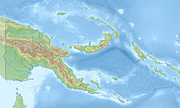
L'isola Goodenough è la più piccola e la più settentrionale dell'arcipelago delle isole di D'Entrecasteaux e si trova a 4 km dalla più grande isola Fergusson, dalla quale è separata dallo stretto di Moresby. Dista circa 30 km dalla Nuova Guinea.
L'isola ha forma circolare e dimensioni che variano dai 39 ai 26 km per un totale di 687 km². La cima più alta dell'isola, il monte Vineuo, raggiunge i 2.536 metri s.l.m. ed è una delle più alte montagne al mondo a occupare un'isola di simili dimensioni (relativamente piccola).
Botanica
Nell'isola di Goodenough cresce, in continuità con la flora australiana, il Citrus garrawayi, agrume tipico anche del Queensland settentrionale e analogo al finger lime.
Storia
L'isola fu esplorata per la prima volta nel 1874 dal capitano John Moresby sulla nave HMS Basilisk che le diede il nome corrente in onore di un suo collega, il commodoro James Graham Goodenough.
Bibliografia
- L'isola sul sito Oceandot.com, su oceandots.com.
Voci correlate
- Cane nativo dell'isola di Goodenough
Altri progetti
 Wikimedia Commons contiene immagini o altri file su Goodenough
| Controllo di autorità | VIAF (EN) 315526318 · LCCN (EN) sh85055901 · J9U (EN, HE) 987007533756305171 |
|---|
На других языках
[de] Goodenough-Insel
Nidula, die "Goodenough-Insel", befindet sich in der Milne-Bay-Provinz von Papua-Neuguinea. Sie liegt östlich des Festlandes in der Salomonensee. Goodenough ist eine der D’Entrecasteaux-Inseln, nahe den Trobriand-Inseln gelegen. Diese Insel wurde 1873 von Kapitän John Moresby besucht, der sie nach Kommodore James Graham Goodenough benannte.[en] Goodenough Island
Goodenough Island in the Solomon Sea, also known as Nidula Island, is the westernmost of the three large islands of the D'Entrecasteaux Islands in Milne Bay Province of Papua New Guinea. It lies to the east of mainland New Guinea and southwest of the Trobriand Islands.[1] It is roughly circular in shape, measuring 39 by 26 kilometres (24 by 16 mi) with an area of 687 square kilometres (265 sq mi) and a shoreline of 116 kilometres (72 mi). From a coastal belt varying in width from 2 to 10 kilometres (1.2 to 6.2 mi) in width, the island rises sharply to the summit of Mount Vineuo, 2,536 metres (8,320 ft) above sea level, making it one of the most precipitous islands in the world.[2] The small outlier Wagifa Island lies to the south-east of the island, and is included within Goodenough's administration.[fr] Goodenough (île)
Goodenough est une île de la province de Baie Milne en Papouasie-Nouvelle-Guinée.- [it] Goodenough (isola)
[ru] Гуденаф (остров)
Остров Гуденаф (англ. Goodenough, иногда Нидула англ. Nidula) — остров в Соломоновом море, часть архипелага острова Д'Антркасто. Площадь острова — 686,7 км², протяженность береговой линии — около 116 км. По переписи 2000 года на острове проживало 20 814 человек. Административно относятся к провинции Милн-Бей региона Папуа. Главный населенный пункт — Болуболу.Другой контент может иметь иную лицензию. Перед использованием материалов сайта WikiSort.org внимательно изучите правила лицензирования конкретных элементов наполнения сайта.
WikiSort.org - проект по пересортировке и дополнению контента Википедии