geo.wikisort.org - Isola
Bishop e Clerk Islets sono un gruppo di isolotti a sud di Macquarie Island nell'oceano Pacifico sud-occidentale che appartengono allo stato della Tasmania (Australia).
| Bishop e Clerk Islets | |
|---|---|
| Geografia fisica | |
| Localizzazione | Oceano Pacifico |
| Coordinate | 55°02′52″S 158°46′20″E |
| Superficie | 0,6 km² |
| Altitudine massima | 45 m s.l.m. |
| Geografia politica | |
| Stato | |
| Stato federato | |
| Cartografia | |
 Bishop e Clerk Islets | |
| voci di isole dell'Australia presenti su Wikipedia | |
Gli isolotti si trovano all'interno della Macquarie Island Nature Reserve[1], gestita dal Tasmanian Parks and Wildlife Service. Assieme a Macquarie Island e Judge and Clerk Islets[2] sono stati inscritti nel 1997 nel patrimonio mondiale dell'UNESCO.[3][4]
Geografia
 |
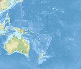
Bishop e Clerk Islets si trovano 33 km a sud di Macquarie Island; sono un gruppo di 24 tra isolotti e scogli per un'area complessiva di 0,6 km². Bishop ha un'area di 0,03 km² e il suo punto più elevato raggiunge i 45 m.[5] Il gruppo di isolotti è il punto terrestre più meridionale sia dell'Australia (escluso il Territorio antartico australiano) che della Tasmania.
Flora e fauna
L'unica pianta vascolare registrata su Bishop è il Colobanthus muscoides; sono presenti inoltre alcuni licheni.
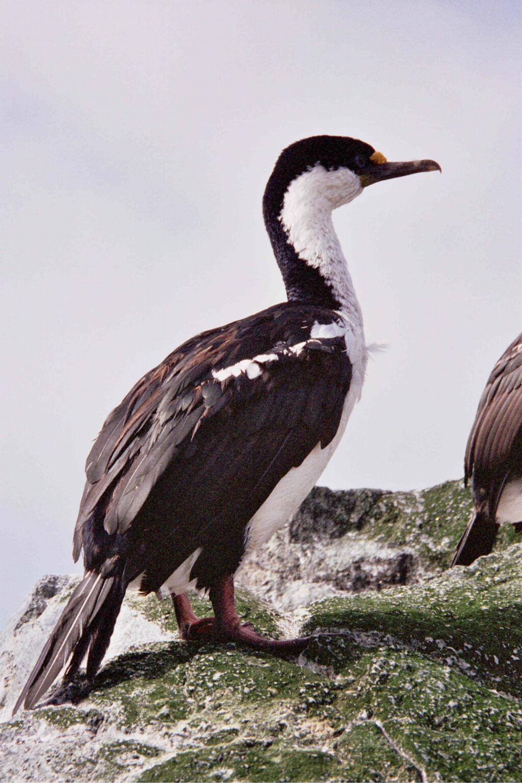
Nidifica sugli isolotti il cormorano delle Macquarie; nel 1965 è stata scoperta una colonia di albatro sopracciglio nero.[6][7]
Note
- (EN) Macquarie Island Nature Reserve and World Heritage Area (PDF), su parks.tas.gov.au. URL consultato il 30 gennaio 2018 (archiviato dall'url originale il 21 luglio 2008).
- Judge and Clerk Islets si trovano 11 km a nord di Macquarie Island 54°21′S 159°00′E.
- (EN) World Heritage Places - Macquarie Island - Outstanding Universal Value, su environment.gov.au. URL consultato il 31 gennaio 2018.
- (EN) Macquarie Island, su whc.unesco.org. URL consultato il 31 gennaio 2018.
- (EN) ACAP Breeding Site No. 66. Bishop and Clerk Islets: Australia’s southernmost albatross colony, su acap.aq. URL consultato il 30 gennaio 2018.
- (EN) Alderman, R; Double, M; Valencia, J; Gales, R, Genetic affinities of newly sampled populations of Wandering and Black-browed Albatross, su tandfonline.com. URL consultato il 31 gennaio 2018.
- The avifauna of Bishop and Clerk Islets and its relationship to nearby Macquarie Island (PDF), su eprints.utas.edu.au. URL consultato il 31 gennaio 2018 (archiviato dall'url originale il 5 marzo 2016).
На других языках
[de] Bishop- und Clerkinseln
Die unbewohnten Bishop- und Clerkinseln (englisch Bishop and Clerk Islets) liegen 28,4 km südlich von Hurd Point, des südlichsten Punktes der Macquarieinsel im südlichen Pazifischen Ozean und umfassen eine Landfläche von 3 ha (0,03 km²). Sie bilden den südlichsten Punkt Australiens und sind 1526 km von der Insel Tasmanien sowie 1995 km vom australischen Kontinent (Victoria) entfernt. Sie sind Bestandteil des Macquarie Island Commonwealth Marine Reserve, das von Tasmanien aus verwaltet wird.[en] Bishop and Clerk Islets
The Bishop and Clerk Islets are a 60-hectare (150-acre) group of islets, lying 33 kilometres (21 mi) south of Macquarie Island in the southwestern Pacific Ocean. They are, with Macquarie Island, part of the Australian state of Tasmania.[2][3] The group consists of Bishop Islet, 24 smaller islets, and various rocks and reefs. Bishop Islet has an area of 3 hectares (7.4 acres) and is mostly rock with some shallow patches of soil. Its highest elevation is 45 metres (148 ft).[1]- [it] Bishop e Clerk Islets
Другой контент может иметь иную лицензию. Перед использованием материалов сайта WikiSort.org внимательно изучите правила лицензирования конкретных элементов наполнения сайта.
WikiSort.org - проект по пересортировке и дополнению контента Википедии