geo.wikisort.org - Île
L’île Richards est une île des Territoires du Nord-Ouest, au Canada. Il s'agit de la plus grande île fluviale du pays. Elle a une superficie de 2 165 km² (environ 80 km de long pour 40 km de large). Elle est bordée à l'est par le bras principal du fleuve Mackenzie, et à l'ouest par le chenal Reindeer, plus étroit, et au nord par la mer de Beaufort. Des travaux de prospection pétrolière y ont été menés au cours des années 1960[1].
Cet article est une ébauche concernant le monde insulaire et les Territoires du Nord-Ouest.
Vous pouvez partager vos connaissances en l’améliorant (comment ?) selon les recommandations des projets correspondants.
| Île Richards Richards Island (en) | |||
| Géographie | |||
|---|---|---|---|
| Pays | |||
| Coordonnées | 69° 20′ 00″ N, 134° 30′ 00″ O | ||
| Superficie | 2 165 km2 | ||
| Administration | |||
| Territoire | Nord-Ouest | ||
| Région | Inuvik | ||
| Démographie | |||
| Population | Aucun habitant | ||
| Autres informations | |||
| Fuseau horaire | UTC−07:00 | ||
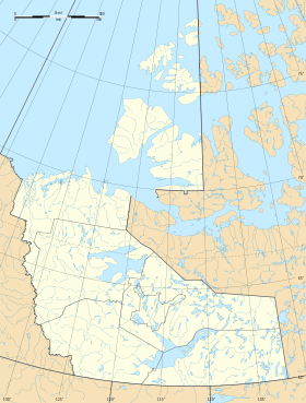
| Géolocalisation sur la carte : Territoires du Nord-Ouest
Géolocalisation sur la carte : Canada
| |||
| Île au Canada | |||
| modifier |
|||

En 1826, John Richardson lui a attribué le nom de John Baker Richards, alors gouverneur de la Banque d'Angleterre[2].
Notes et références
- (en) Oil and Gas Exploration & Development Activity Forecast - Canadian Beaufort Sea 2012 – 2027, avril 2012.
- Franklin, John, Narrative of a second expedition to the shores of the Polar sea in the years 1825, 1826 and 1827 by John Franklin,... including an account of the progress of a detachment to the Eastward, by John Richardson., Londres, J. Murray, Londres, 1828.
 Portail des Territoires du Nord-Ouest
  Portail du monde insulaire
На других языках
[de] Richards Island (Nordwest-Territorien)
Richards Island ist eine zu den Nordwest-Territorien gehörende kanadische arktische Insel in der Beaufortsee. Mit 2165 km² ist sie die größte in diesem Gewässer. Sie ist unbewohnt.[en] Richards Island
Richards Island is one of the Canadian arctic islands within the Northwest Territories, Canada. The island has an area of 2,165 square kilometres (836 square miles), being 85 kilometres (53 miles) long and 42 kilometres (26 miles) wide. Its eastern limit is marked by the main channel of the Mackenzie River, while its western limit is defined by the narrower Reindeer Channel.[1][es] Isla Richards
La isla Richards (en inglés: Richards Island) es una isla deshabitada del ártico canadiense localizada en aguas del mar de Beaufort, perteneciente a los Territorios del Noroeste, Canadá.- [fr] Île Richards
[it] Isola Richard
L'isola Richard (in inglese Richards Island) è una delle moltissime isole dell'Arcipelago artico canadese e appartiene ai Territori del Nord-Ovest, Canada.Другой контент может иметь иную лицензию. Перед использованием материалов сайта WikiSort.org внимательно изучите правила лицензирования конкретных элементов наполнения сайта.
WikiSort.org - проект по пересортировке и дополнению контента Википедии