geo.wikisort.org - Île
L'île Rose est un atoll des Samoa américaines, point situé le plus au sud des États-Unis.
Pour les articles homonymes, voir Rose.
Cet article est une ébauche concernant le monde insulaire et les Samoa américaines.
Vous pouvez partager vos connaissances en l’améliorant (comment ?) selon les recommandations des projets correspondants.
| Rose Rose Island, Motu O Manu ou Rose Atoll | |||
 L'île Rose | |||
| Géographie | |||
|---|---|---|---|
| Pays | |||
| Archipel | Samoa américaines | ||
| Localisation | Océan Pacifique | ||
| Coordonnées | 14° 32′ 48″ S, 168° 09′ 07″ O | ||
| Superficie | 0,214 km2 | ||
| Administration | |||
| Démographie | |||
| Population | Aucun habitant | ||
| Autres informations | |||
| Géolocalisation sur la carte : océan Pacifique
Géolocalisation sur la carte : Samoa américaines
| |||
| modifier |
|||


Géographie

Entourée d'un lagon et de récifs s'étendant sur 5 km2, il existe deux îlots dans son nord-est.
Histoire
La première mention de l'île apparait chez Louis de Freycinet en 1819 qui lui donne le prénom de sa femme, Rose de Freycinet[1].
Plus tard en 1824, Otto von Kotzebue lui donne le nom de son premier lieutenant, Kordinkov.
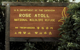
L'île est célèbre pour le Rose Atoll Marine National Monument
Notes et références
- M. S. Rivière, A Woman of Courage: The journal of Rose de Freycinet on her voyage around the world 1817–1820, National Library of Australia, Canberra, 1996, p. xxi
Liens externes
- Ressource relative à la géographie :
 Portail des Samoa américaines
  Portail du monde insulaire
На других языках
[de] Rose-Atoll
Das Rose-Atoll, auch Rose Island, ist ein unbewohntes[1], nahezu quadratisch geformtes Atoll im Pazifischen Ozean, das zum Territorium Amerikanisch-Samoas gehört. Die Landfläche beträgt 0,214 km², und die Gesamtfläche des Atolls mit Lagune beträgt rund 5 km². Im Nordosten des Korallenriffs liegen zwei Inseln, die größere Rose Island im Osten und die vegetationslose Sand Island im Norden.[en] Rose Atoll
Rose Atoll, sometimes called Rose Island or Motu O Manu ("Bird Island") by people of the nearby Manu'a Islands, is an oceanic atoll within the U.S. territory of American Samoa. An uninhabited wildlife refuge, it is the southernmost point belonging to the United States. The land area is just 0.05 km2 (12 acres) at high tide. The total area of the atoll, including lagoon and reef flat amounts to 6.33 km2 (1,560 acres). Just west of the northernmost point is a channel into the lagoon, about 40 m wide. There are two islets on the northeastern rim of the reef, larger Rose Island in the east (3.5 m high) and the non-vegetated Sand Island in the north (1.5 m high). The Rose Atoll Marine National Monument that lies on the two outstanding islands of the Atoll is managed cooperatively between the U.S. Fish and Wildlife Service and the government of American Samoa.[1]- [fr] Rose (île)
[it] Atollo Rose
L'atollo Rose (in inglese Rose Atoll, in samoano Motu O Manu) è un atollo delle Samoa Americane, situato a est delle isole Manu'a.[ru] Розе (атолл)
Атолл Розе (англ. Rose Atoll, иногда остров Розе, остров Роз) — необитаемый[1] атолл, заповедник недалеко от островов Мануа. Является частью Американского Самоа. Древнее название — Моту-О-Ману (Motu O Manu).Текст в блоке "Читать" взят с сайта "Википедия" и доступен по лицензии Creative Commons Attribution-ShareAlike; в отдельных случаях могут действовать дополнительные условия.
Другой контент может иметь иную лицензию. Перед использованием материалов сайта WikiSort.org внимательно изучите правила лицензирования конкретных элементов наполнения сайта.
Другой контент может иметь иную лицензию. Перед использованием материалов сайта WikiSort.org внимательно изучите правила лицензирования конкретных элементов наполнения сайта.
2019-2026
WikiSort.org - проект по пересортировке и дополнению контента Википедии
WikiSort.org - проект по пересортировке и дополнению контента Википедии