geo.wikisort.org - Île
Nerlandsøya est une île la commune de Herøy, du comté de Møre et Romsdal, dans la mer de Norvège. Elle fait partie de l'archipel de Sørøyane[1].
Cet article est une ébauche concernant le monde insulaire et la Norvège.
Vous pouvez partager vos connaissances en l’améliorant (comment ?) selon les recommandations des projets correspondants.
| Nerlandsøya | |||
 Nerlandsøya et le pont d'accès | |||
| Géographie | |||
|---|---|---|---|
| Pays | |||
| Archipel | Sørøyane | ||
| Localisation | Mer de Norvège | ||
| Coordonnées | 62° 21′ 03″ N, 5° 33′ 10″ E | ||
| Superficie | 14,6 km2 | ||
| Point culminant | Storevarden (430 m) | ||
| Administration | |||
| Région | Vestlandet | ||
| Comté | Møre et Romsdal | ||
| Municipalité | Herøy | ||
| Démographie | |||
| Population | 888 hab. (2015) | ||
| Densité | 60,82 hab./km2 | ||
| Autres informations | |||
| Fuseau horaire | UTC+02:00 | ||
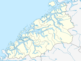
| Géolocalisation sur la carte : Møre og Romsdal
Géolocalisation sur la carte : Norvège
| |||
| Île en Norvège | |||
| modifier |
|||

Description
L'île de 14,6 km2 est située au nord-ouest de la ville de Fosnavåg et à l'est de l'île de Skorpa. L'île est reliée à l'île Bergsøya (au sud-est) par le Nerlandsøy Bridge (en). Les îles Flåvær se trouvent au sud. Le plus grand village de l'île est Kvalsund.
Du côté est de l'île se trouvent les fjords de Breidsundet et Holmefjord, qui la séparent de l'île de Remøya[2].
Galerie
 Pont de Nerlandsøy
 Village de Kvalsund


Voir aussi
Notes et références
Liens internes
 Portail de la Norvège
  Portail du monde insulaire
На других языках
[de] Nerlandsøya
Nerlandsøya ist die drittgrößte Insel der Gemeinde Herøy, eine zu den Sørøyane („Südinseln“) gehörende Insel in Sunnmøre (Møre og Romsdal). Die Inselgruppe befindet sich südwestlich von Ålesund. Auf der Insel liegen die Ortschaften Kvalsund und Kvalsvik, sowie Koperstad. Nerlandsøya hatte im Jahr 2005 853 Einwohner. Die Insel ist mit der Nachbarinsel Bergsøya mit einer Brücke, der Nerlandsøybrua, verbunden. An der Westseite der Insel befindet sich die beliebte Badebucht Mulevika. Von der Ortschaft Kvalsvik führt eine Straße nach Mulevika. Im Südwesten der Insel liegt die heute unbewohnte Insel Skorpa, auf der eine Herde Wildziegen lebt.[en] Nerlandsøya
Nerlandsøya is an island in the municipality of Herøy in Møre og Romsdal county, Norway. The island is located northwest of the town of Fosnavåg and east of the island of Skorpa. The island is connected to the island Bergsøya (to the southeast) by the Nerlandsøy Bridge. The Flåvær islands lie to the south. The highest point on the island is Storevarden which is 430 metres (1,410 ft) above sea level. The island has an area of 14.6 square kilometres (5.6 sq mi). In 2015, there were 888 residents living on the island.[1] The largest village on the island is Kvalsund.- [fr] Nerlandsøya
Текст в блоке "Читать" взят с сайта "Википедия" и доступен по лицензии Creative Commons Attribution-ShareAlike; в отдельных случаях могут действовать дополнительные условия.
Другой контент может иметь иную лицензию. Перед использованием материалов сайта WikiSort.org внимательно изучите правила лицензирования конкретных элементов наполнения сайта.
Другой контент может иметь иную лицензию. Перед использованием материалов сайта WikiSort.org внимательно изучите правила лицензирования конкретных элементов наполнения сайта.
2019-2025
WikiSort.org - проект по пересортировке и дополнению контента Википедии
WikiSort.org - проект по пересортировке и дополнению контента Википедии