geo.wikisort.org - Île
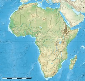
L'île de Wasini se situe dans l'Océan Indien en près de la côte sud du Kenya, près de Shimoni et du parc marin national de Kisite-Mpunguti et possède une barrière de corail exposée. Elle mesure 5 km sur 1 km de large.
Géographie
Wasini est célèbre pour la richesse de son écosystème corallien, où il est possible de nager sans équipement (snorkelling) au milieu d'une impressionnante biodiversité de coraux, poissons, invertébrés marins, mais aussi tortues et dauphins, particulièrement prisés des touristes.
Il n'y existe aucune route ni automobile, ni de système d’approvisionnement en eau. Cette île a été un centre swahili.
Le Jardin de Corail
Wasini compte aussi un monument extrêmement rare : le « jardin de corail »[1], un ensemble de ruines naturelles d'un récif de corail fossile, situé au-dessus du niveau actuel de la mer mais qui sont régulièrement ré-inondés lors des marées exceptionnellement hautes. On peut y voir évoluer une population de crabes violonistes, ainsi que 6 espèces d'arbres de mangrove et une espèce d'herbe halophile capable de survivre sous l'eau de mer. Les femmes de Wasini y ont construit un ponton, le plus grand d'Afrique, pour permettre aux touristes d'y circuler à pied sec et sans abîmer le fragile écosystème.
- L'île est située sur un récif de corail fossile, qui se voit bien le long des côtes.
- Le Jardin de Corail à marée basse.
Notes et références
- Voir le reportage qui y a été consacré à l'émission Thalassa
Voir aussi
Articles connexes
- Liste des îles sans voitures
- Portail du Kenya
- Portail du monde insulaire
- Portail de l’océan Indien
На других языках
[de] Wasini Island
Wasini Island ist eine kenianische Insel im äußersten Südosten des Landes.[1][2][en] Wasini Island
Wasini Island lies in southeast Kenya 3 kilometres (1.9 mi) off the coast of the Indian Ocean, 75 kilometres (47 mi) south of Mombasa, and 3 kilometres (1.9 mi) opposite the harbour of the village Shimoni.[1] It is approximately 7 kilometres (4.3 mi) long and 3 kilometres (1.9 mi) across. the name "wasini mpunguti" came from the early inhabitants who originally were the Chinese they were short Chinese, hence the name wasini mpunguti which to the locals, means short Chinese. The island has only footpaths of sharp old coral or sand. There are no cars, carts or bicycles. Cargo is transported by foot or by a wheelbarrow with a solid tyre. Transport is over the paths, or via the beaches, mainly consisting of coral and only passable with low tide, or by boat over the sea. Before 1963, in the British colonial time, there was an airstrip in the lagoon situated longitudinal south on the island; only small parts of tarmac are reminders of this history.- [fr] Wasini
Другой контент может иметь иную лицензию. Перед использованием материалов сайта WikiSort.org внимательно изучите правила лицензирования конкретных элементов наполнения сайта.
WikiSort.org - проект по пересортировке и дополнению контента Википедии


