geo.wikisort.org - Île
Les Ryke Yseøyane sont un archipel inhabité de Norvège, dans le Sud-Est du Svalbard, au large d'Edgeøya.
Cet article est une ébauche concernant le monde insulaire, la Norvège et l’Arctique.
Vous pouvez partager vos connaissances en l’améliorant (comment ?) selon les recommandations des projets correspondants.
| Ryke Yseøyane | ||
| Géographie | ||
|---|---|---|
| Pays | ||
| Archipel | Svalbard | |
| Localisation | Océan Arctique | |
| Coordonnées | 77° 28′ N, 25° 05′ E | |
| Superficie | 1,75 km2 | |
| Nombre d'îles | 3 | |
| Géologie | Îles continentales | |
| Administration | ||
| Territoire | Svalbard | |
| Démographie | ||
| Population | Aucun habitant | |
| Autres informations | ||
| Découverte | 1640 | |
| Fuseau horaire | UTC+1 | |
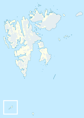
| Géolocalisation sur la carte : Svalbard
| ||
| Archipels en Norvège | ||
| modifier |
||
Géographie
L'archipel est situé à l'est du glacier Stonebreen.
L'archipel est composé de trois îles donc aucune n'est nommée et de quelques rochers épars.
Géologie
La plupart de ces îles sont formées de falaises de basalte.
Histoire
L'archipel a été découvert en 1640-1645 par Ryke Yse, un chasseur de baleines néerlandais[1]..
Depuis 1973, l'archipel fait partie de la Réserve naturelle de Søraust-Svalbard.
Lien externe
Références
- (no) Norsk Polar Instittutt. (11 novembre 2015)
 Portail de la Norvège
  Portail du monde insulaire
  Portail de l’Arctique
На других языках
[en] Ryke Yseøyane
Ryke Yseøyane is a group of several small islands off the east coast of the island of Edgeøya in Svalbard, Norway. The islands are named after the Dutch whaler Ryke Yse of Vlieland, who discovered them about 1640–1645. The group was first marked by Hendrick Doncker, of Amsterdam, in 1663. Two Norwegian polar bear hunters wintered on Ryke Yseøyane for two subsequent winters in 1967–1969. During the second winter, one of them was lost in drifting ice. They are part of the Southeast Svalbard Nature Reserve.[1]- [fr] Ryke Yseøyane
[ru] Рейке-Эйсе
Рейке-Эйсе[источник не указан 3017 дней] (норв. Ryke Yseøyane) — группа островов, располагающихся у восточного побережья острова Эдж. Архипелаг был назван так в честь фризского китобоя Рейке Эйсе из Влиланда, который обнаружил эти острова в 1640—1645 годах. Впервые архипелаг появился на карте Хендрика Донкера в 1663 году.Текст в блоке "Читать" взят с сайта "Википедия" и доступен по лицензии Creative Commons Attribution-ShareAlike; в отдельных случаях могут действовать дополнительные условия.
Другой контент может иметь иную лицензию. Перед использованием материалов сайта WikiSort.org внимательно изучите правила лицензирования конкретных элементов наполнения сайта.
Другой контент может иметь иную лицензию. Перед использованием материалов сайта WikiSort.org внимательно изучите правила лицензирования конкретных элементов наполнения сайта.
2019-2025
WikiSort.org - проект по пересортировке и дополнению контента Википедии
WikiSort.org - проект по пересортировке и дополнению контента Википедии