geo.wikisort.org - Île
Eriskay (en gaélique écossais : Eirisgeidh, API : /ˈeɾʲiʃkʲej/) est une île du Royaume-Uni située en Écosse, dans l'archipel des Hébrides extérieures.
Pour l’article homonyme, voir Eriskay (cheval).
| Eriskay | ||
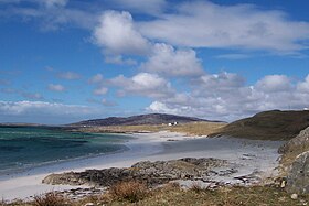
 Plage Bonnie Prince Charlie's à Eriskay. | ||
| Géographie | ||
|---|---|---|
| Pays | ||
| Archipel | Hébrides extérieures | |
| Localisation | Océan Atlantique | |
| Coordonnées | 57° 04′ 22″ N, 7° 17′ 27″ O | |
| Superficie | 7,03 km2 | |
| Point culminant | Beinn Sciathan (185,6 m) | |
| Géologie | Île continentale | |
| Administration | ||
| Nation constitutive | Écosse | |
| Council Area | Hébrides extérieures | |
| Démographie | ||
| Population | 133 hab. | |
| Densité | 18,92 hab./km2 | |
| Autres informations | ||
| Découverte | Préhistoire | |
| Fuseau horaire | UTC+0 | |
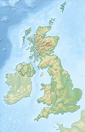
| Géolocalisation sur la carte : Hébrides extérieures
| ||
| Îles au Royaume-Uni | ||
| modifier |
||
Elle a donné son nom à une race rare de poneys originaire de l'île : l'Eriskay.
Lien externe
- Portail de l’Écosse
- Portail du monde insulaire
На других языках
[de] Eriskay
Die Insel Eriskay (schottisch-gälisch: Èirisgeigh [.mw-parser-output .IPA a{text-decoration:none}ˈeɾʲiʃkʲej], von altnord. Eiríksey, dt. „Eiríkrs Insel“) gehört zu den Äußeren Hebriden in Nordschottland. Sie gehört zur Civil parish South Uist. Sie liegt zwischen South Uist und Barra und ist mit South Uist durch den 2002 eröffneten Eriskay Causeway, einen Straßendamm, verbunden. Im gleichen Jahr wurde eine Fährstrecke zwischen Eriskay und Barra eröffnet. Die neue Fähre verkehrt zwischen Ceann a’ Gharaidh auf Eriskay und Ardmore auf Barra. Die Überfahrt dauert rund 40 Minuten. 2011 lebten 143 Personen auf der Insel.[1][en] Eriskay
Eriskay (Scottish Gaelic: Èirisgeigh), from the Old Norse for "Eric's Isle", is an island and community council area of the Outer Hebrides in northern Scotland with a population of 143, as of the 2011 census.[2] It lies between South Uist and Barra and is connected to South Uist by a causeway which was opened in 2001. In the same year Ceann a' Ghàraidh in Eriskay became the ferry terminal for travelling between South Uist and Barra. The Caledonian MacBrayne vehicular ferry travels between Eriskay and Ardmore in Barra. The crossing takes around 40 minutes.- [fr] Eriskay
[it] Eriskay
Eriskay (in gaelico scozzese: Eirisgeidh[1]; Eiriosgaigh[2][3] o Èirisgeigh; 2, 7 km²; 130 ab. circa) è un'isola della Scozia nord-occidentale, facente parte dell'arcipelago delle Ebridi Esterne (Outer Hebrides) e situata nel Sound of Barra[3] (Oceano Atlantico).[ru] Эрискей
Э́рискей (англ. Eriskay; гэльск. Èirisgeigh) — остров в составе архипелага Внешние Гебриды, расположенного вблизи западного побережья Шотландии. Площадь составляет 7,03 км². Расположен между островами Саут-Уист и Барра; с Саут-Уист соединён дамбой, строительство которой было завершено в 2001 году. Имеется паромная связь с островом Барра, путь занимает около 40 мин.Текст в блоке "Читать" взят с сайта "Википедия" и доступен по лицензии Creative Commons Attribution-ShareAlike; в отдельных случаях могут действовать дополнительные условия.
Другой контент может иметь иную лицензию. Перед использованием материалов сайта WikiSort.org внимательно изучите правила лицензирования конкретных элементов наполнения сайта.
Другой контент может иметь иную лицензию. Перед использованием материалов сайта WikiSort.org внимательно изучите правила лицензирования конкретных элементов наполнения сайта.
2019-2025
WikiSort.org - проект по пересортировке и дополнению контента Википедии
WikiSort.org - проект по пересортировке и дополнению контента Википедии

