geo.wikisort.org - Île
Le Bobrof est une île volcanique située au Sud-Ouest de l'Alaska, aux États-Unis, dans les îles Andreanof. Elle est constituée d'un stratovolcan culminant à 738 mètres d'altitude[1]. Le volcan date probablement de l'Holocène[1].
Cet article est une ébauche concernant le volcanisme, la montagne, le monde insulaire et l’Alaska.
Vous pouvez partager vos connaissances en l’améliorant (comment ?) selon les recommandations des projets correspondants.
| Bobrof | |||
 Vue aérienne du Bobrof. | |||
| Géographie | |||
|---|---|---|---|
| Pays | |||
| Archipel | Îles Andreanof (îles Aléoutiennes) | ||
| Localisation | Océan Pacifique (mer de Béring) | ||
| Coordonnées | 51° 54′ 30″ N, 177° 26′ 20″ O | ||
| Point culminant | Bobrof (738 m) | ||
| Géologie | |||
| Géologie | Île volcanique | ||
| Type | Volcan de subduction | ||
| Morphologie | Stratovolcan | ||
| Activité | Inconnue | ||
| Dernière éruption | Inconnue | ||
| Code GVP | 311100 | ||
| Observatoire | Observatoire volcanologique d'Alaska | ||
| Administration | |||
| État | Alaska | ||
| Région de recensement | Aléoutiennes occidentales | ||
| Démographie | |||
| Population | Aucun hab. | ||
| Autres informations | |||
| Fuseau horaire | UTC-10 | ||
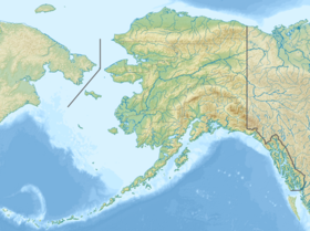
| Géolocalisation sur la carte : États-Unis
Géolocalisation sur la carte : Alaska
| |||
| modifier |
|||

Sa constitution ressemble à celle du volcan Moffett (en), situé 50 km à l'est[2].
Notes et références
- (en) « Bobrof », sur http://www.volcano.si.edu, Global Volcanism Program, Smithsonian Institution
- (en) « Bobrof - Introduction », sur http://www.avo.alaska.edu (consulté le )
Voir aussi
Articles connexes
Liens externes
- Ressources relatives à la géographie :
 Portail du monde insulaire
  Portail de la montagne
  Portail du volcanisme
  Portail de l’Alaska
На других языках
[de] Bobrof Island
Bobrof Island ist eine kleine unbewohnte Vulkaninsel der Andreanof Islands, die zu den Aleuten gehört. Die etwa 4 km lange Insel liegt zwischen Kanaga Island und Tanaga Island.[en] Bobrof Island
Bobrof Island (Aleut: Walĝa[3]) is one of the Andreanof Islands subgroup of the Aleutian Islands in southwestern Alaska, United States.[4] Bobrof Island is a small, uninhabited island about 9 miles (14 km) north and west of Kanaga Island, and 7 miles (11 km) northeast of Cape Sudak on Tanaga Island. Bobrof Island is 2.6 miles (4.2 km) long and 1.8 miles (2.9 km) wide with an area of 3 square miles (7.8 km2), and consists primarily of the 2,421-foot (738 m) high Bobrof Volcano.[4] The volcanic crater, or cone, has been heavily dissected.[5] Underwater deposits adjacent to the island's northeast flank suggest an immense debris-avalanche has taken place.[4]- [fr] Bobrof
[it] Bobrof
Bobrof (in lingua aleutina Walĝa[1]) è un'isola che fa parte del gruppo delle Andreanof, nell'arcipelago delle Aleutine; si trova nel mare di Bering e appartiene all'Alaska (USA).Текст в блоке "Читать" взят с сайта "Википедия" и доступен по лицензии Creative Commons Attribution-ShareAlike; в отдельных случаях могут действовать дополнительные условия.
Другой контент может иметь иную лицензию. Перед использованием материалов сайта WikiSort.org внимательно изучите правила лицензирования конкретных элементов наполнения сайта.
Другой контент может иметь иную лицензию. Перед использованием материалов сайта WikiSort.org внимательно изучите правила лицензирования конкретных элементов наполнения сайта.
2019-2026
WikiSort.org - проект по пересортировке и дополнению контента Википедии
WikiSort.org - проект по пересортировке и дополнению контента Википедии