geo.wikisort.org - Île
Barren Island est une ancienne île formant une péninsule sur la rive sud-est de Brooklyn à New York. Situé sur la baie de Jamaica, elle faisait géographiquement partie du groupe d'îles de l'Outer Barrier sur la rive sud (South Shore) de Long Island.
Cet article est une ébauche concernant le monde insulaire et l'État de New York.
Vous pouvez partager vos connaissances en l’améliorant (comment ?) selon les recommandations des projets correspondants.
| Barren Island | ||||
 Atlas du borough de Brooklyn, New York. 1916 | ||||
| Géographie | ||||
|---|---|---|---|---|
| Pays | ||||
| Archipel | Outer Barrier | |||
| Localisation | Baie de Jamaica (Océan Atlantique) | |||
| Coordonnées | 40° 35′ 34″ N, 73° 53′ 35″ O | |||
| Administration | ||||
| État | New York | |||
| Autres informations | ||||
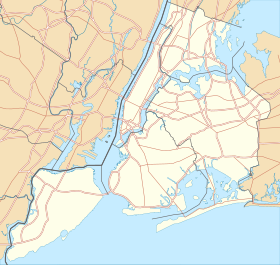
| Géolocalisation sur la carte : New York
Géolocalisation sur la carte : États-Unis
Géolocalisation sur la carte : New York
| ||||
| Île aux États-Unis par État | ||||
| modifier |
||||


L'ancien aérodrome Floyd Bennett Field y est situé.
 Portail de New York
  Portail du monde insulaire
На других языках
[en] Barren Island, Brooklyn
Barren Island is a peninsula and former island on the southeast shore of Brooklyn in New York City. Located on Jamaica Bay, it was geographically part of the Outer Barrier island group on the South Shore of Long Island. The island was occupied by the Lenape Native Americans prior to the arrival of Dutch settlers in the 17th century. Its name is a corruption of Beeren Eylandt, the Dutch-language term for "Bears' Island".- [fr] Barren Island
Текст в блоке "Читать" взят с сайта "Википедия" и доступен по лицензии Creative Commons Attribution-ShareAlike; в отдельных случаях могут действовать дополнительные условия.
Другой контент может иметь иную лицензию. Перед использованием материалов сайта WikiSort.org внимательно изучите правила лицензирования конкретных элементов наполнения сайта.
Другой контент может иметь иную лицензию. Перед использованием материалов сайта WikiSort.org внимательно изучите правила лицензирования конкретных элементов наполнения сайта.
2019-2026
WikiSort.org - проект по пересортировке и дополнению контента Википедии
WikiSort.org - проект по пересортировке и дополнению контента Википедии